Directions to OUE Downtown 2 (Singapore) with public transport
The following transport lines have routes that pass near OUE Downtown 2
How to get to OUE Downtown 2 by bus?
Click on the bus route to see step by step directions with maps, line arrival times and updated time schedules.
How to get to OUE Downtown 2 by metro?
Click on the metro route to see step by step directions with maps, line arrival times and updated time schedules.
Bus stops near OUE Downtown 2 in Singapore
- Shenton Way - Uic Bldg (03129), 3 min walk,
- Shenton Way - Opp Axa Twr (03217), 4 min walk,
- Robinson Rd - Aft Capital Twr (03111), 5 min walk,
- Cecil St - Opp Gb Bldg (03151), 5 min walk,
- Anson Rd - Tanjong Pagar Stn Exit C (03223), 6 min walk,
- Shenton Way - Opp Mas Bldg (03218), 7 min walk,
- Raffles Quay - One Raffles Quay (03059), 7 min walk,
- Central Blvd - Downtown Stn Exit E (03529), 9 min walk,
Metro stations near OUE Downtown 2 in Singapore
- Shenton Way (Te19), 4 min walk,
- Tanjong Pagar (EW15), 5 min walk,
- Downtown (DT17), 8 min walk,
Bus lines to OUE Downtown 2 in Singapore
- 10, Tampines Int ↔ Kent Ridge Ter,
- 57, Bishan Int ↔ Bt Merah Int,
- 70, Yio Chu Kang Int ↔ Shenton Way Ter,
- 97, Jurong East Int ↔ Marina Ctr Ter,
- 100, Serangoon Int ↔ Ghim Moh Ter,
- 106, Bt Batok Int ↔ Shenton Way Ter,
- 107, Hougang Ctrl Int ↔ Shenton Way Ter,
- 130, Ang Mo Kio Int ↔ Shenton Way Ter,
- 131, St. Michael’s Ter ↔ Bt Merah Int,
- 133, Ang Mo Kio Int ↔ Shenton Way Ter,
- 167, Sembawang Int ↔ Bt Merah Int,
- 186, Shenton Way Ter ↔ St. Michael’s Ter,
- 196, Bedok Int ↔ Clementi Int,
- 400, Shenton Way Ter ↺ Marina Coastal Dr,
- 502, Soon Lee Bus Pk ↺ Bayfront Ave,
- 513, [AM]: Shenton Way (Opp MAS Bldg) [PM]: Tampines Ave 5 (Opp Darul Ghufran Mque),
- 574, [AM]: Anson Rd (Tg Pagar Stn Exit C),
- 575, Sengkang East Rd (Blk 301D) → Upp Cross St (Opp State Ct),
- 591, [AM]: Anson Rd (Tg Pagar Stn Exit C) [PM]: Punggol Dr (Kadaloor Stn),
- 621, [AM]: Shenton Way (Opp MAS Bldg) [PM]: Bedok Reservoir Rd (Opp Blk 426),
What are the nearest stations to OUE Downtown 2?
The nearest stations to OUE Downtown 2 are:
- Shenton Way - Uic Bldg (03129) is 191 meters away, 3 min walk.
- Shenton Way (Te19) is 238 meters away, 4 min walk.
- Shenton Way - Opp Axa Twr (03217) is 302 meters away, 4 min walk.
- Robinson Rd - Aft Capital Twr (03111) is 336 meters away, 5 min walk.
- Tanjong Pagar (EW15) is 338 meters away, 5 min walk.
- Cecil St - Opp Gb Bldg (03151) is 346 meters away, 5 min walk.
- Anson Rd - Tanjong Pagar Stn Exit C (03223) is 427 meters away, 6 min walk.
- Shenton Way - Opp Mas Bldg (03218) is 472 meters away, 7 min walk.
- Raffles Quay - One Raffles Quay (03059) is 514 meters away, 7 min walk.
- Downtown (DT17) is 576 meters away, 8 min walk.
- Central Blvd - Downtown Stn Exit E (03529) is 643 meters away, 9 min walk.
Which bus lines stop near OUE Downtown 2?
These bus lines stop near OUE Downtown 2: 10, 100, 106, 130, 196, 57.
Which metro lines stop near OUE Downtown 2?
These metro lines stop near OUE Downtown 2: DOWNTOWN LINE, EAST WEST LINE, NORTH SOUTH LINE, THOMSON-EAST COAST LINE.
What’s the nearest metro station to OUE Downtown 2 in Singapore?
The nearest metro station to OUE Downtown 2 in Singapore is Shenton Way (Te19). It’s a 4 min walk away.
What’s the nearest bus station to OUE Downtown 2 in Singapore?
The nearest bus station to OUE Downtown 2 in Singapore is Shenton Way - Uic Bldg (03129). It’s a 3 min walk away.
What time is the first metro to OUE Downtown 2 in Singapore?
The THOMSON-EAST COAST LINE is the first metro that goes to OUE Downtown 2 in Singapore. It stops nearby at 05:57.
What time is the last metro to OUE Downtown 2 in Singapore?
The DOWNTOWN LINE is the last metro that goes to OUE Downtown 2 in Singapore. It stops nearby at 00:46.
What time is the first bus to OUE Downtown 2 in Singapore?
The 196 is the first bus that goes to OUE Downtown 2 in Singapore. It stops nearby at 05:40.
What time is the last bus to OUE Downtown 2 in Singapore?
The 167 is the last bus that goes to OUE Downtown 2 in Singapore. It stops nearby at 00:53.
See OUE Downtown 2, Singapore, on the map
Public Transit to OUE Downtown 2 in Singapore
Wondering how to get to OUE Downtown 2 in Singapore? Moovit helps you find the best way to get to OUE Downtown 2 with step-by-step directions from the nearest public transit station.
Moovit provides free maps and live directions to help you navigate through your city. View schedules, routes, timetables, and find out how long does it take to get to OUE Downtown 2 in real time.
Looking for the nearest stop or station to OUE Downtown 2? Check out this list of stops closest to your destination: Shenton Way - Uic Bldg (03129); Shenton Way (Te19); Shenton Way - Opp Axa Twr (03217); Robinson Rd - Aft Capital Twr (03111); Tanjong Pagar (EW15); Cecil St - Opp Gb Bldg (03151); Anson Rd - Tanjong Pagar Stn Exit C (03223); Shenton Way - Opp Mas Bldg (03218); Raffles Quay - One Raffles Quay (03059); Downtown (DT17); Central Blvd - Downtown Stn Exit E (03529).
Bus: 10, 100, 106, 130, 196, 57, 70, 97, 592, 545, 762, 868E.Metro: DOWNTOWN LINE, EAST WEST LINE, NORTH SOUTH LINE, THOMSON-EAST COAST LINE.
Want to see if there’s another route that gets you there at an earlier time? Moovit helps you find alternative routes or times. Get directions from and directions to OUE Downtown 2 easily from the Moovit App or Website.
We make riding to OUE Downtown 2 easy, which is why over 1.5 million users, including users in Singapore, trust Moovit as the best app for public transit. You don’t need to download an individual bus app or train app, Moovit is your all-in-one transit app that helps you find the best bus time or train time available.
For information on prices of metro and bus, costs and ride fares to OUE Downtown 2, please check the Moovit app.
Use the app to navigate to popular places including to the airport, hospital, stadium, grocery store, mall, coffee shop, school, college, and university.
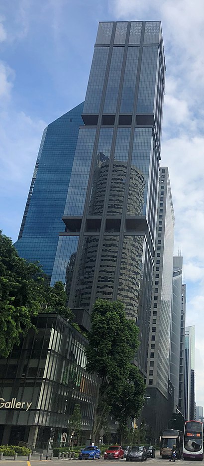
OUE Downtown 2 Address: 6 Shenton Way street in Singapore
Places Near OUE Downtown 2 (Singapore)
How to get to popular places in Singapore with public transport
Get around Singapore by public transport!
Travelling around Singapore has never been so easy. See step by step directions as you travel to any attraction, street or major public transport station. View bus and train timetables, arrival times, service alerts and detailed routes on a map, so you know exactly how to get to anywhere in Singapore.
When travelling to any destination around Singapore use Moovit's Live Directions with Get Off Notifications to know exactly where and how far to walk, how long to wait for your line , and how many stops are left. Moovit will alert you when it’s time to get off — no need to constantly re-check whether yours is the next stop.
Wondering how to use public transport in Singapore or how to pay for public transport in Singapore? Moovit public transport app can help you navigate your way with public transport easily, and at minimum cost. It includes public transport fees, ticket prices, and costs. Looking for a map of Singapore public transport lines? Moovit public transport app shows all public transport maps in Singapore with all Bus, Train, Metro, MRT & LRT, Ferry and Cable Car routes and stops on an interactive map.
Singapore has 6 transport type(s), including: Bus, Train, Metro, MRT & LRT, Ferry and Cable Car, operated by several transport agencies, including SMRT, SBS Transit, Tower Transit, Go-Ahead Singapore, Premium Bus, City Direct Bus, Changi Airport, Sentosa Development Corporation, Cross Border Bus, Singapore Cable Car Network, NUS Shuttle (ComfortDelGro), NTU Shuttle (ComfortDelGro), JTC Corp, Shuttle Bus (Appx. Schedule) and Tourist Bus (Book in Advance)