Directions to Officeworks (Pakenham) with public transport
The following transport lines have routes that pass near Officeworks
 Bus: 925, 926, FOUNTAIN GATE - COWES VIA SAN REMO, PAKENHAM.
- Train: PAKENHAM, REPLACEMENT BUS, TRARALGON.
How to get to Officeworks by bus?
Click on the bus route to see step by step directions with maps, line arrival times and updated time schedules.
From St. John Of God Berwick Hospital, Berwick
47 minFrom Hillcrest Christian College, Clyde
79 minFrom Kambrya College, Berwick
46 minFrom Casey Hospital, Berwick
56 minFrom Bekim Zekeri, Berwick
64 minFrom Nossal High School, Berwick
57 minFrom Chisholm Institute, Berwick
50 minFrom Parkhill Plaza Shopping Centre, Berwick
64 minFrom Amazon Locker-Fingal, Narre Warren South
66 minFrom Alkira Secondary College, Narre Warren South
77 min
How to get to Officeworks by train?
Click on the train route to see step by step directions with maps, line arrival times and updated time schedules.
Bus stop near Officeworks in Pakenham
- Michael St/Princes Hwy, 4 min walk,VIEW
Train stations near Officeworks in Pakenham
Bus lines to Officeworks in Pakenham
What are the nearest stations to Officeworks?
The nearest stations to Officeworks are:
- Michael St/Princes Hwy is 229 meters away, 4 min walk.
- Cardinia Road Railway Station is 2519 meters away, 33 min walk.
- Pakenham Railway Station is 3626 meters away, 47 min walk.
Which bus lines stop near Officeworks?
These bus lines stop near Officeworks: 925, 926.
Which train line stops near Officeworks?
PAKENHAM (East Pakenham)
What’s the nearest bus station to Officeworks in Pakenham?
The nearest bus station to Officeworks in Pakenham is Michael St/Princes Hwy. It’s a 4 min walk away.
What time is the first train to Officeworks in Pakenham?
The PAKENHAM is the first train that goes to Officeworks in Pakenham. It stops nearby at 03:54.
What time is the last train to Officeworks in Pakenham?
The REPLACEMENT BUS is the last train that goes to Officeworks in Pakenham. It stops nearby at 01:57.
What time is the first bus to Officeworks in Pakenham?
The 925 is the first bus that goes to Officeworks in Pakenham. It stops nearby at 05:30.
What time is the last bus to Officeworks in Pakenham?
The 926 is the last bus that goes to Officeworks in Pakenham. It stops nearby at 22:31.
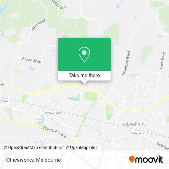
See Officeworks, Pakenham, on the map
Public Transit to Officeworks in Pakenham
Wondering how to get to Officeworks in Pakenham? Moovit helps you find the best way to get to Officeworks with step-by-step directions from the nearest public transit station.
Moovit provides free maps and live directions to help you navigate through your city. View schedules, routes, timetables, and find out how long does it take to get to Officeworks in real time.
Looking for the nearest stop or station to Officeworks? Check out this list of stops closest to your destination: Michael St/Princes Hwy; Cardinia Road Railway Station; Pakenham Railway Station.
Bus: 925, 926, FOUNTAIN GATE - COWES VIA SAN REMO, PAKENHAM.Train: PAKENHAM, REPLACEMENT BUS, TRARALGON.
Want to see if there’s another route that gets you there at an earlier time? Moovit helps you find alternative routes or times. Get directions from and directions to Officeworks easily from the Moovit App or Website.
We make riding to Officeworks easy, which is why over 1.5 million users, including users in Pakenham, trust Moovit as the best app for public transit. You don’t need to download an individual bus app or train app, Moovit is your all-in-one transit app that helps you find the best bus time or train time available.
For information on prices of bus and train, costs and ride fares to Officeworks, please check the Moovit app.
Use the app to navigate to popular places including to the airport, hospital, stadium, grocery store, mall, coffee shop, school, college, and university.
Officeworks Address: Obrien Parade street in Pakenham
- Mr Mustafa Sarwari Dietitian,
- Dr Dominic Chow Cardiologist,
- Mercy Family Doctors,
- Vitaalife Physio at Mercy Family Doctors Pakenham,
- Pathology Nurse,
- MS Xin Sheen Yang - Psychologist at Mercy Family Doctors,
- Little Stars Pakenham,
- Amazon Hub Locker Monk,
- Amazon Locker-Monk,
- Bunnings,
- Bunnings Pakenham,
- Bunnings Warehouse,
- Brighten That Smile,
- Trek Bicycle Corporati,
- Storelocal Pakenham,
- Supercheap Auto,
- Dmack Plumbing & Gas,
- Total Car Servicing Pakenham,
- Keyed Right Locksmiths and Repair Centre,
- Paks Kebabs
Places Near Officeworks (Pakenham)
- Dfo South Wharf, Southbank,
- Melbourne Convention and Exhibition Centre, Southbank,
- Cabrini Hospital, Malvern,
- RACV Club, Melbourne,
- Lygon Street, Carlton,
- Queen Victoria Market, Melbourne,
- South Melbourne Market, South Melbourne,
- Royal Exhibition Building, Carlton,
- Tram Stop D5 -The Goods Shed (70 / Circle), Docklands,
- Footscray Hospital, Footscray,
- Met Art World, Port Melbourne,
- Chinatown, Melbourne,
- Highpoint Shopping Centre, Maribyrnong,
- Crown Casino, Southbank,
- William Street, Melbourne,
- Alfred Hospital, Melbourne,
- Her Majesty's Theatre, Melbourne,
- Marvel Stadium, Docklands,
- Peter Maccallum Cancer Centre, Melbourne,
- Ikea, Richmond
How to get to popular places in Melbourne with public transport
Get around Pakenham by public transport!
Travelling around Pakenham has never been so easy. See step by step directions as you travel to any attraction, street or major public transport station. View bus and train timetables, arrival times, service alerts and detailed routes on a map, so you know exactly how to get to anywhere in Pakenham.
When travelling to any destination around Pakenham use Moovit's Live Directions with Get Off Notifications to know exactly where and how far to walk, how long to wait for your line , and how many stops are left. Moovit will alert you when it’s time to get off — no need to constantly re-check whether yours is the next stop.
Wondering how to use public transport in Pakenham or how to pay for public transport in Pakenham? Moovit public transport app can help you navigate your way with public transport easily, and at minimum cost. It includes public transport fees, ticket prices, and costs. Looking for a map of Pakenham public transport lines? Moovit public transport app shows all public transport maps in Pakenham with all Bus, Train and Tram routes and stops on an interactive map.
Melbourne has 3 transport type(s), including: Bus, Train and Tram, operated by several transport agencies, including PTV Bus, Yarra Trams, SkyBus and V/Line