How to get to One71 Pump Track by bus?
Click on the bus route to see step by step directions with maps, line arrival times and updated time schedules.
Bus stops near One71 Pump Track in Baldivis
What are the nearest stations to One71 Pump Track?
The nearest stations to One71 Pump Track are:
- Lochern Rd After Gresham Bvd is 207 meters away, 3 min walk.
- Cervantes Av Before Pemberton Bvd is 758 meters away, 11 min walk.
Which bus line stops near One71 Pump Track?
569 (Baldivis)
What’s the nearest bus station to One71 Pump Track in Baldivis?
The nearest bus station to One71 Pump Track in Baldivis is Lochern Rd After Gresham Bvd. It’s a 3 min walk away.
What time is the first bus to One71 Pump Track in Baldivis?
The 568 is the first bus that goes to One71 Pump Track in Baldivis. It stops nearby at 05:24.
What time is the last bus to One71 Pump Track in Baldivis?
The 568 is the last bus that goes to One71 Pump Track in Baldivis. It stops nearby at 21:13.
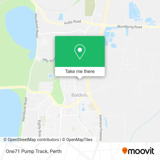
See One71 Pump Track, Baldivis, on the map
Public Transit to One71 Pump Track in Baldivis
Wondering how to get to One71 Pump Track in Baldivis? Moovit helps you find the best way to get to One71 Pump Track with step-by-step directions from the nearest public transit station.
Moovit provides free maps and live directions to help you navigate through your city. View schedules, routes, timetables, and find out how long does it take to get to One71 Pump Track in real time.
Looking for the nearest stop or station to One71 Pump Track? Check out this list of stops closest to your destination: Lochern Rd After Gresham Bvd; Cervantes Av Before Pemberton Bvd.
Bus: 569, 568.
Want to see if there’s another route that gets you there at an earlier time? Moovit helps you find alternative routes or times. Get directions from and directions to One71 Pump Track easily from the Moovit App or Website.
We make riding to One71 Pump Track easy, which is why over 1.7 million users, including users in Baldivis, trust Moovit as the best app for public transit. You don’t need to download an individual bus app or train app, Moovit is your all-in-one transit app that helps you find the best bus time or train time available.
For information on prices of bus and train, costs and ride fares to One71 Pump Track, please check the Moovit app.
Use the app to navigate to popular places including to the airport, hospital, stadium, grocery store, mall, coffee shop, school, college, and university.
One71 Pump Track Address: Parkville Boulevard street in Baldivis
- South West Fresh Catering,
- Shelford Quality Homes,
- The Pearson Celebration Homes,
- One71 Baldivis Sales Office,
- The Xanadu by Zircon Living,
- New Generation Homes,
- Amlec Services,
- Everglade Display Baldivis,
- Sheoak Grove Primary School,
- Roe Plays,
- YMCA Sheoak Grove Outside School Hours Care,
- Pemberton Reserve North,
- Your Beauty Angel,
- 545 Baldivis,
- Diamond Property Care,
- Taltech GRP,
- Colour Me Crazy,
- The Brightening Bar,
- Den Den Collectibles,
- Display Home by Content Living Cote Dazur
Places Near One71 Pump Track (Baldivis)
- Karrinyup Shopping Centre, Karrinyup,
- Blue Boat House,
- McCallum Park, Victoria Park,
- Mount Hospital, Perth,
- Perth Convention Exhibition Centre, Perth,
- Yankee Mart, Baldivis,
- Westfield Carousel, Cannington,
- IKEA, Innaloo,
- Fiona Stanley Hospital, Murdoch,
- Scitech, West Perth,
- Aqwa Aquarium, Hillarys,
- Crown Perth Casino, Burswood,
- Pelicaan Investment Ho, Bellevue,
- Sir Charles Gairdner Hospital, Nedlands,
- DFO, Perth Airport,
- Langley Park, Perth,
- Royal Perth Hospital, Perth,
- Watertown, Perth,
- Optus Stadium, Burswood,
- Rac Arena, Perth
How to get to popular places in Perth with public transport
Get around Baldivis by public transport!
Travelling around Baldivis has never been so easy. See step by step directions as you travel to any attraction, street or major public transport station. View bus and train timetables, arrival times, service alerts and detailed routes on a map, so you know exactly how to get to anywhere in Baldivis.
When travelling to any destination around Baldivis use Moovit's Live Directions with Get Off Notifications to know exactly where and how far to walk, how long to wait for your line , and how many stops are left. Moovit will alert you when it’s time to get off — no need to constantly re-check whether yours is the next stop.
Wondering how to use public transport in Baldivis or how to pay for public transport in Baldivis? Moovit public transport app can help you navigate your way with public transport easily, and at minimum cost. It includes public transport fees, ticket prices, and costs. Looking for a map of Baldivis public transport lines? Moovit public transport app shows all public transport maps in Baldivis with all Bus, Train and Ferry routes and stops on an interactive map.
Perth has 3 transport type(s), including: Bus, Train and Ferry, operated by several transport agencies, including Transperth Rail, Transwa, Transperth Ferry, Transperth, TransBusselton, TransAlbany, TransGoldfields, TransEsperance, TransGeraldton, TransCarnarvon, TransHedland, TransKarratha, TransBunbury, Mandurah Bus Charter and TransBroome