Outram Community Hospital stop - Sunday schedule
| Line | Direction | Time |
|---|---|---|
| SGH CAR PARK H SHUTTLE | Outram Community Hospital | 06:00 |
| SGH CAR PARK H SHUTTLE | Outram Community Hospital | 06:05 |
| SGH CAR PARK H SHUTTLE | Outram Community Hospital | 06:10 |
| SGH CAR PARK H SHUTTLE | Outram Community Hospital | 06:15 |
| SGH CAR PARK H SHUTTLE | Outram Community Hospital | 06:20 |
| SGH CAR PARK H SHUTTLE | Outram Community Hospital | 06:25 |
| SGH CAR PARK H SHUTTLE | Outram Community Hospital | 06:30 |
| SGH CAR PARK H SHUTTLE | Outram Community Hospital | 06:35 |
| SGH CAR PARK H SHUTTLE | Outram Community Hospital | 06:40 |
| SGH CAR PARK H SHUTTLE | Outram Community Hospital | 06:45 |
| SGH CAR PARK H SHUTTLE | Outram Community Hospital | 06:50 |
| SGH CAR PARK H SHUTTLE | Outram Community Hospital | 06:55 |
| SGH CAR PARK H SHUTTLE | Outram Community Hospital | 07:00 |
| SGH WHEELCHAIR SHUTTLE | Sgh | 07:06 |
| SGH CAR PARK H SHUTTLE | Outram Community Hospital | 07:07 |
| SGH CAR PARK H SHUTTLE | Outram Community Hospital | 07:10 |
| SGH CAR PARK H SHUTTLE | Outram Community Hospital | 07:17 |
| SGH CAR PARK H SHUTTLE | Outram Community Hospital | 07:20 |
| SGH CAR PARK H SHUTTLE | Outram Community Hospital | 07:27 |
| SGH CAR PARK H SHUTTLE | Outram Community Hospital | 07:30 |
| SGH WHEELCHAIR SHUTTLE | Sgh | 07:31 |
| SGH CAR PARK H SHUTTLE | Outram Community Hospital | 07:37 |
| SGH CAR PARK H SHUTTLE | Outram Community Hospital | 07:40 |
| SGH CAR PARK H SHUTTLE | Outram Community Hospital | 07:47 |
| SGH CAR PARK H SHUTTLE | Outram Community Hospital | 07:50 |
Directions to Outram Community Hospital stop (Singapore) with public transport
The following transport lines have routes that pass near Outram Community Hospital
How to get to Outram Community Hospital stop by bus?
Click on the bus route to see step by step directions with maps, line arrival times and updated time schedules.
How to get to Outram Community Hospital stop by metro?
Click on the metro route to see step by step directions with maps, line arrival times and updated time schedules.
Metro stations near Outram Community Hospital station in Singapore
- Maxwell (Te18), 1 min walk,
- Outram Park (EW16|NE3), 6 min walk,
- Chinatown (NE4|DT19), 8 min walk,
Bus stops near Outram Community Hospital stop in Singapore
- National Heart Centre Singapore, 3 min walk,
- New Bridge Rd - Bef Neil Rd (10011), 4 min walk,
- Eu Tong Sen St - Aft Hosp Dr (10017), 4 min walk,
- Eu Tong Sen St - Outram Pk Stn Exit 6/Sgh (10018), 6 min walk,
- Jln Bt Merah - Opp Blk 149 (10059), 6 min walk,
- Sgh Nel Shuttle Service Point, 6 min walk,
- Car Park H Shuttle Bus Stop, 13 min walk,
Bus lines to Outram Community Hospital stop in Singapore
- SGH CAMPUS SHUTTLE BLUE ROUTE, Blue Route,
- SGH WHEELCHAIR SHUTTLE, Sgh,
- 2, Changi Village Ter ↔ Kg Bahru Ter,
- 12, Pasir Ris Int ↔ Kg Bahru Ter,
- 54, Bishan Int ↔ Kg Bahru Ter,
- 122, Kg Bahru Ter ↺ Commonwealth Dr,
- 124, St. Michael’s Ter ↔ HarbourFront Int,
- 143, Toa Payoh Int ↔ Jurong East Int,
- 147, Hougang Ctrl Int ↔ Clementi Int,
- 174, Boon Lay Int ↔ Kg Bahru Ter,
- 190, Choa Chu Kang Int ↔ Kg Bahru Ter,
- 961, Woodlands Temp Int ↔ Lor 1 Geylang Ter,
- 12E, Pasir Ris Int ↔ Kg Bahru Ter,
- 174E, [AM Peak]: Kg Bahru Ter [PM Peak]: Boon Lay Int,
- 961M, Woodlands Temp Int ↔ Lor 1 Geylang Ter,
- 61, Bt Batok Int ↔ Eunos Int,
- 166, Ang Mo Kio Int ↔ Clementi Int,
- 167, Sembawang Int ↔ Bt Merah Int,
- 196, Bedok Int ↔ Clementi Int,
- 197, Bedok Int ↔ Jurong East Int,
What are the nearest stations to Outram Community Hospital?
The nearest stations to Outram Community Hospital are:
- Maxwell (Te18) is 43 meters away, 1 min walk.
- National Heart Centre Singapore is 155 meters away, 3 min walk.
- New Bridge Rd - Bef Neil Rd (10011) is 255 meters away, 4 min walk.
- Eu Tong Sen St - Aft Hosp Dr (10017) is 273 meters away, 4 min walk.
- Eu Tong Sen St - Outram Pk Stn Exit 6/Sgh (10018) is 416 meters away, 6 min walk.
- Jln Bt Merah - Opp Blk 149 (10059) is 426 meters away, 6 min walk.
- Sgh Nel Shuttle Service Point is 440 meters away, 6 min walk.
- Outram Park (EW16|NE3) is 457 meters away, 6 min walk.
- Chinatown (NE4|DT19) is 563 meters away, 8 min walk.
- Car Park H Shuttle Bus Stop is 971 meters away, 13 min walk.
Which bus lines stop near Outram Community Hospital?
These bus lines stop near Outram Community Hospital: 143, 147, 166, 190, 961M.
Which metro lines stop near Outram Community Hospital?
These metro lines stop near Outram Community Hospital: EAST WEST LINE, NORTH EAST LINE, THOMSON-EAST COAST LINE.
What’s the nearest metro station to Outram Community Hospital in Singapore?
The nearest metro station to Outram Community Hospital in Singapore is Maxwell (Te18). It’s a 1 min walk away.
What’s the nearest bus stop to Outram Community Hospital in Singapore?
The nearest bus stop to Outram Community Hospital in Singapore is National Heart Centre Singapore. It’s a 3 min walk away.
What time is the first metro to Outram Community Hospital in Singapore?
The THOMSON-EAST COAST LINE is the first metro that goes to Outram Community Hospital in Singapore. It stops nearby at 05:59.
What time is the last metro to Outram Community Hospital in Singapore?
The DOWNTOWN LINE is the last metro that goes to Outram Community Hospital in Singapore. It stops nearby at 00:43.
What time is the first bus to Outram Community Hospital in Singapore?
The 197 is the first bus that goes to Outram Community Hospital in Singapore. It stops nearby at 05:27.
What time is the last bus to Outram Community Hospital in Singapore?
The 961M is the last bus that goes to Outram Community Hospital in Singapore. It stops nearby at 01:02.
See Outram Community Hospital stop, Singapore, on the map
Public transport to Outram Community Hospital stop in Singapore
Looking for directions to Outram Community Hospital in Singapore, Singapore?
Download the Moovit App to find the current schedule and step-by-step directions for Metro or Bus routes that pass through Outram Community Hospital.
Looking for the nearest stops closest to Outram Community Hospital ? Check out this list of closest stops to your destination: Maxwell (Te18); National Heart Centre Singapore; New Bridge Rd - Bef Neil Rd (10011); Eu Tong Sen St - Aft Hosp Dr (10017); Eu Tong Sen St - Outram Pk Stn Exit 6/Sgh (10018); Jln Bt Merah - Opp Blk 149 (10059); Sgh Nel Shuttle Service Point; Outram Park (EW16|NE3); Chinatown (NE4|DT19); Car Park H Shuttle Bus Stop.
Bus: 143, 147, 166, 190, 961M, SGH CAMPUS SHUTTLE BLUE ROUTE, SGH WHEELCHAIR SHUTTLE, 2, 12, 54, 122, 124, 61, 167, 196, 197.Metro: EAST WEST LINE, NORTH EAST LINE, THOMSON-EAST COAST LINE, DOWNTOWN LINE.
We make riding on public transit to Outram Community Hospital easy, which is why over 1.5 million users, including users in Singapore trust Moovit as the best app for public transit.
Use the app to navigate to popular places including to the airport, hospital, stadium, grocery store, mall, coffee shop, school, college, and university.
The first line to this stop is SGH CAR PARK H SHUTTLE, at 06:00, and the last line is SGH CAR PARK H SHUTTLE at 22:25.
9 Hospital Drive, Singapore, Singapore
This stop serves Shuttle Bus (Appx. Schedule)’s lines
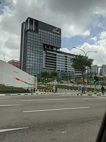
The Outram Community Hospital (OCH) is a 545-bed community hospital in Bukit Merah, Singapore. It is located adjacent to, and complements, the Singapore General Hospital (SGH).Wiki
Popular routes from Outram Community Hospital stop, Singapore
Metro stations near Outram Community Hospital station
Bus stops near Outram Community Hospital stop
Popular public transport stations in Singapore
Get around Singapore by public transport!
Travelling around Singapore has never been so easy. See step by step directions as you travel to any attraction, street or major public transport station. View bus and train timetables, arrival times, service alerts and detailed routes on a map, so you know exactly how to get to anywhere in Singapore.
When travelling to any destination around Singapore use Moovit's Live Directions with Get Off Notifications to know exactly where and how far to walk, how long to wait for your line , and how many stops are left. Moovit will alert you when it’s time to get off — no need to constantly re-check whether yours is the next stop.
Wondering how to use public transport in Singapore or how to pay for public transport in Singapore? Moovit public transport app can help you navigate your way with public transport easily, and at minimum cost. It includes public transport fees, ticket prices, and costs. Looking for a map of Singapore public transport lines? Moovit public transport app shows all public transport maps in Singapore with all Bus, Train, Metro, MRT & LRT, Ferry and Cable Car routes and stops on an interactive map.
Singapore has 6 transport type(s), including: Bus, Train, Metro, MRT & LRT, Ferry and Cable Car, operated by several transport agencies, including SMRT, SBS Transit, MRT/LRT Replacement Services, Tower Transit, Go-Ahead Singapore, Premium Bus, City Direct Bus, Changi Airport, Sentosa Development Corporation, Cross Border Bus, Singapore Cable Car Network, NUS Shuttle (ComfortDelGro), NTU Shuttle (ComfortDelGro), JTC Corp, Shuttle Bus (Appx. Schedule)