Directions to Perth Convenience with public transportation
The following transport lines have routes that pass near Perth Convenience
 Bus: 103, 111, 160, 935, 940.
- Train: AIRPORT LINE, FREMANTLE LINE, MANDURAH LINE, THORNLIE-COCKBURN LINE, YANCHEP LINE.
- Ferry: FERRY ROUTE ELIZABETH QUAY JETTY - FERRY ROUTE MENDS ST JETTY.
How to get to Perth Convenience by bus?
Click on the bus route to see step by step directions with maps, line arrival times and updated time schedules.
From Terminal 3 & Terminal 4
62 minFrom Quest Perth Ascot
47 minFrom Raffles Waterfront
31 minFrom Redcliffe
56 minFrom Swanbourne Beach
62 minFrom Perth Airport-Terminal 4
59 minFrom Garden City Shopping Centre
45 minFrom UWA Wesfarmers Lecture Theatre
37 minFrom Maroomba Airlines
59 minFrom Perth Airport Domestic Terminal T3 T4
60 min
How to get to Perth Convenience by train?
Click on the train route to see step by step directions with maps, line arrival times and updated time schedules.
Bus stops near Perth Convenience
Train stations near Perth Convenience
Ferry station near Perth Convenience
- Ferry Route Elizabeth Quay Jetty, 59 min walk,VIEW
Bus routes to Perth Convenience
- PERTH RED CAT, Hale St / Waca,VIEW
- PERTH YELLOW CAT, Claisebrook Stn,VIEW
- 28, Claremont Stn,VIEW
- 81, City Beach,VIEW
- 82, City Beach,VIEW
- 83, Churchlands Senior High School,VIEW
- 84, City Beach (Hale Rd),VIEW
- 85, Glendalough Stn,VIEW
- PERTH BLUE CAT, Elizabeth Quay Bus Stn,VIEW
- 15, Glendalough Stn,VIEW
- 19, Perth Busport,VIEW
- 30, Manning,VIEW
- 31, Salter Point,VIEW
- 34, Cannington Stn,VIEW
- 38, Cloverdale,VIEW
- 51, Perth Busport,VIEW
- 67, Mirrabooka Bus Stn,VIEW
- 68, Mirrabooka Bus Stn,VIEW
- 220, Armadale Senior High School,VIEW
- 360, Alexander Heights,VIEW
What are the nearest stations to Perth Convenience?
The nearest stations to Perth Convenience are:
- Murray St King Street Cat Id 98 is 171 meters away, 3 min walk.
- Wellington St Yagan Square Cat Id 59 is 190 meters away, 3 min walk.
- Perth Underground Stn is 270 meters away, 4 min walk.
- Wellington St Arena Cat Id 65 is 368 meters away, 6 min walk.
- Perth Busport is 376 meters away, 6 min walk.
- William St Stand 6 is 402 meters away, 6 min walk.
- Perth Stn is 423 meters away, 6 min walk.
- Ferry Route Elizabeth Quay Jetty is 4603 meters away, 59 min walk.
Which bus lines stop near Perth Convenience?
These bus lines stop near Perth Convenience: 103, 111, 160, 935, 940, PERTH YELLOW CAT.
Which train lines stop near Perth Convenience?
These train lines stop near Perth Convenience: AIRPORT LINE, FREMANTLE LINE, MANDURAH LINE, THORNLIE-COCKBURN LINE.
What’s the nearest train station to Perth Convenience?
The nearest train station to Perth Convenience is Perth Underground Stn. It’s a 4 min walk away.
What’s the nearest bus station to Perth Convenience?
The nearest bus stations to Perth Convenience are Murray St King Street Cat Id 98 and Wellington St Yagan Square Cat Id 59. The closest one is a 3 min walk away.
What time is the first train to Perth Convenience?
The ARMADALE LINE is the first train that goes to Perth Convenience. It stops nearby at 05:03.
What time is the last train to Perth Convenience?
The FREMANTLE LINE is the last train that goes to Perth Convenience. It stops nearby at 00:38.
What time is the first bus to Perth Convenience?
The 950 is the first bus that goes to Perth Convenience. It stops nearby at 04:51.
What time is the last bus to Perth Convenience?
The 950 is the last bus that goes to Perth Convenience. It stops nearby at 01:10.
What time is the first ferry to Perth Convenience?
The FERRY ROUTE ELIZABETH QUAY JETTY - FERRY ROUTE MENDS ST JETTY is the first ferry that goes to Perth Convenience. It stops nearby at 06:30.
What time is the last ferry to Perth Convenience?
The FERRY ROUTE ELIZABETH QUAY JETTY - FERRY ROUTE MENDS ST JETTY is the last ferry that goes to Perth Convenience. It stops nearby at 22:25.
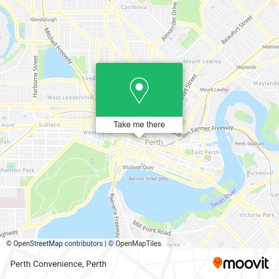
See Perth Convenience on the map
Public Transportation to Perth Convenience
Wondering how to get to Perth Convenience? Moovit helps you find the best way to get to Perth Convenience with step-by-step directions from the nearest public transit station.
Moovit provides free maps and live directions to help you navigate through your city. View schedules, routes, timetables, and find out how long does it take to get to Perth Convenience in real time.
Looking for the nearest stop or station to Perth Convenience? Check out this list of stops closest to your destination: Murray St King Street Cat Id 98; Wellington St Yagan Square Cat Id 59; Perth Underground Stn; Wellington St Arena Cat Id 65; Perth Busport; William St Stand 6; Perth Stn; Ferry Route Elizabeth Quay Jetty.
Bus: 103, 111, 160, 935, 940, PERTH YELLOW CAT, PERTH RED CAT, 28, 81, 82, 83, 84.Train: AIRPORT LINE, FREMANTLE LINE, MANDURAH LINE, THORNLIE-COCKBURN LINE, YANCHEP LINE, ARMADALE LINE, ELLENBROOK LINE, MIDLAND LINE.Ferry: FERRY ROUTE ELIZABETH QUAY JETTY - FERRY ROUTE MENDS ST JETTY.
Want to see if there’s another route that gets you there at an earlier time? Moovit helps you find alternative routes or times. Get directions from and directions to Perth Convenience easily from the Moovit App or Website.
We make riding to Perth Convenience easy, which is why over 1.5 million users, including users in Perth, trust Moovit as the best app for public transit. You don’t need to download an individual bus app or train app, Moovit is your all-in-one transit app that helps you find the best bus time or train time available.
For information on prices of bus and train, costs and ride fares to Perth Convenience, please check the Moovit app.
Use the app to navigate to popular places including to the airport, hospital, stadium, grocery store, mall, coffee shop, school, college, and university.
Perth Convenience Address: Wellington St 585 Perth, 6000 Perth street in Perth
- MC Kilroy,
- P&N Bank,
- 609 Wellington St Parking,
- Aspermont,
- Hotel Ibis,
- Transperth Info Centre,
- Shell House, Perth,
- Shell Energy,
- Rydges Perth Kings Square,
- 621 Wellington Street,
- Peppers Kings Square Hotel,
- 10 Telethon Avenue,
- Red CAT Stop 23 (Raine Square),
- Ibis Hotel,
- Hotel Ibis Perth,
- Good Sammy,
- King Street Arts Centre,
- Market Grounds,
- NOVOTEL Perth Murray Street,
- Miss Mi Perth
Places Near Perth Convenience
- DFO, Perth Airport,
- Fiona Stanley Hospital, Murdoch,
- Mount Hospital, Perth,
- Blue Boat House,
- Royal Perth Hospital, Perth,
- Yankee Mart, Baldivis,
- Rac Arena, Perth,
- IKEA, Innaloo,
- Pelicaan Investment Ho, Bellevue,
- Sir Charles Gairdner Hospital, Nedlands,
- McCallum Park, Victoria Park,
- Karrinyup Shopping Centre, Karrinyup,
- Crown Perth Casino, Burswood,
- Perth Convention Exhibition Centre, Perth,
- Langley Park, Perth,
- Aqwa Aquarium, Hillarys,
- Scitech, West Perth,
- Westfield Carousel, Cannington,
- Hillarys Boat Harbour,
- Optus Stadium, Burswood
How to get to popular places in Perth with public transport
Get around Perth by public transport!
Travelling around Perth has never been so easy. See step by step directions as you travel to any attraction, street or major public transport station. View bus and train timetables, arrival times, service alerts and detailed routes on a map, so you know exactly how to get to anywhere in Perth.
When travelling to any destination around Perth use Moovit's Live Directions with Get Off Notifications to know exactly where and how far to walk, how long to wait for your line , and how many stops are left. Moovit will alert you when it’s time to get off — no need to constantly re-check whether yours is the next stop.
Wondering how to use public transport in Perth or how to pay for public transport in Perth? Moovit public transport app can help you navigate your way with public transport easily, and at minimum cost. It includes public transport fees, ticket prices, and costs. Looking for a map of Perth public transport lines? Moovit public transport app shows all public transport maps in Perth with all Bus, Train and Ferry routes and stops on an interactive map.
Perth has 3 transport type(s), including: Bus, Train and Ferry, operated by several transport agencies, including Transperth Rail, Transwa, Transperth Ferry, Transperth, TransBusselton, TransAlbany, TransGoldfields, TransEsperance, TransGeraldton, TransCarnarvon, TransHedland, TransKarratha, TransBunbury, Mandurah Bus Charter and TransBroome