Directions to Perth Jet Photos (Duncraig) with public transport
The following transport lines have routes that pass near Perth Jet Photos
 Bus: 423, 443, 444, 441.
- Train: YANCHEP LINE.
How to get to Perth Jet Photos by bus?
Click on the bus route to see step by step directions with maps, line arrival times and updated time schedules.
From Wembley Golf Course, Wembley Downs
91 minFrom St Andrews Grammar School, Dianella
58 minFrom Ikea, Osborne Park
71 minFrom Lakeside Joondalup Shopping City, Joondalup
50 minFrom Sinagra, Sinagra
75 minFrom St Mark's Anglican Community School, Hillarys
32 minFrom Lakeside Joondalup, Joondalup
52 minFrom Yokine, Yokine
57 minFrom Scarborough Beach, Scarborough
55 minFrom Mirrabooka Softball Complex, Mirrabooka
48 min
How to get to Perth Jet Photos by train?
Click on the train route to see step by step directions with maps, line arrival times and updated time schedules.
Bus stops near Perth Jet Photos in Duncraig
Bus lines to Perth Jet Photos in Duncraig
What are the nearest stations to Perth Jet Photos?
The nearest stations to Perth Jet Photos are:
- Warwick Rd After Lilburne Rd is 60 meters away, 2 min walk.
- Glengarry Dr After Portree Wy is 394 meters away, 6 min walk.
- Poynter Dr Before Kelso Ct is 522 meters away, 8 min walk.
Which bus lines stop near Perth Jet Photos?
These bus lines stop near Perth Jet Photos: 423, 443, 444.
Which train line stops near Perth Jet Photos?
YANCHEP LINE (Yanchep Stn)
What’s the nearest bus station to Perth Jet Photos in Duncraig?
The nearest bus station to Perth Jet Photos in Duncraig is Warwick Rd After Lilburne Rd. It’s a 2 min walk away.
What time is the first bus to Perth Jet Photos in Duncraig?
The 423 is the first bus that goes to Perth Jet Photos in Duncraig. It stops nearby at 04:53.
What time is the last bus to Perth Jet Photos in Duncraig?
The 441 is the last bus that goes to Perth Jet Photos in Duncraig. It stops nearby at 00:11.
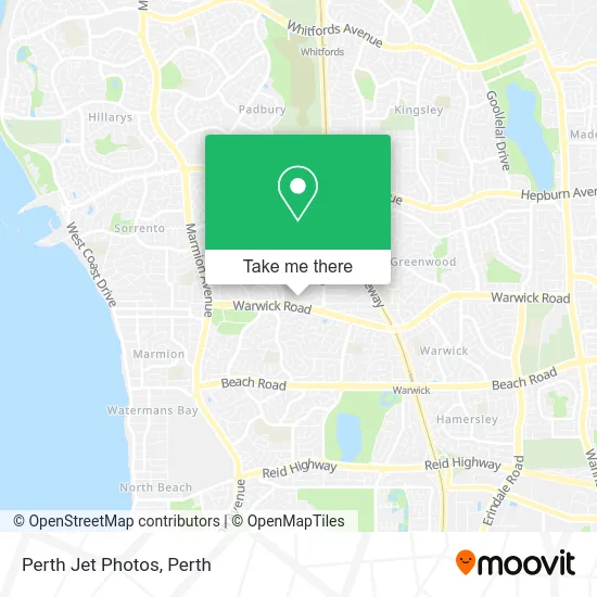
See Perth Jet Photos, Duncraig, on the map
Public Transit to Perth Jet Photos in Duncraig
Wondering how to get to Perth Jet Photos in Duncraig? Moovit helps you find the best way to get to Perth Jet Photos with step-by-step directions from the nearest public transit station.
Moovit provides free maps and live directions to help you navigate through your city. View schedules, routes, timetables, and find out how long does it take to get to Perth Jet Photos in real time.
Looking for the nearest stop or station to Perth Jet Photos? Check out this list of stops closest to your destination: Warwick Rd After Lilburne Rd; Glengarry Dr After Portree Wy; Poynter Dr Before Kelso Ct.
Bus: 423, 443, 444, 441.Train: YANCHEP LINE.
Want to see if there’s another route that gets you there at an earlier time? Moovit helps you find alternative routes or times. Get directions from and directions to Perth Jet Photos easily from the Moovit App or Website.
We make riding to Perth Jet Photos easy, which is why over 1.5 million users, including users in Duncraig, trust Moovit as the best app for public transit. You don’t need to download an individual bus app or train app, Moovit is your all-in-one transit app that helps you find the best bus time or train time available.
For information on prices of bus and train, costs and ride fares to Perth Jet Photos, please check the Moovit app.
Use the app to navigate to popular places including to the airport, hospital, stadium, grocery store, mall, coffee shop, school, college, and university.
Perth Jet Photos Address: 29 Portree Way Duncraig WA 6023 street in Duncraig
- Park Beach Place,
- Feel Good Therapies,
- Dr Luchjo M Meshulam DDS,
- Worldwide Salon Marketing,
- Duncraig Rise Upholstery Couch Sofa,
- Dani Caye Beauty,
- Quest Specialist Physiotherapy,
- A1 Simply Human Resources,
- Dr Luksa M Mihly DDS,
- Like U Asian Cuisine,
- The Emotional Healing Centre Couples Counselling & Psychotherapy,
- Down West Plumbing & Gas,
- Itnls Property Group LLC,
- Realmark Realmark,
- Droopy Ears Rabbitry,
- B's Bees - Pure Honey - Western Australia,
- Sunburnt Films,
- Tactical Super,
- Origin Landscapes,
- Duncraig East Lpo
Places Near Perth Jet Photos (Duncraig)
- Westfield Carousel, Cannington,
- Royal Perth Hospital, Perth,
- Aqwa Aquarium, Hillarys,
- Crown Perth Casino, Burswood,
- Pelicaan Investment Ho, Bellevue,
- Karrinyup Shopping Centre, Karrinyup,
- Langley Park, Perth,
- Perth Convention Exhibition Centre, Perth,
- Yankee Mart, Baldivis,
- McCallum Park, Victoria Park,
- Hillarys Boat Harbour,
- Rac Arena, Perth,
- Mount Hospital, Perth,
- Optus Stadium, Burswood,
- Scitech, West Perth,
- DFO, Perth Airport,
- IKEA, Innaloo,
- Blue Boat House,
- Sir Charles Gairdner Hospital, Nedlands,
- Fiona Stanley Hospital, Murdoch
How to get to popular places in Perth with public transport
Get around Duncraig by public transport!
Travelling around Duncraig has never been so easy. See step by step directions as you travel to any attraction, street or major public transport station. View bus and train timetables, arrival times, service alerts and detailed routes on a map, so you know exactly how to get to anywhere in Duncraig.
When travelling to any destination around Duncraig use Moovit's Live Directions with Get Off Notifications to know exactly where and how far to walk, how long to wait for your line , and how many stops are left. Moovit will alert you when it’s time to get off — no need to constantly re-check whether yours is the next stop.
Wondering how to use public transport in Duncraig or how to pay for public transport in Duncraig? Moovit public transport app can help you navigate your way with public transport easily, and at minimum cost. It includes public transport fees, ticket prices, and costs. Looking for a map of Duncraig public transport lines? Moovit public transport app shows all public transport maps in Duncraig with all Bus, Train and Ferry routes and stops on an interactive map.
Perth has 3 transport type(s), including: Bus, Train and Ferry, operated by several transport agencies, including Transperth Rail, Transwa, Transperth Ferry, Transperth, TransBusselton, TransAlbany, TransGoldfields, TransEsperance, TransGeraldton, TransCarnarvon, TransHedland, TransKarratha, TransBunbury, Mandurah Bus Charter and TransBroome