Directions to Perth Retina (Subiaco) with public transport
The following transport lines have routes that pass near Perth Retina
 Bus: 81, 82, 84, 85, 95.
- Train: AIRPORT LINE, FREMANTLE LINE, MANDURAH LINE, YANCHEP LINE, ARMADALE LINE.
- Ferry: FERRY ROUTE ELIZABETH QUAY JETTY - FERRY ROUTE MENDS ST JETTY.
How to get to Perth Retina by bus?
Click on the bus route to see step by step directions with maps, line arrival times and updated time schedules.
From Trigg Beach, Trigg
75 minFrom Garden City Shopping Centre, Booragoon
82 minFrom Trinity College, East Perth
46 minFrom Bunnings Warehouse, Bayswater
74 minFrom Trigg Beach, Trigg
74 minFrom The Trustee for Zipwas, Alfred Cove
61 minFrom Balcatta Senior High School, Balcatta
59 minFrom Tassels Place Bar & Bistro, Innaloo
33 minFrom Optus Stadium Bus Stands, Burswood
55 minFrom Inglewood, Inglewood
50 min
How to get to Perth Retina by train?
Click on the train route to see step by step directions with maps, line arrival times and updated time schedules.
Bus stops near Perth Retina in Subiaco
Train stations near Perth Retina in Subiaco
Ferry station near Perth Retina in Subiaco
- Ferry Route Elizabeth Quay Jetty, 50 min walk,VIEW
Bus lines to Perth Retina in Subiaco
- 28, Claremont Stn,VIEW
- AIRPORT LINE, High Wycombe Stn,VIEW
- FREMANTLE LINE, Claremont Stn,VIEW
- 95, Bob Hawke College,VIEW
- 97, Crawley,VIEW
- 906, Fremantle Stn,VIEW
- 81, City Beach,VIEW
- 82, City Beach,VIEW
- 83, Churchlands Senior High School,VIEW
- 84, City Beach (Hale Rd),VIEW
- 85, Glendalough Stn,VIEW
- 650, Karrinyup Bus Stn,VIEW
What are the nearest stations to Perth Retina?
The nearest stations to Perth Retina are:
- Roberts Rd Before Centro Av is 343 meters away, 5 min walk.
- Subiaco Stn is 373 meters away, 5 min walk.
- Cambridge St Before Station St is 409 meters away, 6 min walk.
- Cambridge St - St John Of God Hospital is 633 meters away, 9 min walk.
- Elizabeth Quay Stn is 3200 meters away, 42 min walk.
- Perth Stn is 3777 meters away, 49 min walk.
- Ferry Route Elizabeth Quay Jetty is 3838 meters away, 50 min walk.
Which bus lines stop near Perth Retina?
These bus lines stop near Perth Retina: 81, 82, 84, 85, 95.
Which train lines stop near Perth Retina?
These train lines stop near Perth Retina: AIRPORT LINE, FREMANTLE LINE.
What’s the nearest bus station to Perth Retina in Subiaco?
The nearest bus stations to Perth Retina in Subiaco are Roberts Rd Before Centro Av and Subiaco Stn. The closest one is a 5 min walk away.
What time is the first train to Perth Retina in Subiaco?
The ARMADALE LINE is the first train that goes to Perth Retina in Subiaco. It stops nearby at 05:03.
What time is the last train to Perth Retina in Subiaco?
The FREMANTLE LINE is the last train that goes to Perth Retina in Subiaco. It stops nearby at 00:38.
What time is the first bus to Perth Retina in Subiaco?
The 84 is the first bus that goes to Perth Retina in Subiaco. It stops nearby at 05:12.
What time is the last bus to Perth Retina in Subiaco?
The 84 is the last bus that goes to Perth Retina in Subiaco. It stops nearby at 00:21.
What time is the first ferry to Perth Retina in Subiaco?
The FERRY ROUTE ELIZABETH QUAY JETTY - FERRY ROUTE MENDS ST JETTY is the first ferry that goes to Perth Retina in Subiaco. It stops nearby at 06:30.
What time is the last ferry to Perth Retina in Subiaco?
The FERRY ROUTE ELIZABETH QUAY JETTY - FERRY ROUTE MENDS ST JETTY is the last ferry that goes to Perth Retina in Subiaco. It stops nearby at 22:25.
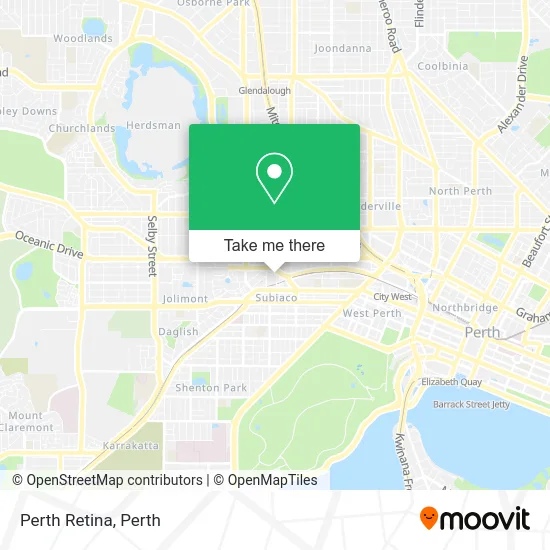
See Perth Retina, Subiaco, on the map
Public Transit to Perth Retina in Subiaco
Wondering how to get to Perth Retina in Subiaco? Moovit helps you find the best way to get to Perth Retina with step-by-step directions from the nearest public transit station.
Moovit provides free maps and live directions to help you navigate through your city. View schedules, routes, timetables, and find out how long does it take to get to Perth Retina in real time.
Looking for the nearest stop or station to Perth Retina? Check out this list of stops closest to your destination: Roberts Rd Before Centro Av; Subiaco Stn; Cambridge St Before Station St; Cambridge St - St John Of God Hospital; Elizabeth Quay Stn; Perth Stn; Ferry Route Elizabeth Quay Jetty.
Bus: 81, 82, 84, 85, 95, 28, AIRPORT LINE, FREMANTLE LINE, 97, 906, 83.Train: AIRPORT LINE, FREMANTLE LINE, MANDURAH LINE, YANCHEP LINE, ARMADALE LINE, ELLENBROOK LINE, MIDLAND LINE, THORNLIE-COCKBURN LINE.Ferry: FERRY ROUTE ELIZABETH QUAY JETTY - FERRY ROUTE MENDS ST JETTY.
Want to see if there’s another route that gets you there at an earlier time? Moovit helps you find alternative routes or times. Get directions from and directions to Perth Retina easily from the Moovit App or Website.
We make riding to Perth Retina easy, which is why over 1.5 million users, including users in Subiaco, trust Moovit as the best app for public transit. You don’t need to download an individual bus app or train app, Moovit is your all-in-one transit app that helps you find the best bus time or train time available.
For information on prices of bus and train, costs and ride fares to Perth Retina, please check the Moovit app.
Use the app to navigate to popular places including to the airport, hospital, stadium, grocery store, mall, coffee shop, school, college, and university.
Perth Retina Address: 9 Salvado Rd Subiaco WA 6008 street in Subiaco
- Dr Reuven Gurfinkel,
- Dr Todd Ladanchuk,
- Med Forum,
- 2023 Med Forum,
- Dr Catherine Harris,
- Envirodevelopment,
- Dr Benny Sullivan,
- Dr Marko Lambasa,
- Operation Rainbow,
- Optic Property,
- St Joseph's Catholic Church,
- Hekateros Pte,
- Perth Ent Centre,
- Perth Skin and Vein,
- Uthana Mission,
- The Parisian,
- Bendat Family Comprehensive Cancer Centre,
- Artesian,
- Dr Sani Erak,
- Shirt for Me
Places Near Perth Retina (Subiaco)
- Fiona Stanley Hospital, Murdoch,
- DFO, Perth Airport,
- Aqwa Aquarium, Hillarys,
- Rac Arena, Perth,
- Pelicaan Investment Ho, Bellevue,
- Langley Park, Perth,
- Crown Perth Casino, Burswood,
- Westfield Carousel, Cannington,
- Royal Perth Hospital, Perth,
- Blue Boat House,
- Karrinyup Shopping Centre, Karrinyup,
- Hillarys Boat Harbour,
- McCallum Park, Victoria Park,
- Yankee Mart, Baldivis,
- Sir Charles Gairdner Hospital, Nedlands,
- Optus Stadium, Burswood,
- Perth Convention Exhibition Centre, Perth,
- Mount Hospital, Perth,
- Scitech, West Perth,
- IKEA, Innaloo
How to get to popular places in Perth with public transport
Get around Subiaco by public transport!
Travelling around Subiaco has never been so easy. See step by step directions as you travel to any attraction, street or major public transport station. View bus and train timetables, arrival times, service alerts and detailed routes on a map, so you know exactly how to get to anywhere in Subiaco.
When travelling to any destination around Subiaco use Moovit's Live Directions with Get Off Notifications to know exactly where and how far to walk, how long to wait for your line , and how many stops are left. Moovit will alert you when it’s time to get off — no need to constantly re-check whether yours is the next stop.
Wondering how to use public transport in Subiaco or how to pay for public transport in Subiaco? Moovit public transport app can help you navigate your way with public transport easily, and at minimum cost. It includes public transport fees, ticket prices, and costs. Looking for a map of Subiaco public transport lines? Moovit public transport app shows all public transport maps in Subiaco with all Bus, Train and Ferry routes and stops on an interactive map.
Perth has 3 transport type(s), including: Bus, Train and Ferry, operated by several transport agencies, including Transperth Rail, Transwa, Transperth Ferry, Transperth, TransBusselton, TransAlbany, TransGoldfields, TransEsperance, TransGeraldton, TransCarnarvon, TransHedland, TransKarratha, TransBunbury, Mandurah Bus Charter and TransBroome