How to get to Perth Student Services by bus?
Click on the bus route to see step by step directions with maps, line arrival times and updated time schedules.
From Saint Mary's Cathedral, Perth
46 minFrom Morley Senior High School, Noranda
82 minFrom Newpark Shopping Centre, Girrawheen
72 minFrom St Andrews Grammar School, Dianella
77 minFrom Parliament House, West Perth
35 minFrom South Perth Hospital, South Perth
76 minFrom Watertown, Perth
31 minFrom Claremont Quarter, Claremont
44 minFrom Iona presentation College, Mosman Park
60 minFrom Morley, Morley
52 min
How to get to Perth Student Services by train?
Click on the train route to see step by step directions with maps, line arrival times and updated time schedules.
Bus stops near Perth Student Services in Churchlands
Bus lines to Perth Student Services in Churchlands
What are the nearest stations to Perth Student Services?
The nearest stations to Perth Student Services are:
- Pearson St After Dolomite Ct is 263 meters away, 4 min walk.
- Pearson St Before Hale Rd is 318 meters away, 5 min walk.
- Pearson St After Hale Rd is 435 meters away, 6 min walk.
- Tuscany Wy Before Mantua Cr is 550 meters away, 8 min walk.
- Pearson St Before Goldfinch Av is 637 meters away, 9 min walk.
Which bus lines stop near Perth Student Services?
These bus lines stop near Perth Student Services: 84, 998, 999.
Which train line stops near Perth Student Services?
YANCHEP LINE (Whitfords Stn)
What’s the nearest bus station to Perth Student Services in Churchlands?
The nearest bus station to Perth Student Services in Churchlands is Pearson St After Dolomite Ct. It’s a 4 min walk away.
What time is the first bus to Perth Student Services in Churchlands?
The 84 is the first bus that goes to Perth Student Services in Churchlands. It stops nearby at 05:05.
What time is the last bus to Perth Student Services in Churchlands?
The 84 is the last bus that goes to Perth Student Services in Churchlands. It stops nearby at 00:32.
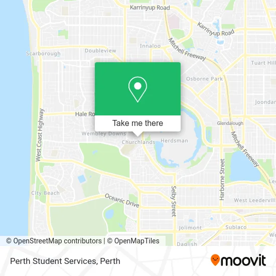
See Perth Student Services, Churchlands, on the map
Public Transit to Perth Student Services in Churchlands
Wondering how to get to Perth Student Services in Churchlands? Moovit helps you find the best way to get to Perth Student Services with step-by-step directions from the nearest public transit station.
Moovit provides free maps and live directions to help you navigate through your city. View schedules, routes, timetables, and find out how long does it take to get to Perth Student Services in real time.
Looking for the nearest stop or station to Perth Student Services? Check out this list of stops closest to your destination: Pearson St After Dolomite Ct; Pearson St Before Hale Rd; Pearson St After Hale Rd; Tuscany Wy Before Mantua Cr; Pearson St Before Goldfinch Av.
Bus: 84, 998, 999, 412, 83, 650.Train: YANCHEP LINE.
Want to see if there’s another route that gets you there at an earlier time? Moovit helps you find alternative routes or times. Get directions from and directions to Perth Student Services easily from the Moovit App or Website.
We make riding to Perth Student Services easy, which is why over 1.5 million users, including users in Churchlands, trust Moovit as the best app for public transit. You don’t need to download an individual bus app or train app, Moovit is your all-in-one transit app that helps you find the best bus time or train time available.
For information on prices of bus and train, costs and ride fares to Perth Student Services, please check the Moovit app.
Use the app to navigate to popular places including to the airport, hospital, stadium, grocery store, mall, coffee shop, school, college, and university.
Perth Student Services Address: 23 Silkwood Turn Churchlands WA 6018 street in Churchlands
- John Lucas Oval,
- Persian Delivery Food,
- The Marist Brothers,
- Activ Foundation Inc,
- Churchlands Senior High School,
- Floreat Waters Tennis Court,
- The Welsh Free Church of Wa,
- Purple Creatives Pty,
- Newman Sienna Netball Club,
- Spawned in Eatery by Fibrous Eatery Haha,
- Bull Banksia Tree,
- Champagnat Chapel,
- Marist Auditorium,
- Perth Dance Challeng,
- Short and Sweet Weddings,
- Marketing Academy Group,
- Splashsms,
- Ecommerce,
- Churchlands Campus Edith Cowan Childcare,
- Dance Stepz
Places Near Perth Student Services (Churchlands)
- Sir Charles Gairdner Hospital, Nedlands,
- Perth Convention Exhibition Centre, Perth,
- Optus Stadium, Burswood,
- Pelicaan Investment Ho, Bellevue,
- DFO, Perth Airport,
- Scitech, West Perth,
- Mount Hospital, Perth,
- McCallum Park, Victoria Park,
- Langley Park, Perth,
- Westfield Carousel, Cannington,
- Fiona Stanley Hospital, Murdoch,
- Hillarys Boat Harbour,
- Blue Boat House,
- Aqwa Aquarium, Hillarys,
- Crown Perth Casino, Burswood,
- Rac Arena, Perth,
- Yankee Mart, Baldivis,
- IKEA, Innaloo,
- Karrinyup Shopping Centre, Karrinyup,
- Royal Perth Hospital, Perth
How to get to popular places in Perth with public transport
Get around Churchlands by public transport!
Travelling around Churchlands has never been so easy. See step by step directions as you travel to any attraction, street or major public transport station. View bus and train timetables, arrival times, service alerts and detailed routes on a map, so you know exactly how to get to anywhere in Churchlands.
When travelling to any destination around Churchlands use Moovit's Live Directions with Get Off Notifications to know exactly where and how far to walk, how long to wait for your line , and how many stops are left. Moovit will alert you when it’s time to get off — no need to constantly re-check whether yours is the next stop.
Wondering how to use public transport in Churchlands or how to pay for public transport in Churchlands? Moovit public transport app can help you navigate your way with public transport easily, and at minimum cost. It includes public transport fees, ticket prices, and costs. Looking for a map of Churchlands public transport lines? Moovit public transport app shows all public transport maps in Churchlands with all Bus, Train and Ferry routes and stops on an interactive map.
Perth has 3 transport type(s), including: Bus, Train and Ferry, operated by several transport agencies, including Transperth Rail, Transwa, Transperth Ferry, Transperth, TransBusselton, TransAlbany, TransGoldfields, TransEsperance, TransGeraldton, TransCarnarvon, TransHedland, TransKarratha, TransBunbury, Mandurah Bus Charter and TransBroome