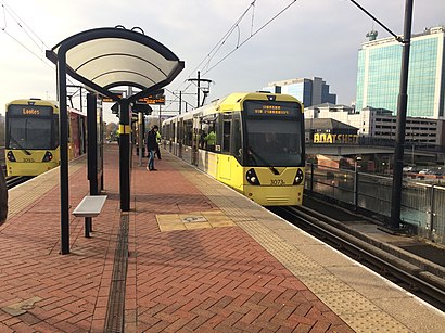
Pomona (Manchester Metrolink) station - Saturday schedule
| Line | Direction | Time |
|---|---|---|
| RED LINE | Deansgate-Castlefield (Manchester Metrolink) | 06:03 |
| BLUE LINE | Ashton-Under-Lyne (Manchester Metrolink) | 06:10 |
| BLUE LINE | Victoria (Manchester Metrolink) | 06:13 |
| RED LINE | Deansgate-Castlefield (Manchester Metrolink) | 06:15 |
| BLUE LINE | Ashton-Under-Lyne (Manchester Metrolink) | 06:22 |
| BLUE LINE | Victoria (Manchester Metrolink) | 06:25 |
| RED LINE | Deansgate-Castlefield (Manchester Metrolink) | 06:27 |
| BLUE LINE | Ashton-Under-Lyne (Manchester Metrolink) | 06:34 |
| BLUE LINE | Victoria (Manchester Metrolink) | 06:37 |
| RED LINE | Deansgate-Castlefield (Manchester Metrolink) | 06:39 |
| BLUE LINE | Ashton-Under-Lyne (Manchester Metrolink) | 06:46 |
| BLUE LINE | Victoria (Manchester Metrolink) | 06:49 |
| RED LINE | Deansgate-Castlefield (Manchester Metrolink) | 06:51 |
| BLUE LINE | Ashton-Under-Lyne (Manchester Metrolink) | 06:58 |
| BLUE LINE | Victoria (Manchester Metrolink) | 07:01 |
| RED LINE | Deansgate-Castlefield (Manchester Metrolink) | 07:03 |
| BLUE LINE | Ashton-Under-Lyne (Manchester Metrolink) | 07:10 |
| BLUE LINE | Victoria (Manchester Metrolink) | 07:13 |
| RED LINE | Deansgate-Castlefield (Manchester Metrolink) | 07:15 |
| BLUE LINE | Ashton-Under-Lyne (Manchester Metrolink) | 07:22 |
| BLUE LINE | Victoria (Manchester Metrolink) | 07:25 |
| RED LINE | Deansgate-Castlefield (Manchester Metrolink) | 07:27 |
| BLUE LINE | Ashton-Under-Lyne (Manchester Metrolink) | 07:34 |
| BLUE LINE | Victoria (Manchester Metrolink) | 07:37 |
| RED LINE | Deansgate-Castlefield (Manchester Metrolink) | 07:39 |
Directions to Pomona (Manchester Metrolink) station (Trafford Bar) with public transport
The following transport lines have routes that pass near Pomona (Manchester Metrolink)
 Bus: 256, 263, 53, X50, 79.
- Train: NORTHERN.
- Light rail: BLUE LINE.
How to get to Pomona (Manchester Metrolink) station by bus?
Click on the bus route to see step by step directions with maps, line arrival times and updated time schedules.
How to get to Pomona (Manchester Metrolink) station by train?
Click on the train route to see step by step directions with maps, line arrival times and updated time schedules.
How to get to Pomona (Manchester Metrolink) station by light rail?
Click on the light rail route to see step by step directions with maps, line arrival times and updated time schedules.
Bus stops near Pomona (Manchester Metrolink) stop in Trafford Bar
- Clippers Quay, 1 min walk,
- Trafford Road, 6 min walk,
- White City, 10 min walk,
- Trafford Bar, 12 min walk,
- Boyer Street, 12 min walk,
Light Rail stations near Pomona (Manchester Metrolink) station in Trafford Bar
- Exchange Quay (Manchester Metrolink), 2 min walk,
- Trafford Bar (Manchester Metrolink), 20 min walk,
- Pomona (Manchester Metrolink), 31 min walk,
Bus lines to Pomona (Manchester Metrolink) station in Trafford Bar
- 53, Velopark Metrolink Stop,
- 79, Stretford Arndale,
- 745, Loreto College,
- X50, Piccadilly Gardens,
- 255, Partington - Manchester,
- 256, Urmston - Manchester,
- 250, Piccadilly Gardens,
- 263, Altrincham Interchange,
- 253, Piccadilly Gardens,
What are the nearest stations to Pomona (Manchester Metrolink)?
The nearest stations to Pomona (Manchester Metrolink) are:
- Clippers Quay is 51 meters away, 1 min walk.
- Exchange Quay (Manchester Metrolink) is 142 meters away, 2 min walk.
- Trafford Road is 446 meters away, 6 min walk.
- White City is 731 meters away, 10 min walk.
- Trafford Bar is 871 meters away, 12 min walk.
- Boyer Street is 922 meters away, 12 min walk.
- Trafford Bar (Manchester Metrolink) is 1510 meters away, 20 min walk.
- Pomona (Manchester Metrolink) is 2363 meters away, 31 min walk.
Which bus lines stop near Pomona (Manchester Metrolink)?
These bus lines stop near Pomona (Manchester Metrolink): 256, 263, 53, X50.
Which train line stops near Pomona (Manchester Metrolink)?
NORTHERN (Windermere)
Which light rail line stops near Pomona (Manchester Metrolink)?
BLUE LINE (Mediacityuk (Manchester Metrolink))
What’s the nearest light rail station to Pomona (Manchester Metrolink) in Trafford Bar?
The nearest light rail station to Pomona (Manchester Metrolink) in Trafford Bar is Exchange Quay (Manchester Metrolink). It’s a 2 min walk away.
What’s the nearest bus station to Pomona (Manchester Metrolink) in Trafford Bar?
The nearest bus station to Pomona (Manchester Metrolink) in Trafford Bar is Clippers Quay. It’s a 1 min walk away.
What time is the first light rail to Pomona (Manchester Metrolink) in Trafford Bar?
The BLUE LINE is the first light rail that goes to Pomona (Manchester Metrolink) in Trafford Bar. It stops nearby at 05:02.
What time is the last light rail to Pomona (Manchester Metrolink) in Trafford Bar?
The BLUE LINE is the last light rail that goes to Pomona (Manchester Metrolink) in Trafford Bar. It stops nearby at 00:56.
What time is the first bus to Pomona (Manchester Metrolink) in Trafford Bar?
The 256 is the first bus that goes to Pomona (Manchester Metrolink) in Trafford Bar. It stops nearby at 04:47.
What time is the last bus to Pomona (Manchester Metrolink) in Trafford Bar?
The 256 is the last bus that goes to Pomona (Manchester Metrolink) in Trafford Bar. It stops nearby at 00:45.
See Pomona (Manchester Metrolink) station, Trafford Bar, on the map
Public transport to Pomona (Manchester Metrolink) station in Trafford Bar
Looking for directions to Pomona (Manchester Metrolink) in Trafford Bar, United Kingdom?
Download the Moovit App to find the current schedule and step-by-step directions for Light rail, Bus or Train routes that pass through Pomona (Manchester Metrolink).
Looking for the nearest stops closest to Pomona (Manchester Metrolink) ? Check out this list of closest stops to your destination: Clippers Quay; Exchange Quay (Manchester Metrolink); Trafford Road; White City; Trafford Bar; Boyer Street; Trafford Bar (Manchester Metrolink); Pomona (Manchester Metrolink).
Bus: 256, 263, 53, X50, 79, 745, 255, 250, 253.Train: NORTHERN.Light rail: BLUE LINE.
We make riding on public transit to Pomona (Manchester Metrolink) easy, which is why over 1.5 million users, including users in Trafford Bar trust Moovit as the best app for public transit.
Use the app to navigate to popular places including to the airport, hospital, stadium, grocery store, mall, coffee shop, school, college, and university.
The first line to this station is RED LINE, at 06:03, and the last line is RED LINE at 00:23.
This station serves Metrolink’s lines
- Clippers Quay,
- Trafford Road,
- White City,
- Trafford Bar,
- Boyer Street
Bus stops near Pomona (Manchester Metrolink) stop
- Exchange Quay (Manchester Metrolink),
- Trafford Bar (Manchester Metrolink),
- Pomona (Manchester Metrolink)
Light Rail stations near Pomona (Manchester Metrolink) station
- Manor Avenue,
- Hurlston Hall Golf Club,
- Haslingden Road,
- Marple Bridge,
- Hebden Bridge,
- Rough Hill Lane,
- Woodsmoor,
- Campbell Street,
- Longfield Centre,
- Cobden Street,
- Littleborough,
- The Owls,
- Runcorn Station,
- Hightown,
- Lord North Street,
- Grangethorpe Road,
- Victoria Square,
- Hasty Lane,
- Bold Street,
- Victoria Hospital (To Blackpool)
Popular public transport stations in Trafford Bar
Get around Trafford Bar by public transport!
Travelling around Trafford Bar has never been so easy. See step by step directions as you travel to any attraction, street or major public transport station. View bus and train timetables, arrival times, service alerts and detailed routes on a map, so you know exactly how to get to anywhere in Trafford Bar.
When travelling to any destination around Trafford Bar use Moovit's Live Directions with Get Off Notifications to know exactly where and how far to walk, how long to wait for your line , and how many stops are left. Moovit will alert you when it’s time to get off — no need to constantly re-check whether yours is the next stop.
Wondering how to use public transport in Trafford Bar or how to pay for public transport in Trafford Bar? Moovit public transport app can help you navigate your way with public transport easily, and at minimum cost. It includes public transport fees, ticket prices, and costs. Looking for a map of Trafford Bar public transport lines? Moovit public transport app shows all public transport maps in Trafford Bar with all Bus, Train, Light rail and Ferry routes and stops on an interactive map.
North West has 4 transport type(s), including: Bus, Train, Light rail and Ferry, operated by several transport agencies, including Arriva North West, Stagecoach Merseyside and South Lancashire, Stagecoach Cumbria and North Lancashire, First Halifax, National Express, Warrington's Own Buses, First Potteries, Rosso, Blackpool Transport, The Blackburn Bus Company, The Burnley Bus Company, Vision Bus, National Rail, Huyton Travel and Stotts Tours