Directions to Quickstop (Myaree) with public transport
The following transport lines have routes that pass near Quickstop
 Bus: 160, 502, 915, 658.
- Train: MANDURAH LINE.
How to get to Quickstop by bus?
Click on the bus route to see step by step directions with maps, line arrival times and updated time schedules.
From B Shed Jetty, Fremantle
27 minFrom Bib & Tucker, North Fremantle
55 minFrom Mount Hospital Perth Radilogical Clinic, Perth
52 minFrom Phoenix Shopping Centre, Spearwood
39 minFrom The Gate Bar & Bistro, Success
78 minFrom Aurea Hotel Perth Kings Park, Perth
51 minFrom Southbank Day Surgery, South Perth
71 minFrom Cicerello's, Fremantle
35 minFrom John Oldham Park, Perth
52 minFrom Zamia Cafe, Perth
58 min
How to get to Quickstop by train?
Click on the train route to see step by step directions with maps, line arrival times and updated time schedules.
Bus stops near Quickstop in Myaree
Bus lines to Quickstop in Myaree
What are the nearest stations to Quickstop?
The nearest stations to Quickstop are:
- Leach Hwy After Wheyland St is 247 meters away, 4 min walk.
- North Lake Rd After Leach Hwy is 542 meters away, 8 min walk.
- Leach Hwy After Joiner St is 564 meters away, 8 min walk.
- Leach Hwy After North Lake Rd is 650 meters away, 9 min walk.
Which bus lines stop near Quickstop?
These bus lines stop near Quickstop: 160, 502.
Which train line stops near Quickstop?
MANDURAH LINE (Mandurah Stn)
What’s the nearest bus station to Quickstop in Myaree?
The nearest bus station to Quickstop in Myaree is Leach Hwy After Wheyland St. It’s a 4 min walk away.
What time is the first bus to Quickstop in Myaree?
The 160 is the first bus that goes to Quickstop in Myaree. It stops nearby at 05:16.
What time is the last bus to Quickstop in Myaree?
The 160 is the last bus that goes to Quickstop in Myaree. It stops nearby at 23:47.
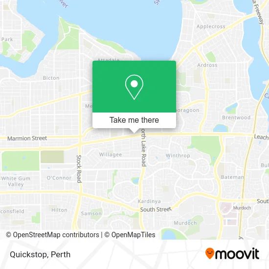
See Quickstop, Myaree, on the map
Public Transit to Quickstop in Myaree
Wondering how to get to Quickstop in Myaree? Moovit helps you find the best way to get to Quickstop with step-by-step directions from the nearest public transit station.
Moovit provides free maps and live directions to help you navigate through your city. View schedules, routes, timetables, and find out how long does it take to get to Quickstop in real time.
Looking for the nearest stop or station to Quickstop? Check out this list of stops closest to your destination: Leach Hwy After Wheyland St; North Lake Rd After Leach Hwy; Leach Hwy After Joiner St; Leach Hwy After North Lake Rd.
Bus: 160, 502, 915, 658.Train: MANDURAH LINE.
Want to see if there’s another route that gets you there at an earlier time? Moovit helps you find alternative routes or times. Get directions from and directions to Quickstop easily from the Moovit App or Website.
We make riding to Quickstop easy, which is why over 1.5 million users, including users in Myaree, trust Moovit as the best app for public transit. You don’t need to download an individual bus app or train app, Moovit is your all-in-one transit app that helps you find the best bus time or train time available.
For information on prices of bus and train, costs and ride fares to Quickstop, please check the Moovit app.
Use the app to navigate to popular places including to the airport, hospital, stadium, grocery store, mall, coffee shop, school, college, and university.
Quickstop Address: 182 Leach Hwy Myaree WA 6154 street in Myaree
- Mobil,
- Ipoh Garden Restaurant,
- HK Massage au,
- Redi Lending,
- Ipoh Restaurant,
- Ohnami Myr Ohnamiyamy,
- Bigwave Catering Myaree,
- 2 Curries do Culture,
- Raspa Property Group,
- CORA Charcoal BBQ,
- Doordash Main Area,
- QBR Solutions,
- Chop Chop BBQ,
- Myaree Megaplex,
- Melville Renault,
- Pony Mod Shop,
- Prestige Used Cars Perth,
- T4U,
- Melville SUBARU,
- Vitaaus Vita Australia
Places Near Quickstop (Myaree)
- Rac Arena, Perth,
- Optus Stadium, Burswood,
- Perth Convention Exhibition Centre, Perth,
- McCallum Park, Victoria Park,
- Yankee Mart, Baldivis,
- IKEA, Innaloo,
- Karrinyup Shopping Centre, Karrinyup,
- Royal Perth Hospital, Perth,
- Westfield Carousel, Cannington,
- Scitech, West Perth,
- Sir Charles Gairdner Hospital, Nedlands,
- Aqwa Aquarium, Hillarys,
- Fiona Stanley Hospital, Murdoch,
- Pelicaan Investment Ho, Bellevue,
- DFO, Perth Airport,
- Watertown, Perth,
- Mount Hospital, Perth,
- Crown Perth Casino, Burswood,
- Langley Park, Perth,
- Blue Boat House
How to get to popular places in Perth with public transport
Get around Myaree by public transport!
Travelling around Myaree has never been so easy. See step by step directions as you travel to any attraction, street or major public transport station. View bus and train timetables, arrival times, service alerts and detailed routes on a map, so you know exactly how to get to anywhere in Myaree.
When travelling to any destination around Myaree use Moovit's Live Directions with Get Off Notifications to know exactly where and how far to walk, how long to wait for your line , and how many stops are left. Moovit will alert you when it’s time to get off — no need to constantly re-check whether yours is the next stop.
Wondering how to use public transport in Myaree or how to pay for public transport in Myaree? Moovit public transport app can help you navigate your way with public transport easily, and at minimum cost. It includes public transport fees, ticket prices, and costs. Looking for a map of Myaree public transport lines? Moovit public transport app shows all public transport maps in Myaree with all Bus, Train and Ferry routes and stops on an interactive map.
Perth has 3 transport type(s), including: Bus, Train and Ferry, operated by several transport agencies, including Transperth Rail, Transwa, Transperth Ferry, Transperth, TransBusselton, TransAlbany, TransGoldfields, TransEsperance, TransGeraldton, TransCarnarvon, TransHedland, TransKarratha, TransBunbury, Mandurah Bus Charter and TransBroome