Directions to Quickstop (Wanneroo) with public transport
The following transport lines have routes that pass near Quickstop
 Bus: 467, 468, 390, 391.
- Train: YANCHEP LINE.
How to get to Quickstop by bus?
Click on the bus route to see step by step directions with maps, line arrival times and updated time schedules.
From Adam & Carley's Brothel , All You Can Eat Buffet & Karaoke, Madeley
36 minFrom Peter Moyes Anglican Community School, Mindarie
82 minFrom Clarkson Station, Clarkson
73 minFrom Belridge Secondary College, Beldon
39 minFrom Woodvale Tavern, Woodvale
51 minFrom Irene Mccormack Catholic College, Butler
76 minFrom Quinns Rocks, Quinns Rocks
72 minFrom Hillarys, Hillarys
49 minFrom Beldon, Beldon
57 minFrom Landsdale, Landsdale
57 min
How to get to Quickstop by train?
Click on the train route to see step by step directions with maps, line arrival times and updated time schedules.
Bus stops near Quickstop in Wanneroo
Bus lines to Quickstop in Wanneroo
What are the nearest stations to Quickstop?
The nearest stations to Quickstop are:
- Wanneroo Rd Before Clarkson Av is 158 meters away, 3 min walk.
- Wanneroo Rd Before Joondalup Dr is 217 meters away, 3 min walk.
- Joondalup Dr Before Wanneroo Rd is 458 meters away, 6 min walk.
Which bus lines stop near Quickstop?
These bus lines stop near Quickstop: 467, 468.
Which train line stops near Quickstop?
YANCHEP LINE (Elizabeth Quay Stn)
What’s the nearest bus station to Quickstop in Wanneroo?
The nearest bus stations to Quickstop in Wanneroo are Wanneroo Rd Before Clarkson Av and Wanneroo Rd Before Joondalup Dr. The closest one is a 3 min walk away.
What time is the first bus to Quickstop in Wanneroo?
The 390 is the first bus that goes to Quickstop in Wanneroo. It stops nearby at 04:48.
What time is the last bus to Quickstop in Wanneroo?
The 468 is the last bus that goes to Quickstop in Wanneroo. It stops nearby at 23:28.
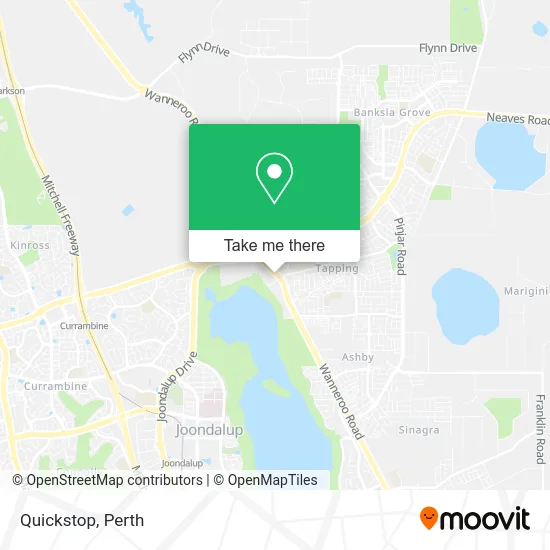
See Quickstop, Wanneroo, on the map
Public Transit to Quickstop in Wanneroo
Wondering how to get to Quickstop in Wanneroo? Moovit helps you find the best way to get to Quickstop with step-by-step directions from the nearest public transit station.
Moovit provides free maps and live directions to help you navigate through your city. View schedules, routes, timetables, and find out how long does it take to get to Quickstop in real time.
Looking for the nearest stop or station to Quickstop? Check out this list of stops closest to your destination: Wanneroo Rd Before Clarkson Av; Wanneroo Rd Before Joondalup Dr; Joondalup Dr Before Wanneroo Rd.
Bus: 467, 468, 390, 391.Train: YANCHEP LINE.
Want to see if there’s another route that gets you there at an earlier time? Moovit helps you find alternative routes or times. Get directions from and directions to Quickstop easily from the Moovit App or Website.
We make riding to Quickstop easy, which is why over 1.5 million users, including users in Wanneroo, trust Moovit as the best app for public transit. You don’t need to download an individual bus app or train app, Moovit is your all-in-one transit app that helps you find the best bus time or train time available.
For information on prices of bus and train, costs and ride fares to Quickstop, please check the Moovit app.
Use the app to navigate to popular places including to the airport, hospital, stadium, grocery store, mall, coffee shop, school, college, and university.
Quickstop Address: 1369 Wanneroo Rd Wanneroo WA 6065 street in Wanneroo
- Bosch Service,
- Pie Face Tapping,
- Bridgestone Select Tyre and Auto Tapping,
- Revo Fitness,
- Wanneroo Early Learning,
- Lollipops Playland & Cafe Wanneroo,
- Chipmunks Australia,
- Good Sammy,
- Shell SELECT,
- Water Ponyz Swim School Wanneroo,
- Kaylin Harston Retreat,
- G Max Ceiling Solution,
- Hansen Psychological Services,
- Sleep Remedies,
- Knight Health-Wanneroo,
- Richer Nails,
- The Butcher the Ba,
- Drovers-Family Fresh Growers Market,
- Brookside Medical,
- Drovers Medical Centre
Places Near Quickstop (Wanneroo)
- Pelicaan Investment Ho, Bellevue,
- Aqwa Aquarium, Hillarys,
- Westfield Carousel, Cannington,
- Yankee Mart, Baldivis,
- Scitech, West Perth,
- Hillarys Boat Harbour,
- Perth Convention Exhibition Centre, Perth,
- Blue Boat House,
- DFO, Perth Airport,
- Optus Stadium, Burswood,
- Karrinyup Shopping Centre, Karrinyup,
- Fiona Stanley Hospital, Murdoch,
- Rac Arena, Perth,
- Royal Perth Hospital, Perth,
- Crown Perth Casino, Burswood,
- Langley Park, Perth,
- Sir Charles Gairdner Hospital, Nedlands,
- Mount Hospital, Perth,
- McCallum Park, Victoria Park,
- IKEA, Innaloo
How to get to popular places in Perth with public transport
Get around Wanneroo by public transport!
Travelling around Wanneroo has never been so easy. See step by step directions as you travel to any attraction, street or major public transport station. View bus and train timetables, arrival times, service alerts and detailed routes on a map, so you know exactly how to get to anywhere in Wanneroo.
When travelling to any destination around Wanneroo use Moovit's Live Directions with Get Off Notifications to know exactly where and how far to walk, how long to wait for your line , and how many stops are left. Moovit will alert you when it’s time to get off — no need to constantly re-check whether yours is the next stop.
Wondering how to use public transport in Wanneroo or how to pay for public transport in Wanneroo? Moovit public transport app can help you navigate your way with public transport easily, and at minimum cost. It includes public transport fees, ticket prices, and costs. Looking for a map of Wanneroo public transport lines? Moovit public transport app shows all public transport maps in Wanneroo with all Bus, Train and Ferry routes and stops on an interactive map.
Perth has 3 transport type(s), including: Bus, Train and Ferry, operated by several transport agencies, including Transperth Rail, Transwa, Transperth Ferry, Transperth, TransBusselton, TransAlbany, TransGoldfields, TransEsperance, TransGeraldton, TransCarnarvon, TransHedland, TransKarratha, TransBunbury, Mandurah Bus Charter and TransBroome