Directions to RBS (Holyhead) with public transport
The following transport lines have routes that pass near RBS
 Bus: 11A, 11C, 54, 54A, 61A.
- Train: WEST MIDLANDS RAILWAY, CHILTERN RAILWAYS.
How to get to RBS by bus?
Click on the bus route to see step by step directions with maps, line arrival times and updated time schedules.
From Mucklow Hill, Halesowen South
40 minFrom University Of Birmingham Vincent Drive Car Park, Edgbaston
44 minFrom The Foxy Lady Adult Cinema, Bilston East
57 minFrom Birmingham Dental Hospital and School of Dentistry, Edgbaston
61 minFrom Swan Shopping Centre, South Yardley
54 minFrom College Road, Kingstanding
36 minFrom Elmhurst Ballet School, Edgbaston
61 minFrom Irish Centre, Billesley
59 minFrom Rowheath Pavilion, Bournville & Cotteridge
41 minFrom Lifford House, Stirchley
45 min
How to get to RBS by train?
Click on the train route to see step by step directions with maps, line arrival times and updated time schedules.
From University Of Birmingham Vincent Drive Car Park, Edgbaston
66 minFrom Birmingham Dental Hospital and School of Dentistry, Edgbaston
92 minFrom Swan Shopping Centre, South Yardley
80 minFrom Irish Centre, Billesley
100 minFrom Rowheath Pavilion, Bournville & Cotteridge
96 minFrom Lifford House, Stirchley
99 min
Bus stops near RBS in Holyhead
Light Rail stations near RBS in Holyhead
- Handsworth Booth Street (West Midlands Metro), 31 min walk,VIEW
Train station near RBS in Holyhead
- The Hawthorns, 31 min walk,VIEW
Bus lines to RBS in Holyhead
What are the nearest stations to RBS?
The nearest stations to RBS are:
- University Campus is 176 meters away, 3 min walk.
- Newcombe Rd is 403 meters away, 6 min walk.
- Stockwell Rd is 423 meters away, 6 min walk.
- Greenhill Road is 476 meters away, 7 min walk.
- Handsworth Booth Street (West Midlands Metro) is 2357 meters away, 31 min walk.
- The Hawthorns is 2390 meters away, 31 min walk.
Which bus lines stop near RBS?
These bus lines stop near RBS: 11A, 11C.
Which train line stops near RBS?
WEST MIDLANDS RAILWAY (Walsall)
What’s the nearest bus station to RBS in Holyhead?
The nearest bus station to RBS in Holyhead is University Campus. It’s a 3 min walk away.
What time is the first light rail to RBS in Holyhead?
The METRO is the first light rail that goes to RBS in Holyhead. It stops nearby at 07:24.
What time is the last light rail to RBS in Holyhead?
The METRO is the last light rail that goes to RBS in Holyhead. It stops nearby at 00:33.
What time is the first train to RBS in Holyhead?
The WEST MIDLANDS RAILWAY is the first train that goes to RBS in Holyhead. It stops nearby at 09:35.
What time is the last train to RBS in Holyhead?
The WEST MIDLANDS RAILWAY is the last train that goes to RBS in Holyhead. It stops nearby at 23:15.
What time is the first bus to RBS in Holyhead?
The 11A is the first bus that goes to RBS in Holyhead. It stops nearby at 06:49.
What time is the last bus to RBS in Holyhead?
The 11C is the last bus that goes to RBS in Holyhead. It stops nearby at 00:31.
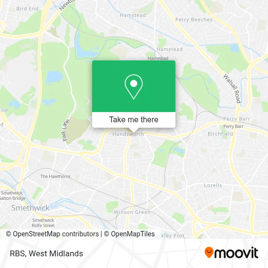
See RBS, Holyhead, on the map
Public Transit to RBS in Holyhead
Wondering how to get to RBS in Holyhead? Moovit helps you find the best way to get to RBS with step-by-step directions from the nearest public transit station.
Moovit provides free maps and live directions to help you navigate through your city. View schedules, routes, timetables, and find out how long does it take to get to RBS in real time.
Looking for the nearest stop or station to RBS? Check out this list of stops closest to your destination: University Campus; Newcombe Rd; Stockwell Rd; Greenhill Road; Handsworth Booth Street (West Midlands Metro); The Hawthorns.
Bus: 11A, 11C, 54, 54A, 61A, 61, 101.Train: WEST MIDLANDS RAILWAY, CHILTERN RAILWAYS.
Want to see if there’s another route that gets you there at an earlier time? Moovit helps you find alternative routes or times. Get directions from and directions to RBS easily from the Moovit App or Website.
We make riding to RBS easy, which is why over 1.7 million users, including users in Holyhead, trust Moovit as the best app for public transit. You don’t need to download an individual bus app or train app, Moovit is your all-in-one transit app that helps you find the best bus time or train time available.
For information on prices of bus, train and light rail, costs and ride fares to RBS, please check the Moovit app.
Use the app to navigate to popular places including to the airport, hospital, stadium, grocery store, mall, coffee shop, school, college, and university.
RBS Address: Handsworth Birmingham B21 9 street in Holyhead
- Lloyds Pharmacy,
- Ak Builders & Contractors,
- Manor Grove,
- N & A Liquor Store,
- Fika Moment,
- Abs Heating Plumbing Supplies,
- Mathu International,
- SM Pest Control,
- Let Prestige,
- Fireworks,
- Notemachine,
- Big World Of Fireworks,
- Ram's Dhaba Limited,
- Tasteofpunjabhandsworth,
- Nawroz,
- Fast Uk Trading,
- Bairstow Eves,
- HUNTERS,
- Laurel Road Community Sports Centre,
- 360andvibes
Places Near RBS (Holyhead)
- The Merry Hill Centre, Brierley Hill,
- Studley Castle, Studley,
- Boundary Mill Stores, Bentley And Darlaston North,
- Birmingham And Midland Eye Centre, Soho & Jewellery Quarter,
- Birmingham Dental Hospital, Edgbaston,
- Heritage Building (Queen Elizabeth Hospital), Edgbaston,
- IKEA Wednesbury, Oldbury,
- Woodlands Cemetery And Crematorium, Coleshill North,
- Travelodge Birmingham Airport Hotel Birmingham, Bickenhill,
- One Stop Shopping Centre, Perry Barr,
- Waseley Hills Crematorium, Frankley Great Park,
- Royal Orthopaedic Hospital, Northfield,
- Fort Shopping Centre, Birmingham, Pype Hayes,
- Lilleshall Hall National Sports Centre, Telford,
- Wolstanton Retail Park, Wolstanton,
- IKEA Birmingham Central, Ladywood,
- Bournville Staff Shop (Cadbury World), Bournville & Cotteridge,
- Tally Ho Police Training, Birmingham, Edgbaston,
- Crown Wharf Retail Park, St. Matthew's,
- Bickerstaff Endoscopy Unit (PRH), Apley Castle
How to get to popular places in West Midlands with public transport
Get around Holyhead by public transport!
Travelling around Holyhead has never been so easy. See step by step directions as you travel to any attraction, street or major public transport station. View bus and train timetables, arrival times, service alerts and detailed routes on a map, so you know exactly how to get to anywhere in Holyhead.
When travelling to any destination around Holyhead use Moovit's Live Directions with Get Off Notifications to know exactly where and how far to walk, how long to wait for your line , and how many stops are left. Moovit will alert you when it’s time to get off — no need to constantly re-check whether yours is the next stop.
Wondering how to use public transport in Holyhead or how to pay for public transport in Holyhead? Moovit public transport app can help you navigate your way with public transport easily, and at minimum cost. It includes public transport fees, ticket prices, and costs. Looking for a map of Holyhead public transport lines? Moovit public transport app shows all public transport maps in Holyhead with all Bus, Train and Light rail routes and stops on an interactive map.
West Midlands has 3 transport type(s), including: Bus, Train and Light rail, operated by several transport agencies, including National Express West Midlands, National Express Coventry, National Express, Diamond Bus, Arriva Midlands, Stagecoach Midlands, West Midlands Metro, Stagecoach West, Stagecoach South Wales, First Potteries, First Worcestershire, LandFlight, trentbarton, D & G Bus and Flexibus