How to get to Rac Bunbury by bus?
Click on the bus route to see step by step directions with maps, line arrival times and updated time schedules.
Bus stops near Rac Bunbury
Bus routes to Rac Bunbury
- 827, Picton Primary School,VIEW
- 828, Bunbury Bus Stn,VIEW
- 829, Bunbury Bus Stn,VIEW
- 832, Bunbury Bus Stn,VIEW
- 843, Bunbury Bus Stn,VIEW
- 826, Bunbury Bus Stn,VIEW
- 840, Kingston Dr / Holbrook Rd,VIEW
- 841, Australind,VIEW
- 844, Millbridge,VIEW
- 830, Somerville Dr / Winthrop Av,VIEW
- EAST PERTH, Collie,VIEW
- 825, Dolphin Discovery Centre,VIEW
- 899, Hands Oval,VIEW
What are the nearest stations to Rac Bunbury?
The nearest stations to Rac Bunbury are:
- Hayes St After Charles St is 287 meters away, 4 min walk.
- Wittenoom St After Prinsep St is 368 meters away, 6 min walk.
- Blair St After Stirling St is 453 meters away, 6 min walk.
- Symmons St Before Wittenoom St is 564 meters away, 8 min walk.
- Bunbury Bus Stn is 699 meters away, 9 min walk.
Which bus lines stop near Rac Bunbury?
These bus lines stop near Rac Bunbury: 826, 827, 840, 841.
What’s the nearest bus station to Rac Bunbury?
The nearest bus station to Rac Bunbury is Hayes St After Charles St. It’s a 4 min walk away.
What time is the first bus to Rac Bunbury?
The 843 is the first bus that goes to Rac Bunbury. It stops nearby at 06:48.
What time is the last bus to Rac Bunbury?
The 826 is the last bus that goes to Rac Bunbury. It stops nearby at 20:41.
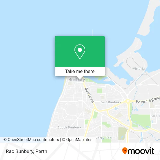
See Rac Bunbury on the map
Public Transportation to Rac Bunbury
Wondering how to get to Rac Bunbury? Moovit helps you find the best way to get to Rac Bunbury with step-by-step directions from the nearest public transit station.
Moovit provides free maps and live directions to help you navigate through your city. View schedules, routes, timetables, and find out how long does it take to get to Rac Bunbury in real time.
Looking for the nearest stop or station to Rac Bunbury? Check out this list of stops closest to your destination: Hayes St After Charles St; Wittenoom St After Prinsep St; Blair St After Stirling St; Symmons St Before Wittenoom St; Bunbury Bus Stn.
Bus: 826, 827, 840, 841, 828, 829, 832, 843, 844, 830, EAST PERTH, 825, 899.
Want to see if there’s another route that gets you there at an earlier time? Moovit helps you find alternative routes or times. Get directions from and directions to Rac Bunbury easily from the Moovit App or Website.
We make riding to Rac Bunbury easy, which is why over 1.5 million users, including users in Bunbury, trust Moovit as the best app for public transit. You don’t need to download an individual bus app or train app, Moovit is your all-in-one transit app that helps you find the best bus time or train time available.
For information on prices of bus, costs and ride fares to Rac Bunbury, please check the Moovit app.
Use the app to navigate to popular places including to the airport, hospital, stadium, grocery store, mall, coffee shop, school, college, and university.
Rac Bunbury Address: 22-28 Stephen St Bunbury WA 6230 street in Bunbury
- Este Lauder,
- KD Design & Marketing,
- Discovery Parks - Bunbury Village,
- Blade Cartel Bunbury,
- Ruby's Accessories,
- Plumber Bunbury,
- Sunglass Hut,
- Bambi Blonde,
- Croweaters Pl,
- Kitchen Formations,
- Ideal Breakfast Shake,
- Local by Heart,
- Heatseeker,
- Eloise Fashions Bunbury,
- The Golden Roast Bunbury,
- Hillview Counselling,
- Brittany Ford Myofunctional Therapy,
- Voice Central,
- Vinnies Retail Centre,
- Hoolee Dooleez Variety and Value
Places Near Rac Bunbury
- Perth Convention Exhibition Centre, Perth,
- Optus Stadium, Burswood,
- DFO, Perth Airport,
- Pelicaan Investment Ho, Bellevue,
- Rac Arena, Perth,
- Langley Park, Perth,
- Aqwa Aquarium, Hillarys,
- Royal Perth Hospital, Perth,
- Scitech, West Perth,
- Mount Hospital, Perth,
- IKEA, Innaloo,
- Westfield Carousel, Cannington,
- Blue Boat House,
- Fiona Stanley Hospital, Murdoch,
- McCallum Park, Victoria Park,
- Sir Charles Gairdner Hospital, Nedlands,
- Karrinyup Shopping Centre, Karrinyup,
- Hillarys Boat Harbour,
- Crown Perth Casino, Burswood,
- Yankee Mart, Baldivis
How to get to popular places in Perth with public transport
Get around Bunbury by public transport!
Travelling around Bunbury has never been so easy. See step by step directions as you travel to any attraction, street or major public transport station. View bus and train timetables, arrival times, service alerts and detailed routes on a map, so you know exactly how to get to anywhere in Bunbury.
When travelling to any destination around Bunbury use Moovit's Live Directions with Get Off Notifications to know exactly where and how far to walk, how long to wait for your line , and how many stops are left. Moovit will alert you when it’s time to get off — no need to constantly re-check whether yours is the next stop.
Wondering how to use public transport in Bunbury or how to pay for public transport in Bunbury? Moovit public transport app can help you navigate your way with public transport easily, and at minimum cost. It includes public transport fees, ticket prices, and costs. Looking for a map of Bunbury public transport lines? Moovit public transport app shows all public transport maps in Bunbury with all Bus, Train and Ferry routes and stops on an interactive map.
Perth has 3 transport type(s), including: Bus, Train and Ferry, operated by several transport agencies, including Transperth Rail, Transwa, Transperth Ferry, Transperth, TransBusselton, TransAlbany, TransGoldfields, TransEsperance, TransGeraldton, TransCarnarvon, TransHedland, TransKarratha, TransBunbury, Mandurah Bus Charter and TransBroome