Directions to Rac Travel Mandurah (Halls Head) with public transport
The following transport lines have routes that pass near Rac Travel Mandurah
 Bus: 591.
How to get to Rac Travel Mandurah by bus?
Click on the bus route to see step by step directions with maps, line arrival times and updated time schedules.
From Austin Cove Baptist College, West Pinjarra
148 minFrom Secret Harbour, Secret Harbour
97 minFrom Singleton WA Australia, Singleton
86 minFrom Peel Health Campus, Greenfields
50 minFrom Port Kennedy, Port Kennedy
100 minFrom Lakelands Shopping Centre, Lakelands
70 minFrom Larkhill Sporting Complex, Port Kennedy
94 minFrom Truckers Enterprises P, Port Kennedy
91 minFrom Mandurah Baptist College, Lakelands
63 minFrom Amaze Miniature Park, Barragup
76 min
Bus stop near Rac Travel Mandurah in Halls Head
- Janis St After Leighton Rd, 8 min walk,VIEW
Bus lines to Rac Travel Mandurah in Halls Head
- 591, Erskine,VIEW
What are the nearest stations to Rac Travel Mandurah?
The nearest stations to Rac Travel Mandurah are:
- Janis St After Leighton Rd is 599 meters away, 8 min walk.
Which bus line stops near Rac Travel Mandurah?
591 (Erskine)
What’s the nearest bus station to Rac Travel Mandurah in Halls Head?
The nearest bus station to Rac Travel Mandurah in Halls Head is Janis St After Leighton Rd. It’s a 8 min walk away.
What time is the first bus to Rac Travel Mandurah in Halls Head?
The 591 is the first bus that goes to Rac Travel Mandurah in Halls Head. It stops nearby at 05:37.
What time is the last bus to Rac Travel Mandurah in Halls Head?
The 591 is the last bus that goes to Rac Travel Mandurah in Halls Head. It stops nearby at 20:50.
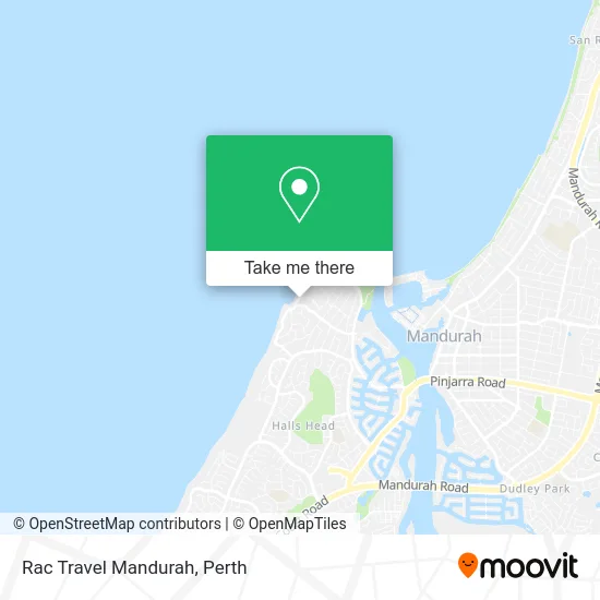
See Rac Travel Mandurah, Halls Head, on the map
Public Transit to Rac Travel Mandurah in Halls Head
Wondering how to get to Rac Travel Mandurah in Halls Head? Moovit helps you find the best way to get to Rac Travel Mandurah with step-by-step directions from the nearest public transit station.
Moovit provides free maps and live directions to help you navigate through your city. View schedules, routes, timetables, and find out how long does it take to get to Rac Travel Mandurah in real time.
Looking for the nearest stop or station to Rac Travel Mandurah? Check out this list of stops closest to your destination: Janis St After Leighton Rd.
Bus: 591.
Want to see if there’s another route that gets you there at an earlier time? Moovit helps you find alternative routes or times. Get directions from and directions to Rac Travel Mandurah easily from the Moovit App or Website.
We make riding to Rac Travel Mandurah easy, which is why over 1.5 million users, including users in Halls Head, trust Moovit as the best app for public transit. You don’t need to download an individual bus app or train app, Moovit is your all-in-one transit app that helps you find the best bus time or train time available.
For information on prices of bus and train, costs and ride fares to Rac Travel Mandurah, please check the Moovit app.
Use the app to navigate to popular places including to the airport, hospital, stadium, grocery store, mall, coffee shop, school, college, and university.
Rac Travel Mandurah Address: Halls Head Pde Halls Head WA 6210 street in Halls Head
- Blue Bay Beach,
- Sean Pepper Carpenter,
- Roofus Tools,
- Blue Bay Beach Stay-Halls Head,
- Blue Bay Beach Stay,
- Smurfettes Cleaning Service I Domestic House Cleaners I Office Cleaner,
- Elle Challis- Hair Stylist,
- Earth Whitening,
- Ecokleensolar Mandurah Region,
- Bayside Heights,
- Mh102,
- Mister Minit Halls He,
- Eastern Hills Service Station,
- Mandurah Computer Repairs,
- Di Prinzio Properties,
- Harcourts Mandurah,
- Christine K Jackson Counselling & Psychic Medium,
- Janis St After Leighton Rd,
- Opulent Dental,
- Childs Play Park
Places Near Rac Travel Mandurah (Halls Head)
- Langley Park, Perth,
- Mount Hospital, Perth,
- Aqwa Aquarium, Hillarys,
- Westfield Carousel, Cannington,
- Yankee Mart, Baldivis,
- Sir Charles Gairdner Hospital, Nedlands,
- McCallum Park, Victoria Park,
- IKEA, Innaloo,
- Royal Perth Hospital, Perth,
- Rac Arena, Perth,
- Hillarys Boat Harbour,
- Fiona Stanley Hospital, Murdoch,
- Karrinyup Shopping Centre, Karrinyup,
- Perth Convention Exhibition Centre, Perth,
- Pelicaan Investment Ho, Bellevue,
- DFO, Perth Airport,
- Crown Perth Casino, Burswood,
- Scitech, West Perth,
- Blue Boat House,
- Optus Stadium, Burswood
How to get to popular places in Perth with public transport
Get around Halls Head by public transport!
Travelling around Halls Head has never been so easy. See step by step directions as you travel to any attraction, street or major public transport station. View bus and train timetables, arrival times, service alerts and detailed routes on a map, so you know exactly how to get to anywhere in Halls Head.
When travelling to any destination around Halls Head use Moovit's Live Directions with Get Off Notifications to know exactly where and how far to walk, how long to wait for your line , and how many stops are left. Moovit will alert you when it’s time to get off — no need to constantly re-check whether yours is the next stop.
Wondering how to use public transport in Halls Head or how to pay for public transport in Halls Head? Moovit public transport app can help you navigate your way with public transport easily, and at minimum cost. It includes public transport fees, ticket prices, and costs. Looking for a map of Halls Head public transport lines? Moovit public transport app shows all public transport maps in Halls Head with all Bus, Train and Ferry routes and stops on an interactive map.
Perth has 3 transport type(s), including: Bus, Train and Ferry, operated by several transport agencies, including Transperth Rail, Transwa, Transperth Ferry, Transperth, TransBusselton, TransAlbany, TransGoldfields, TransEsperance, TransGeraldton, TransCarnarvon, TransHedland, TransKarratha, TransBunbury, Mandurah Bus Charter and TransBroome