Ramshead Approach stop - Friday schedule
| Line | Direction | Time |
|---|---|---|
| 9C | White Rose Centre Stand A | 08:05 |
| 9C | White Rose Centre Stand A | 09:05 |
| 9C | White Rose Centre Stand A | 10:05 |
| 9C | White Rose Centre Stand A | 11:05 |
| 9C | White Rose Centre Stand A | 12:05 |
| 9C | White Rose Centre Stand A | 13:05 |
| 9C | White Rose Centre Stand A | 14:05 |
| 9C | White Rose Centre Stand A | 15:05 |
| 9C | White Rose Centre Stand A | 16:10 |
| 9C | White Rose Centre Stand A | 17:10 |
Directions to Ramshead Approach stop (Leeds) with public transport
The following transport lines have routes that pass near Ramshead Approach
 Bus: 16, 16A, 49, 50, 11.
- Train: NORTHERN.
How to get to Ramshead Approach stop by bus?
Click on the bus route to see step by step directions with maps, line arrival times and updated time schedules.
How to get to Ramshead Approach stop by train?
Click on the train route to see step by step directions with maps, line arrival times and updated time schedules.
Bus stops near Ramshead Approach stop in Leeds
- Ramshead Hill, 4 min walk,
- Bailey's Lane, 4 min walk,
- Ramshead Approach Limewood Rd, 6 min walk,
Bus lines to Ramshead Approach stop in Leeds
- 50, Horsforth the Green,
- 49, Bramley Bus Station,
- 11, Cross Gates Ctr A,
- 16, Whinmoor Shop Ctr,
- 16A, Pudsey Bus Station,
- 50A, Seacroft Bus Stn,
- 9C, White Rose Centre Stand A,
- 9, White Rose Centre Stand A,
What are the nearest stations to Ramshead Approach?
The nearest stations to Ramshead Approach are:
- Ramshead Hill stop is 244 meters away, 4 min walk.
- Bailey's Lane stop is 301 meters away, 4 min walk.
- Ramshead Approach Limewood Rd stop is 445 meters away, 6 min walk.
Which bus lines stop near Ramshead Approach?
These bus lines stop near Ramshead Approach: 16, 16A, 49, 50.
Which train line stops near Ramshead Approach?
NORTHERN (York)
What’s the nearest bus station to Ramshead Approach in Leeds?
The nearest bus stations to Ramshead Approach in Leeds are Ramshead Hill and Bailey's Lane. The closest one is a 4 min walk away.
What time is the first bus to Ramshead Approach in Leeds?
The 16A is the first bus that goes to Ramshead Approach in Leeds. It stops nearby at 05:39.
What time is the last bus to Ramshead Approach in Leeds?
The 50A is the last bus that goes to Ramshead Approach in Leeds. It stops nearby at 00:11.
Ramshead Approach station
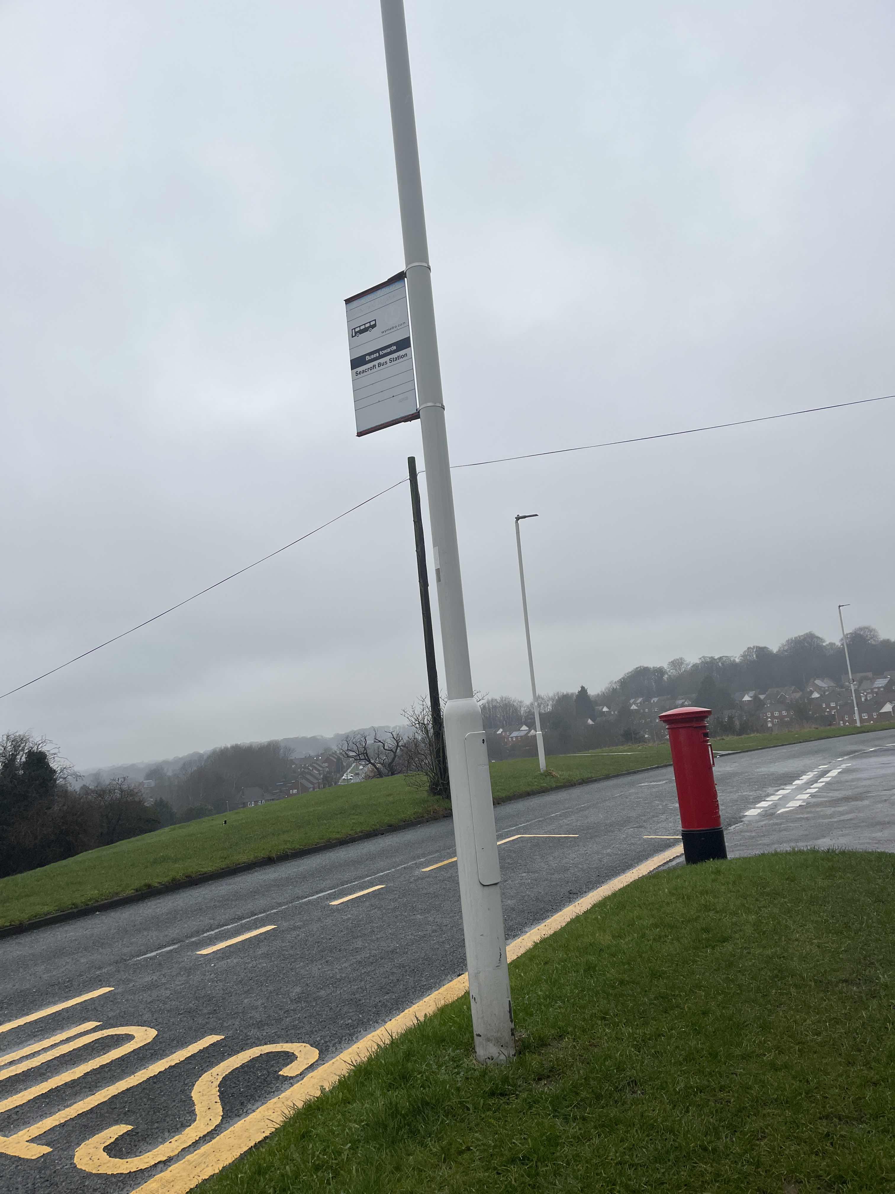 Taken by Anonymous
See Ramshead Approach stop, Leeds, on the map
Public transport to Ramshead Approach stop (ID: 45013763) in Leeds
Looking for directions to Ramshead Approach in Leeds, United Kingdom?
Download the Moovit App to find the current schedule and step-by-step directions for Bus or Train routes that pass through Ramshead Approach.
Looking for the nearest stops closest to Ramshead Approach ? Check out this list of closest stops to your destination: Ramshead Hill; Bailey's Lane; Ramshead Approach Limewood Rd.
Bus: 16, 16A, 49, 50, 11, 50A, 9, 9C.Train: NORTHERN.
We make riding on public transit to Ramshead Approach easy, which is why over 1.7 billion users, including users in Leeds trust Moovit as the best app for public transit.
Use the app to navigate to popular places including to the airport, hospital, stadium, grocery store, mall, coffee shop, school, college, and university.
Ramshead Approach stop’s code is 45013763
The first line to this stop is 9C, at 08:05, and the last line is 9C at 17:10.
This stop serves Squarepeg’s lines
- Ramshead Hill,
- Bailey's Lane,
- Ramshead Approach Limewood Rd
Bus stops near Ramshead Approach stop
- Helles Barracks,
- Huddersfield,
- Green Lane,
- City Square I,
- Great North Road/Doncaster Lane,
- New Earswick Shops,
- Commercial Road,
- Old Scalby Mills,
- Thorpe House Avenue/Lees Hall Road,
- Egton,
- John Leggott College,
- Barnsley Road/Aldham House Lane,
- Cricket Inn Road/Cricket Inn Crescent,
- Leeds University,
- Charter Row/Moorhead Mh4,
- Five Lane Ends,
- Abbey Brook Drive/Abbey Brook Court,
- Mayo Avenue Morrisons,
- Clifton Gate,
- Bexley Wing
Popular public transport stations in Leeds
Get around Leeds by public transport!
Travelling around Leeds has never been so easy. See step by step directions as you travel to any attraction, street or major public transport station. View bus and train timetables, arrival times, service alerts and detailed routes on a map, so you know exactly how to get to anywhere in Leeds.
When travelling to any destination around Leeds use Moovit's Live Directions with Get Off Notifications to know exactly where and how far to walk, how long to wait for your line , and how many stops are left. Moovit will alert you when it’s time to get off — no need to constantly re-check whether yours is the next stop.
Wondering how to use public transport in Leeds or how to pay for public transport in Leeds? Moovit public transport app can help you navigate your way with public transport easily, and at minimum cost. It includes public transport fees, ticket prices, and costs. Looking for a map of Leeds public transport lines? Moovit public transport app shows all public transport maps in Leeds with all Bus, Train and Light rail routes and stops on an interactive map.
Yorkshire has 3 transport type(s), including: Bus, Train and Light rail, operated by several transport agencies, including First Leeds, First South Yorkshire, First York, Arriva Yorkshire, Stagecoach Yorkshire, National Rail, First Bradford, First Halifax, Calder Valley & Huddersfield, East Yorkshire, The Keighley Bus Company, South Yorkshire Future Tram, The Harrogate Bus Company, TM Travel, Coastliner and Stevenson's Travel