Directions to Rangers Supporters Club (Leederville) with public transport
The following transport lines have routes that pass near Rangers Supporters Club
How to get to Rangers Supporters Club by bus?
Click on the bus route to see step by step directions with maps, line arrival times and updated time schedules.
From ZLR*Office, Malaga
86 minFrom L.P Freese & P.G Freese, Mount Pleasant
64 minFrom Mettams Pool, North Beach
89 minFrom Oats Street Station, East Victoria Park
75 minFrom City Beach, City Beach
61 minFrom Balcatta, Balcatta
41 minFrom Optus Stadium, Burswood
60 minFrom Jaiama Investments Pty, Malaga
82 minFrom Crown Perth Casino, Burswood
68 minFrom Great Eastern Motor Lodge, Rivervale
69 min
How to get to Rangers Supporters Club by train?
Click on the train route to see step by step directions with maps, line arrival times and updated time schedules.
Bus stop near Rangers Supporters Club in Leederville
- Anzac Rd After Federation St, 7 min walk,VIEW
Train stations near Rangers Supporters Club in Leederville
Ferry station near Rangers Supporters Club in Leederville
- Ferry Route Elizabeth Quay Jetty, 31 min walk,VIEW
Bus lines to Rangers Supporters Club in Leederville
- 15, Perth Busport,VIEW
What are the nearest stations to Rangers Supporters Club?
The nearest stations to Rangers Supporters Club are:
- Anzac Rd After Federation St is 415 meters away, 7 min walk.
- Perth Underground Stn is 1525 meters away, 20 min walk.
- Perth Stn is 1528 meters away, 20 min walk.
- Ferry Route Elizabeth Quay Jetty is 2349 meters away, 31 min walk.
Which bus lines stop near Rangers Supporters Club?
These bus lines stop near Rangers Supporters Club: 15, 83.
Which train line stops near Rangers Supporters Club?
YANCHEP LINE (Yanchep Stn)
What’s the nearest train station to Rangers Supporters Club in Leederville?
The nearest train stations to Rangers Supporters Club in Leederville are Perth Underground Stn and Perth Stn. The closest one is a 20 min walk away.
What’s the nearest bus station to Rangers Supporters Club in Leederville?
The nearest bus station to Rangers Supporters Club in Leederville is Anzac Rd After Federation St. It’s a 7 min walk away.
What time is the first train to Rangers Supporters Club in Leederville?
The ARMADALE LINE is the first train that goes to Rangers Supporters Club in Leederville. It stops nearby at 05:03.
What time is the last train to Rangers Supporters Club in Leederville?
The FREMANTLE LINE is the last train that goes to Rangers Supporters Club in Leederville. It stops nearby at 00:38.
What time is the first bus to Rangers Supporters Club in Leederville?
The 15 is the first bus that goes to Rangers Supporters Club in Leederville. It stops nearby at 05:29.
What time is the last bus to Rangers Supporters Club in Leederville?
The 15 is the last bus that goes to Rangers Supporters Club in Leederville. It stops nearby at 23:41.
What time is the first ferry to Rangers Supporters Club in Leederville?
The FERRY ROUTE ELIZABETH QUAY JETTY - FERRY ROUTE MENDS ST JETTY is the first ferry that goes to Rangers Supporters Club in Leederville. It stops nearby at 06:30.
What time is the last ferry to Rangers Supporters Club in Leederville?
The FERRY ROUTE ELIZABETH QUAY JETTY - FERRY ROUTE MENDS ST JETTY is the last ferry that goes to Rangers Supporters Club in Leederville. It stops nearby at 22:25.
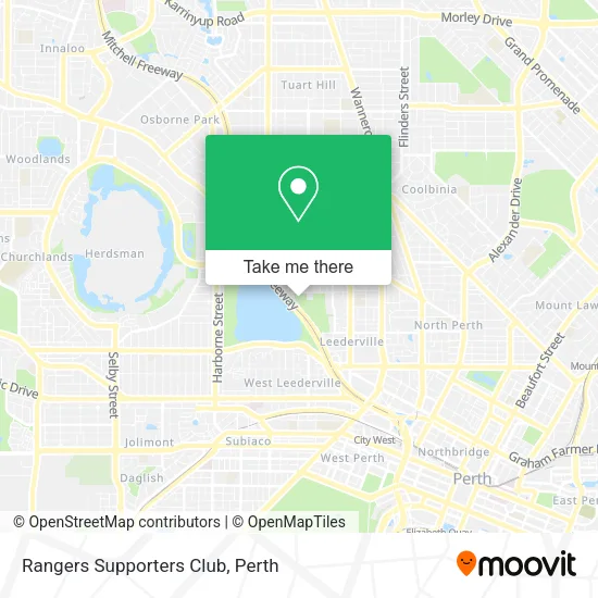
See Rangers Supporters Club, Leederville, on the map
Public Transit to Rangers Supporters Club in Leederville
Wondering how to get to Rangers Supporters Club in Leederville? Moovit helps you find the best way to get to Rangers Supporters Club with step-by-step directions from the nearest public transit station.
Moovit provides free maps and live directions to help you navigate through your city. View schedules, routes, timetables, and find out how long does it take to get to Rangers Supporters Club in real time.
Looking for the nearest stop or station to Rangers Supporters Club? Check out this list of stops closest to your destination: Anzac Rd After Federation St; Perth Underground Stn; Perth Stn; Ferry Route Elizabeth Quay Jetty.
Bus: 15, 83.Train: YANCHEP LINE, AIRPORT LINE, ARMADALE LINE, ELLENBROOK LINE, FREMANTLE LINE, MIDLAND LINE, MANDURAH LINE.Ferry: FERRY ROUTE ELIZABETH QUAY JETTY - FERRY ROUTE MENDS ST JETTY.
Want to see if there’s another route that gets you there at an earlier time? Moovit helps you find alternative routes or times. Get directions from and directions to Rangers Supporters Club easily from the Moovit App or Website.
We make riding to Rangers Supporters Club easy, which is why over 1.5 million users, including users in Leederville, trust Moovit as the best app for public transit. You don’t need to download an individual bus app or train app, Moovit is your all-in-one transit app that helps you find the best bus time or train time available.
For information on prices of bus and train, costs and ride fares to Rangers Supporters Club, please check the Moovit app.
Use the app to navigate to popular places including to the airport, hospital, stadium, grocery store, mall, coffee shop, school, college, and university.
Rangers Supporters Club Address: Britannia Rd Leederville, 6007 Perth street in Leederville
- Leederville Cricket Club,
- Greek Bahari,
- Floreat Athena Soccer Club Inc,
- Litis Stadium,
- Britannia Reserve,
- Melissa Lopez Patisserie,
- Limestonewa,
- Limestonewalls,
- Britannia Road Reserve,
- Life Live It Occupational Therapy,
- Red Lily Renovations,
- Heaven Man Earth Perth,
- Wine Terroirists,
- Project Marketing Management,
- Corgi Studios,
- Searle Construction Lawyers,
- Plush,
- Mount Hawthorn Flair Upholstery Couch Sofa,
- Skymaze Industries,
- Transnational Services
Places Near Rangers Supporters Club (Leederville)
- Aqwa Aquarium, Hillarys,
- Yankee Mart, Baldivis,
- Karrinyup Shopping Centre, Karrinyup,
- Optus Stadium, Burswood,
- Mount Hospital, Perth,
- Scitech, West Perth,
- Pelicaan Investment Ho, Bellevue,
- Westfield Carousel, Cannington,
- Crown Perth Casino, Burswood,
- McCallum Park, Victoria Park,
- Rac Arena, Perth,
- DFO, Perth Airport,
- Watertown, Perth,
- Sir Charles Gairdner Hospital, Nedlands,
- Langley Park, Perth,
- IKEA, Innaloo,
- Royal Perth Hospital, Perth,
- Fiona Stanley Hospital, Murdoch,
- Blue Boat House,
- Perth Convention Exhibition Centre, Perth
How to get to popular places in Perth with public transport
Get around Leederville by public transport!
Travelling around Leederville has never been so easy. See step by step directions as you travel to any attraction, street or major public transport station. View bus and train timetables, arrival times, service alerts and detailed routes on a map, so you know exactly how to get to anywhere in Leederville.
When travelling to any destination around Leederville use Moovit's Live Directions with Get Off Notifications to know exactly where and how far to walk, how long to wait for your line , and how many stops are left. Moovit will alert you when it’s time to get off — no need to constantly re-check whether yours is the next stop.
Wondering how to use public transport in Leederville or how to pay for public transport in Leederville? Moovit public transport app can help you navigate your way with public transport easily, and at minimum cost. It includes public transport fees, ticket prices, and costs. Looking for a map of Leederville public transport lines? Moovit public transport app shows all public transport maps in Leederville with all Bus, Train and Ferry routes and stops on an interactive map.
Perth has 3 transport type(s), including: Bus, Train and Ferry, operated by several transport agencies, including Transperth Rail, Transwa, Transperth Ferry, Transperth, TransBusselton, TransAlbany, TransGoldfields, TransEsperance, TransGeraldton, TransCarnarvon, TransHedland, TransKarratha, TransBunbury, Mandurah Bus Charter and TransBroome