How to get to Rbdhomes by bus?
Click on the bus route to see step by step directions with maps, line arrival times and updated time schedules.
From Bandyup Women's Prison, West Swan
101 minFrom Tuan Tran and Lien T, Herne Hill
35 minFrom Ballajura, Ballajura
105 minFrom 8pag Caversham, Caversham
78 minFrom Bennett Springs, Beechboro
79 minFrom Mandoon Estate, Caversham
87 minFrom Whiteman Park, Whiteman
42 minFrom Sandalford Winery, West Swan
85 minFrom Sandalford Wines, Caversham
85 min
How to get to Rbdhomes by train?
Click on the train route to see step by step directions with maps, line arrival times and updated time schedules.
Bus stops near Rbdhomes in Ellenbrook
Bus lines to Rbdhomes in Ellenbrook
What are the nearest stations to Rbdhomes?
The nearest stations to Rbdhomes are:
- Millhouse Rd Before Wistful Pde is 31 meters away, 1 min walk.
- Millhouse Rd After Vidalia Dr is 688 meters away, 9 min walk.
Which bus lines stop near Rbdhomes?
These bus lines stop near Rbdhomes: 310, 343, 347.
Which train line stops near Rbdhomes?
ELLENBROOK LINE (Ellenbrook Stn)
What’s the nearest bus station to Rbdhomes in Ellenbrook?
The nearest bus station to Rbdhomes in Ellenbrook is Millhouse Rd Before Wistful Pde. It’s a 1 min walk away.
What time is the first bus to Rbdhomes in Ellenbrook?
The 346 is the first bus that goes to Rbdhomes in Ellenbrook. It stops nearby at 04:52.
What time is the last bus to Rbdhomes in Ellenbrook?
The 343 is the last bus that goes to Rbdhomes in Ellenbrook. It stops nearby at 21:39.
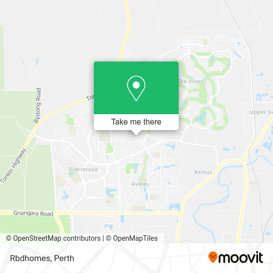
See Rbdhomes, Ellenbrook, on the map
Public Transit to Rbdhomes in Ellenbrook
Wondering how to get to Rbdhomes in Ellenbrook? Moovit helps you find the best way to get to Rbdhomes with step-by-step directions from the nearest public transit station.
Moovit provides free maps and live directions to help you navigate through your city. View schedules, routes, timetables, and find out how long does it take to get to Rbdhomes in real time.
Looking for the nearest stop or station to Rbdhomes? Check out this list of stops closest to your destination: Millhouse Rd Before Wistful Pde; Millhouse Rd After Vidalia Dr.
Bus: 310, 343, 347, 345, 346.Train: ELLENBROOK LINE.
Want to see if there’s another route that gets you there at an earlier time? Moovit helps you find alternative routes or times. Get directions from and directions to Rbdhomes easily from the Moovit App or Website.
We make riding to Rbdhomes easy, which is why over 1.5 million users, including users in Ellenbrook, trust Moovit as the best app for public transit. You don’t need to download an individual bus app or train app, Moovit is your all-in-one transit app that helps you find the best bus time or train time available.
For information on prices of bus and train, costs and ride fares to Rbdhomes, please check the Moovit app.
Use the app to navigate to popular places including to the airport, hospital, stadium, grocery store, mall, coffee shop, school, college, and university.
Rbdhomes Address: 85 Bellazario Prom Aveley WA 6069 street in Ellenbrook
- Alefba Persian Bookshop,
- Venus Nail Arts,
- Beautiful Girl,
- Ellenbrook Detailing,
- Swan Valley Spices,
- Simply Beautiful Lashes,
- CK Datalab,
- Courtney Anne Turner,
- Hky Real Estate,
- Aveley Shopping Centre,
- Skilja Enterprises Pty,
- New Leaf Dietetics,
- Studio 42 Aveley,
- Paramount Barbers,
- First National Real Estate Swans Residential and Commercial,
- Australia Post Woolworths Aveley Parcel Locker,
- Terrywhite Chemmart,
- Delaney Park,
- Posh Boss,
- Ellenbrook Martial Arts
Places Near Rbdhomes (Ellenbrook)
- Pelicaan Investment Ho, Bellevue,
- Karrinyup Shopping Centre, Karrinyup,
- Sir Charles Gairdner Hospital, Nedlands,
- Westfield Carousel, Cannington,
- Scitech, West Perth,
- Perth Convention Exhibition Centre, Perth,
- Crown Perth Casino, Burswood,
- Langley Park, Perth,
- Royal Perth Hospital, Perth,
- Mount Hospital, Perth,
- Aqwa Aquarium, Hillarys,
- Optus Stadium, Burswood,
- Blue Boat House,
- DFO, Perth Airport,
- Yankee Mart, Baldivis,
- McCallum Park, Victoria Park,
- Watertown, Perth,
- Rac Arena, Perth,
- IKEA, Innaloo,
- Fiona Stanley Hospital, Murdoch
How to get to popular places in Perth with public transport
Get around Ellenbrook by public transport!
Travelling around Ellenbrook has never been so easy. See step by step directions as you travel to any attraction, street or major public transport station. View bus and train timetables, arrival times, service alerts and detailed routes on a map, so you know exactly how to get to anywhere in Ellenbrook.
When travelling to any destination around Ellenbrook use Moovit's Live Directions with Get Off Notifications to know exactly where and how far to walk, how long to wait for your line , and how many stops are left. Moovit will alert you when it’s time to get off — no need to constantly re-check whether yours is the next stop.
Wondering how to use public transport in Ellenbrook or how to pay for public transport in Ellenbrook? Moovit public transport app can help you navigate your way with public transport easily, and at minimum cost. It includes public transport fees, ticket prices, and costs. Looking for a map of Ellenbrook public transport lines? Moovit public transport app shows all public transport maps in Ellenbrook with all Bus, Train and Ferry routes and stops on an interactive map.
Perth has 3 transport type(s), including: Bus, Train and Ferry, operated by several transport agencies, including Transperth Rail, Transwa, Transperth Ferry, Transperth, TransBusselton, TransAlbany, TransGoldfields, TransEsperance, TransGeraldton, TransCarnarvon, TransHedland, TransKarratha, TransBunbury, Mandurah Bus Charter and TransBroome