How to get to Repco by bus?
Click on the bus route to see step by step directions with maps, line arrival times and updated time schedules.
From Nsulu Investments Pt, East Bunbury
64 minFrom Caves House Hotel Yallingup, Yallingup
57 minFrom Bunbury Farmers Market, East Bunbury
62 minFrom Pethel Holdings Pty, South Bunbury
126 minFrom Yallingup, Yallingup
67 minFrom Bunbury Senior High School, Bunbury
133 minFrom Manea Senior College, College Grove
281 minFrom DHL Express Service Point DHL Partner Pack & Send Collections Only, East Bunbury
64 minFrom Hands Oval, South Bunbury
151 min
Bus stops near Repco in Busselton
Bus lines to Repco in Busselton
What are the nearest stations to Repco?
The nearest stations to Repco are:
- Strelly St After Causeway Rd is 121 meters away, 2 min walk.
- Peel Tce Before Pries Av is 855 meters away, 11 min walk.
- Peel Tce After Queen St is 886 meters away, 12 min walk.
- Albert St Transwa Busselton is 958 meters away, 13 min walk.
Which bus line stops near Repco?
PEMBERTON (Augusta)
What’s the nearest bus station to Repco in Busselton?
The nearest bus station to Repco in Busselton is Strelly St After Causeway Rd. It’s a 2 min walk away.
What time is the first bus to Repco in Busselton?
The 816 is the first bus that goes to Repco in Busselton. It stops nearby at 07:17.
What time is the last bus to Repco in Busselton?
The 816 is the last bus that goes to Repco in Busselton. It stops nearby at 18:48.
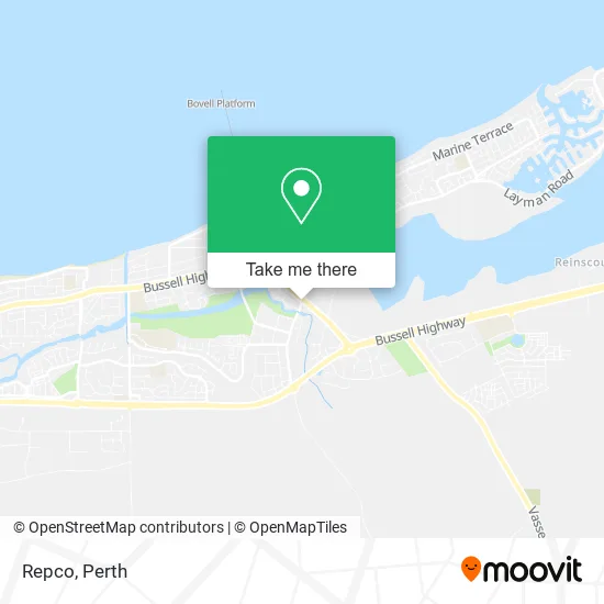
See Repco, Busselton, on the map
Public Transit to Repco in Busselton
Wondering how to get to Repco in Busselton? Moovit helps you find the best way to get to Repco with step-by-step directions from the nearest public transit station.
Moovit provides free maps and live directions to help you navigate through your city. View schedules, routes, timetables, and find out how long does it take to get to Repco in real time.
Looking for the nearest stop or station to Repco? Check out this list of stops closest to your destination: Strelly St After Causeway Rd; Peel Tce Before Pries Av; Peel Tce After Queen St; Albert St Transwa Busselton.
Bus: PEMBERTON, 816, 817, 815.
Want to see if there’s another route that gets you there at an earlier time? Moovit helps you find alternative routes or times. Get directions from and directions to Repco easily from the Moovit App or Website.
We make riding to Repco easy, which is why over 1.5 million users, including users in Busselton, trust Moovit as the best app for public transit. You don’t need to download an individual bus app or train app, Moovit is your all-in-one transit app that helps you find the best bus time or train time available.
For information on prices of bus, costs and ride fares to Repco, please check the Moovit app.
Use the app to navigate to popular places including to the airport, hospital, stadium, grocery store, mall, coffee shop, school, college, and university.
Repco Address: Strelly St Busselton WA 6280 street in Busselton
- Busselton Stockfeeds & Saddlery,
- Shell,
- Mortgage Choice Busselton Greg Moss Rebecca Semark,
- Ray White Stocker Preston,
- Curry Port,
- Curry Port Indian Cuisine,
- Easy Heats,
- Neurolink Physiotherapy,
- Prouds,
- Harcourts Busselton,
- Busselton Mower World,
- Veteran Car Club,
- GT Brake & Clutch Repairs,
- Swan Transit Busselton Bus Depot,
- Buzcon,
- Church of Christ in Wa Busselton,
- Busselton RSL,
- Rusty Nail Designs,
- Rental Choice & Seconds Fletchers,
- Revolution E Bikes Busselton
Places Near Repco (Busselton)
- Langley Park, Perth,
- Watertown, Perth,
- Karrinyup Shopping Centre, Karrinyup,
- Blue Boat House,
- McCallum Park, Victoria Park,
- Sir Charles Gairdner Hospital, Nedlands,
- Fiona Stanley Hospital, Murdoch,
- Yankee Mart, Baldivis,
- DFO, Perth Airport,
- Optus Stadium, Burswood,
- Crown Perth Casino, Burswood,
- Royal Perth Hospital, Perth,
- Mount Hospital, Perth,
- Pelicaan Investment Ho, Bellevue,
- Scitech, West Perth,
- Perth Convention Exhibition Centre, Perth,
- Aqwa Aquarium, Hillarys,
- Westfield Carousel, Cannington,
- Rac Arena, Perth,
- IKEA, Innaloo
How to get to popular places in Perth with public transport
Get around Busselton by public transport!
Travelling around Busselton has never been so easy. See step by step directions as you travel to any attraction, street or major public transport station. View bus and train timetables, arrival times, service alerts and detailed routes on a map, so you know exactly how to get to anywhere in Busselton.
When travelling to any destination around Busselton use Moovit's Live Directions with Get Off Notifications to know exactly where and how far to walk, how long to wait for your line , and how many stops are left. Moovit will alert you when it’s time to get off — no need to constantly re-check whether yours is the next stop.
Wondering how to use public transport in Busselton or how to pay for public transport in Busselton? Moovit public transport app can help you navigate your way with public transport easily, and at minimum cost. It includes public transport fees, ticket prices, and costs. Looking for a map of Busselton public transport lines? Moovit public transport app shows all public transport maps in Busselton with all Bus, Train and Ferry routes and stops on an interactive map.
Perth has 3 transport type(s), including: Bus, Train and Ferry, operated by several transport agencies, including Transperth Rail, Transwa, Transperth Ferry, Transperth, TransBusselton, TransAlbany, TransGoldfields, TransEsperance, TransGeraldton, TransCarnarvon, TransHedland, TransKarratha, TransBunbury, Mandurah Bus Charter and TransBroome