Directions to Riverside Centre (City) with public transport
The following transport lines have routes that pass near Riverside Centre
 Bus: 125, 185, 305, 310, 433.
- Train: BNFG, SHBR, SPNA, AIRP, BDBR.
- Ferry: APOLLO ROAD / RIVERSIDE, HOLMAN STREET / RIVERSIDE, NORTHSHORE HAMILTON / UQ ST LUCIA.
How to get to Riverside Centre by bus?
Click on the bus route to see step by step directions with maps, line arrival times and updated time schedules.
From Westside Private Hospital, Taringa
31 minFrom Moorooka, Moorooka
30 minFrom Mary Mackillop College, Nundah
36 minFrom Mount Coot-Tha Botanic Gardens, Mount Coot-Tha
49 minFrom Griffith University Nathan Campus, Nathan
56 minFrom Hemmant Cemetery And Crematorium, Tingalpa
56 minFrom Queen Elizabeth II Jubilee Hospital, Coopers Plains
50 minFrom Queensland Tennis Centre, Tennyson
51 minFrom Pinkenba, Pinkenba
47 minFrom Mansfield Tavern, Mansfield
38 min
How to get to Riverside Centre by train?
Click on the train route to see step by step directions with maps, line arrival times and updated time schedules.
Bus stops near Riverside Centre in City
- Eagle Street Stop 152 at Riverside Centre, 2 min walk,VIEW
- Eagle St Near Creek St, Stop 62, 2 min walk,VIEW
- Eagle St Near Eagle Lane (Stop 64), 3 min walk,VIEW
- Eagle St App Queen St (Stop 65), 3 min walk,VIEW
- Queen Street Stop 72 Near Eagle Lane, 3 min walk,VIEW
- Creek Street Stop 148 at Riverside Centre, 4 min walk,VIEW
- Queen Street Stop 74 Near Creek St, 4 min walk,VIEW
- Adelaide Street Stop 33 Near Wharf St, 5 min walk,VIEW
- Queen Street Stop 59 Near Creek St, 5 min walk,VIEW
- Queen Street Stop 60 Near Creek St, 5 min walk,VIEW
- Charlotte Street Stop 90 Near Market St, 5 min walk,VIEW
Train station near Riverside Centre in City
- Central Station, 11 min walk,VIEW
Ferry stations near Riverside Centre in City
Bus lines to Riverside Centre in City
- 40, City Loop (clockwise),VIEW
- 125, Garden City - City/valley Via Salisbury,VIEW
- 175, Garden City - City Via Logan Rd,VIEW
- 185, Garden City - City/valley,VIEW
- 204, Carindale - City/valley,VIEW
- 332, Zillmere - City Rocket Via Spring Hill,VIEW
- 344, Carseldine - City Precincts Express,VIEW
- 384, The Gap - City Precincts Rocket,VIEW
- 331, Bracken Ridge - City Rocket,VIEW
- 341, Taigum - City Rocket,VIEW
- 349, Stafford - City Express,VIEW
- 363, Herston - City,VIEW
- 382, The Gap - City Rocket Via Settlement Road,VIEW
- 383, The Gap - City Rocket Via Payne Road,VIEW
- 443, Moggil - City Rocket,VIEW
- 455, Riverhills - City Rocket,VIEW
- 456, Mt Ommaney - City Rocket,VIEW
- 216, Tingalpa - City Rocket,VIEW
- 221, Wynnum - City Rocket,VIEW
- 227, Wynnum - City,VIEW
What are the nearest stations to Riverside Centre?
The nearest stations to Riverside Centre are:
- Eagle Street Stop 152 at Riverside Centre is 102 meters away, 2 min walk.
- Eagle St Near Creek St, Stop 62 is 102 meters away, 2 min walk.
- Eagle St Near Eagle Lane (Stop 64) is 158 meters away, 3 min walk.
- Eagle St App Queen St (Stop 65) is 203 meters away, 3 min walk.
- Queen Street Stop 72 Near Eagle Lane is 215 meters away, 3 min walk.
- Creek Street Stop 148 at Riverside Centre is 250 meters away, 4 min walk.
- Queen Street Stop 74 Near Creek St is 297 meters away, 4 min walk.
- Adelaide Street Stop 33 Near Wharf St is 309 meters away, 5 min walk.
- Queen Street Stop 59 Near Creek St is 329 meters away, 5 min walk.
- Queen Street Stop 60 Near Creek St is 335 meters away, 5 min walk.
- Charlotte Street Stop 90 Near Market St is 342 meters away, 5 min walk.
- Central Station is 789 meters away, 11 min walk.
- Riverside Ferry Terminal is 837 meters away, 11 min walk.
- Dockside Ferry Terminal is 1899 meters away, 25 min walk.
Which bus lines stop near Riverside Centre?
These bus lines stop near Riverside Centre: 125, 185, 305, 310, 433, 470.
Which train lines stop near Riverside Centre?
These train lines stop near Riverside Centre: BNFG, SHBR, SPNA.
What’s the nearest train station to Riverside Centre in City?
The nearest train station to Riverside Centre in City is Central Station. It’s a 11 min walk away.
What’s the nearest bus station to Riverside Centre in City?
The nearest bus stations to Riverside Centre in City are Eagle Street Stop 152 at Riverside Centre and Eagle St Near Creek St, Stop 62. The closest one is a 2 min walk away.
What’s the nearest ferry station to Riverside Centre in City?
The nearest ferry station to Riverside Centre in City is Riverside Ferry Terminal. It’s a 11 min walk away.
What time is the first train to Riverside Centre in City?
The BRCA is the first train that goes to Riverside Centre in City. It stops nearby at 03:46.
What time is the last train to Riverside Centre in City?
The FGBN is the last train that goes to Riverside Centre in City. It stops nearby at 22:34.
What time is the first bus to Riverside Centre in City?
The N413 is the first bus that goes to Riverside Centre in City. It stops nearby at 03:04.
What time is the last bus to Riverside Centre in City?
The 199 is the last bus that goes to Riverside Centre in City. It stops nearby at 23:31.
What time is the first ferry to Riverside Centre in City?
The HOLMAN STREET / RIVERSIDE is the first ferry that goes to Riverside Centre in City. It stops nearby at 06:00.
What time is the last ferry to Riverside Centre in City?
The HOLMAN STREET / RIVERSIDE is the last ferry that goes to Riverside Centre in City. It stops nearby at 23:55.
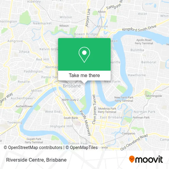
See Riverside Centre, City, on the map
Public Transit to Riverside Centre in City
Wondering how to get to Riverside Centre in City? Moovit helps you find the best way to get to Riverside Centre with step-by-step directions from the nearest public transit station.
Moovit provides free maps and live directions to help you navigate through your city. View schedules, routes, timetables, and find out how long does it take to get to Riverside Centre in real time.
Looking for the nearest stop or station to Riverside Centre? Check out this list of stops closest to your destination: Eagle Street Stop 152 at Riverside Centre; Eagle St Near Creek St; Eagle St Near Eagle Lane (Stop 64); Eagle St App Queen St (Stop 65); Queen Street Stop 72 Near Eagle Lane; Creek Street Stop 148 at Riverside Centre; Queen Street Stop 74 Near Creek St; Adelaide Street Stop 33 Near Wharf St; Queen Street Stop 59 Near Creek St; Queen Street Stop 60 Near Creek St; Charlotte Street Stop 90 Near Market St; Central Station; Riverside Ferry Terminal; Dockside Ferry Terminal.
Bus: 125, 185, 305, 310, 433, 470, 40, 175, 204, 331, 341, 349, 363, 382, 216, 221, 227, 228, 231, 50.Train: BNFG, SHBR, SPNA, AIRP, BDBR, BDVL, BNBR.Ferry: APOLLO ROAD / RIVERSIDE, HOLMAN STREET / RIVERSIDE, NORTHSHORE HAMILTON / UQ ST LUCIA.
Want to see if there’s another route that gets you there at an earlier time? Moovit helps you find alternative routes or times. Get directions from and directions to Riverside Centre easily from the Moovit App or Website.
We make riding to Riverside Centre easy, which is why over 1.5 million users, including users in City, trust Moovit as the best app for public transit. You don’t need to download an individual bus app or train app, Moovit is your all-in-one transit app that helps you find the best bus time or train time available.
For information on prices of bus and train, costs and ride fares to Riverside Centre, please check the Moovit app.
Use the app to navigate to popular places including to the airport, hospital, stadium, grocery store, mall, coffee shop, school, college, and university.
Riverside Centre Address: 123 Eagle St. street in City
- McLean Yeoh,
- Paradox,
- Lowndes Lambert Australia,
- Jackson Teece,
- Mentor Imc Group,
- Transtate,
- Damien Greer Lawyers,
- Blackbird,
- Opa Bar & Mezze,
- Pigs'N'Whistle,
- Eagle St Bus Stop 152,
- Riverside,
- Citibank,
- Seo Brisbane HQ,
- Shaw and Partners Limited,
- Ey,
- One One One Eagle Street,
- Brooklyn Standard,
- Riverland,
- Krause Anthony
Places Near Riverside Centre (City)
- Queen Street Station Platform 3, City,
- Kangaroo Point, Kangaroo Point,
- Stars, Herston,
- Twelfth Night Theatre, Bowen Hills,
- Felons Brewing Co., Fortitude Valley,
- Royal Brisbane & Women's Hospital (RBWH), Herston,
- Brisbane Showgrounds, Bowen Hills,
- QUT Gardens Point, City,
- Brisbane Riverstage, City,
- The Star Gold Coast Hotel & Casino, Broadbeach,
- Westfield Chermside, Chermside,
- The Triffid, Newstead,
- Greenslopes Private Hospital, Greenslopes,
- Queen Street Mall, City,
- St Andrew's Hospital, Spring Hill,
- The Gabba , Woolloongabba,
- Prince Charles Hospital, Chermside,
- Southport Sharks, Southport,
- Casino, City,
- Pat Rafter Arena, Tennyson
How to get to popular places in Brisbane with public transport
Get around City by public transport!
Travelling around City has never been so easy. See step by step directions as you travel to any attraction, street or major public transport station. View bus and train timetables, arrival times, service alerts and detailed routes on a map, so you know exactly how to get to anywhere in City.
When travelling to any destination around City use Moovit's Live Directions with Get Off Notifications to know exactly where and how far to walk, how long to wait for your line , and how many stops are left. Moovit will alert you when it’s time to get off — no need to constantly re-check whether yours is the next stop.
Wondering how to use public transport in City or how to pay for public transport in City? Moovit public transport app can help you navigate your way with public transport easily, and at minimum cost. It includes public transport fees, ticket prices, and costs. Looking for a map of City public transport lines? Moovit public transport app shows all public transport maps in City with all Bus, Train, Light rail and Ferry routes and stops on an interactive map.
Brisbane has 4 transport type(s), including: Bus, Train, Light rail and Ferry, operated by several transport agencies, including TransLink SEQ, TransLink, Christensens Bus and Coach and North Stradbroke Island Buses