See Rodney's Stone, Moray, on the map
Directions to Rodney's Stone (Moray) with public transport
The following transport lines have routes that pass near Rodney's Stone
 Bus:
Bus:
How to get to Rodney's Stone by bus?
Click on the bus route to see step by step directions with maps, line arrival times and updated time schedules.
Bus stations near Rodney's Stone in Moray
- Barleymill Road End, Brodie,8 min walk,
- Brodie Castle, Brodie,13 min walk,
Bus lines to Rodney's Stone in Moray
- 10,Nairn,
- 10A,Elgin,
- 35,Elgin,
- M96,Elgin,
- 110,Nairn,
- 10B,Nairn,
What are the nearest stations to Rodney's Stone?
The nearest stations to Rodney's Stone are:
- Barleymill Road End, Brodie is 592 meters away, 8 min walk.
- Brodie Castle, Brodie is 979 meters away, 13 min walk.
Which bus line stops near Rodney's Stone?
10
What’s the nearest bus stop to Rodney's Stone in Moray?
The nearest bus stop to Rodney's Stone in Moray is Barleymill Road End, Brodie. It’s a 8 min walk away.
See Rodney's Stone, Moray, on the map
Public Transit to Rodney's Stone in Moray
Wondering how to get to Rodney's Stone in Moray, United Kingdom? Moovit helps you find the best way to get to Rodney's Stone with step-by-step directions from the nearest public transit station.
Moovit provides free maps and live directions to help you navigate through your city. View schedules, routes, timetables, and find out how long does it take to get to Rodney's Stone in real time.
Looking for the nearest stop or station to Rodney's Stone? Check out this list of stops closest to your destination: Barleymill Road End; Brodie Castle.
Bus:
Want to see if there’s another route that gets you there at an earlier time? Moovit helps you find alternative routes or times. Get directions from and directions to Rodney's Stone easily from the Moovit App or Website.
We make riding to Rodney's Stone easy, which is why over 1.5 million users, including users in Moray, trust Moovit as the best app for public transit. You don’t need to download an individual bus app or train app, Moovit is your all-in-one transit app that helps you find the best bus time or train time available.
For information on prices of bus and train, costs and ride fares to Rodney's Stone, please check the Moovit app.
Use the app to navigate to popular places including to the airport, hospital, stadium, grocery store, mall, coffee shop, school, college, and university.
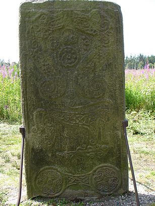
Rodney's Stone Address: 1, Forres, Moray IV36 2TD, UK street in Moray
Attractions near Rodney's Stone
Iv36 0wt,Iv36 0zz,Iv36 0td,Castelo Brodie,Brodie,Barleymill Road End,Iv36 0lp,Brodie Castle,Old Mill Inn,Iv36 2wu,Iv36 2wt,The Old Mill Inn,The Old Mill,Iv36 2lp,Iv36 0gx,Iv36 2gx,Blinkbonny,Iv36 0tq,Brodie Countryfare,Old Mill Caravan ParkHow to get to popular attractions in Moray with public transportation
Motherwell Railway Station (MTH), Motherwell,Glasgow Marriott Hotel, Glasgow,The Standing Order (Wetherspoon), Edinburgh,O2 ABC, Glasgow,Fort William, Fort William,The Sir John Moore (Wetherspoon), Glasgow,Overgate Centre, Dundee,Royal Infirmary Of Edinburgh (Little France), City Of Edinburgh,Asda, Glasgow,Partick Railway Station (PTK), Glasgow,Paisley Gilmour Street Railway Station (PYG), Paisley,New Gorbals, Glasgow,Tesco Extra, Edinburgh,Fir Park Stadium, Motherwell,Drumgelloch Railway Station (DRU), Airdrie,River Clyde, Glasgow City,Dundee Railway Station (DEE), Dundee,McEwan Square, Edinburgh,Clyde Arc (Squinty Bridge), Glasgow City,Nuffield Health Glasgow Central Fitness & Wellbeing Gym, GlasgowGet around Moray by public transport!
Travelling around Moray has never been so easy. See step by step directions as you travel to any attraction, street or major public transport station. View bus and train timetables, arrival times, service alerts and detailed routes on a map, so you know exactly how to get to anywhere in Moray.
When travelling to any destination around Moray use Moovit's Live Directions with Get Off Notifications to know exactly where and how far to walk, how long to wait for your line , and how many stops are left. Moovit will alert you when it’s time to get off — no need to constantly re-check whether yours is the next stop.
Wondering how to use public transport in Moray or how to pay for public transport in Moray? Moovit public transport app can help you navigate your way with public transport easily, and at minimum cost. It includes public transport fees, ticket prices, and costs. Looking for a map of Moray public transport lines? Moovit public transport app shows all public transport maps in Moray with all bus or train routes and stops on an interactive map.
Moray has 2 transport type(s), including: bus or train, operated by several transport agencies, including First Greater Glasgow, First Aberdeen, Lothian Buses, McGill's Bus Service, Stagecoach East Scotland, Stagecoach Bluebird, Xplore Dundee, Community Transport Glasgow, Prentice Westwood, McCall's Coaches, J P Minibus, National Rail, R Robertson & Son, Burnbrae Garage and Ember