Directions to Rowe Park (Claremont) with public transport
The following transport lines have routes that pass near Rowe Park
 Bus: 103, 28, 995, 999, 23.
- Train: AIRPORT LINE, FREMANTLE LINE.
How to get to Rowe Park by bus?
Click on the bus route to see step by step directions with maps, line arrival times and updated time schedules.
From Pinnacles Desert, Perth
39 minFrom William Street Taxi Rank, Perth
40 minFrom Watertown Brand Outlet, West Perth
48 minFrom The Camfield, Burswood
60 minFrom The Camfield, Burswood
61 minFrom John Hughes Vic Park, Victoria Park
62 minFrom Kent Street Senior High School, Victoria Park
71 minFrom Perth Zoo, South Perth
54 minFrom Kings Park, Perth
37 minFrom Kent Street Senior High School, Kensington
75 min
How to get to Rowe Park by train?
Click on the train route to see step by step directions with maps, line arrival times and updated time schedules.
From Pinnacles Desert, Perth
30 minFrom William Street Taxi Rank, Perth
25 minFrom Watertown Brand Outlet, West Perth
25 minFrom The Camfield, Burswood
43 minFrom The Camfield, Burswood
44 minFrom John Hughes Vic Park, Victoria Park
54 minFrom Kent Street Senior High School, Victoria Park
58 minFrom Kings Park, Perth
39 minFrom Kent Street Senior High School, Kensington
64 min
Bus stops near Rowe Park in Claremont
Bus lines to Rowe Park in Claremont
- 23, Elizabeth Quay Bus Stn,VIEW
- 24, East Perth,VIEW
- 25, Shenton Park Stn,VIEW
- 103, Elizabeth Quay Bus Stn,VIEW
- 995, Elizabeth Quay Bus Stn,VIEW
- 998, Galleria Bus Stn,VIEW
- 999, Fremantle Stn,VIEW
- AIRPORT LINE, Perth Stn,VIEW
- FREMANTLE LINE, Claremont Stn,VIEW
- 27, Claremont Stn,VIEW
- 28, Claremont Stn,VIEW
- 102, Claremont Stn,VIEW
- 107, Claremont Stn,VIEW
- 906, Fremantle Stn,VIEW
What are the nearest stations to Rowe Park?
The nearest stations to Rowe Park are:
- Leura Av After Gugeri St is 122 meters away, 2 min walk.
- Leura Av Before Gugeri St is 163 meters away, 3 min walk.
- Claremont Stn is 174 meters away, 3 min walk.
Which bus lines stop near Rowe Park?
These bus lines stop near Rowe Park: 103, 28, 995, 999.
Which train lines stop near Rowe Park?
These train lines stop near Rowe Park: AIRPORT LINE, FREMANTLE LINE.
What’s the nearest bus station to Rowe Park in Claremont?
The nearest bus station to Rowe Park in Claremont is Leura Av After Gugeri St. It’s a 2 min walk away.
What time is the first train to Rowe Park in Claremont?
The AIRPORT LINE is the first train that goes to Rowe Park in Claremont. It stops nearby at 05:29.
What time is the last train to Rowe Park in Claremont?
The FREMANTLE LINE is the last train that goes to Rowe Park in Claremont. It stops nearby at 00:38.
What time is the first bus to Rowe Park in Claremont?
The 24 is the first bus that goes to Rowe Park in Claremont. It stops nearby at 05:07.
What time is the last bus to Rowe Park in Claremont?
The 995 is the last bus that goes to Rowe Park in Claremont. It stops nearby at 00:16.
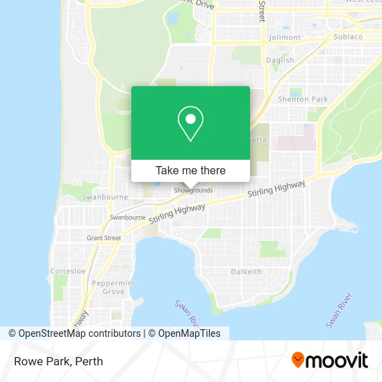
See Rowe Park, Claremont, on the map
Public Transit to Rowe Park in Claremont
Wondering how to get to Rowe Park in Claremont? Moovit helps you find the best way to get to Rowe Park with step-by-step directions from the nearest public transit station.
Moovit provides free maps and live directions to help you navigate through your city. View schedules, routes, timetables, and find out how long does it take to get to Rowe Park in real time.
Looking for the nearest stop or station to Rowe Park? Check out this list of stops closest to your destination: Leura Av After Gugeri St; Leura Av Before Gugeri St; Claremont Stn.
Bus: 103, 28, 995, 999, 23, 24, 25, AIRPORT LINE, FREMANTLE LINE, 27, 102.Train: AIRPORT LINE, FREMANTLE LINE.
Want to see if there’s another route that gets you there at an earlier time? Moovit helps you find alternative routes or times. Get directions from and directions to Rowe Park easily from the Moovit App or Website.
We make riding to Rowe Park easy, which is why over 1.5 million users, including users in Claremont, trust Moovit as the best app for public transit. You don’t need to download an individual bus app or train app, Moovit is your all-in-one transit app that helps you find the best bus time or train time available.
For information on prices of bus and train, costs and ride fares to Rowe Park, please check the Moovit app.
Use the app to navigate to popular places including to the airport, hospital, stadium, grocery store, mall, coffee shop, school, college, and university.
Rowe Park Address: Gugeri Street street in Claremont
- Nano Nagle Centre,
- Claremont Showgrounds,
- The Queenslea,
- Gate 1,
- Lillys Bakehouse,
- Di Parsons Art,
- Showgrounds Equestrian Centre,
- Gate One Theatre,
- Graylands Road,
- Ellie Eaton Pavilion,
- Diamond Brook Cateri,
- Raswa Grandstand,
- Claremont Football Oval,
- Servier Laboratories,
- Dr. Nico Lauw,
- Aumec,
- Pharmaust,
- Young Massage & Beauty,
- Grandstand Apartments,
- Ladders and Rose
Places Near Rowe Park (Claremont)
- Royal Perth Hospital, Perth,
- Mount Hospital, Perth,
- Optus Stadium, Burswood,
- Westfield Carousel, Cannington,
- DFO, Perth Airport,
- McCallum Park, Victoria Park,
- Pelicaan Investment Ho, Bellevue,
- Langley Park, Perth,
- Scitech, West Perth,
- Yankee Mart, Baldivis,
- Karrinyup Shopping Centre, Karrinyup,
- Crown Perth Casino, Burswood,
- Fiona Stanley Hospital, Murdoch,
- Blue Boat House,
- Rac Arena, Perth,
- Aqwa Aquarium, Hillarys,
- IKEA, Innaloo,
- Sir Charles Gairdner Hospital, Nedlands,
- Watertown, Perth,
- Perth Convention Exhibition Centre, Perth
How to get to popular places in Perth with public transport
Get around Claremont by public transport!
Travelling around Claremont has never been so easy. See step by step directions as you travel to any attraction, street or major public transport station. View bus and train timetables, arrival times, service alerts and detailed routes on a map, so you know exactly how to get to anywhere in Claremont.
When travelling to any destination around Claremont use Moovit's Live Directions with Get Off Notifications to know exactly where and how far to walk, how long to wait for your line , and how many stops are left. Moovit will alert you when it’s time to get off — no need to constantly re-check whether yours is the next stop.
Wondering how to use public transport in Claremont or how to pay for public transport in Claremont? Moovit public transport app can help you navigate your way with public transport easily, and at minimum cost. It includes public transport fees, ticket prices, and costs. Looking for a map of Claremont public transport lines? Moovit public transport app shows all public transport maps in Claremont with all Bus, Train and Ferry routes and stops on an interactive map.
Perth has 3 transport type(s), including: Bus, Train and Ferry, operated by several transport agencies, including Transperth Rail, Transwa, Transperth Ferry, Transperth, TransBusselton, TransAlbany, TransGoldfields, TransEsperance, TransGeraldton, TransCarnarvon, TransHedland, TransKarratha, TransBunbury, Mandurah Bus Charter and TransBroome