How to get to Ryton Pools Country Park by bus?
Click on the bus route to see step by step directions with maps, line arrival times and updated time schedules.
From CV2 2DX, Henley
114 minFrom Binley Business Park, Wyken
83 minFrom Norman Place Rd, Coventry, Sherbourne
123 minFrom Royal Leamington Spa Rehabilitation Hospital, Warwick Myton & Heathcote
100 minFrom Canley Crematorium, Wainbody
129 minFrom Jubilee Crescent, Coventry, Radford
124 minFrom Leamington Spa Rehab Hospital, Warwick Myton & Heathcote
101 minFrom Xcel Leisure Centre, Westwood
138 minFrom Cofa Court, Cheylesmore
101 minFrom CV34 6SR, Warwick Myton & Heathcote
101 min
Bus stops near Ryton Pools Country Park in Dunsmore
- Three Horseshoes, 3 min walk,VIEW
Bus lines to Ryton Pools Country Park in Dunsmore
What are the nearest stations to Ryton Pools Country Park?
The nearest stations to Ryton Pools Country Park are:
- Three Horseshoes is 160 meters away, 3 min walk.
Which bus lines stop near Ryton Pools Country Park?
These bus lines stop near Ryton Pools Country Park: 13, 25A.
What’s the nearest bus station to Ryton Pools Country Park in Dunsmore?
The nearest bus station to Ryton Pools Country Park in Dunsmore is Three Horseshoes. It’s a 3 min walk away.
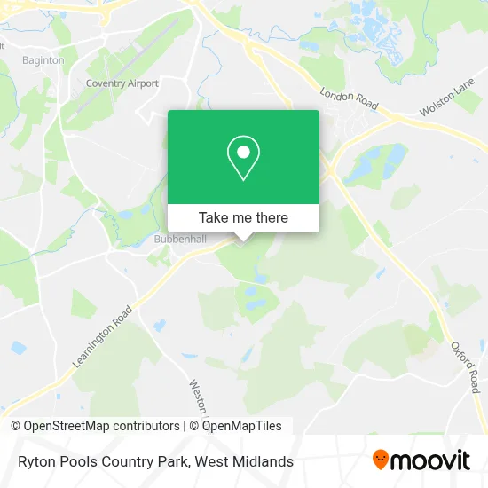
See Ryton Pools Country Park, Dunsmore, on the map
Public Transit to Ryton Pools Country Park in Dunsmore
Wondering how to get to Ryton Pools Country Park in Dunsmore? Moovit helps you find the best way to get to Ryton Pools Country Park with step-by-step directions from the nearest public transit station.
Moovit provides free maps and live directions to help you navigate through your city. View schedules, routes, timetables, and find out how long does it take to get to Ryton Pools Country Park in real time.
Looking for the nearest stop or station to Ryton Pools Country Park? Check out this list of stops closest to your destination: Three Horseshoes.
Bus: 13, 25A, 69, 24A.
Want to see if there’s another route that gets you there at an earlier time? Moovit helps you find alternative routes or times. Get directions from and directions to Ryton Pools Country Park easily from the Moovit App or Website.
We make riding to Ryton Pools Country Park easy, which is why over 1.5 million users, including users in Dunsmore, trust Moovit as the best app for public transit. You don’t need to download an individual bus app or train app, Moovit is your all-in-one transit app that helps you find the best bus time or train time available.
For information on prices of bus, costs and ride fares to Ryton Pools Country Park, please check the Moovit app.
Use the app to navigate to popular places including to the airport, hospital, stadium, grocery store, mall, coffee shop, school, college, and university.
Ryton Pools Country Park Address: Ryton Road, Bubbenhall street in Dunsmore

- The Courtyard Cafe,
- Ryton Pools Country Park,
- Bubbenhall,
- Superduper,
- Punch Partnerships (Ptl),
- Kyra Enterprises,
- Self Catering in the Cotswolds,
- Bubbenhall Three Horseshoes,
- Warwickshire Chiropratic,
- Cv8 3en,
- College Of Policing,
- Sport Connexion,
- Sports Connexion Leisure Club,
- Future Roofing,
- Cv8 3eg,
- Sky Blue Connexion, Ryton-on-Dunsmore,
- Ryton on Dunsmore Sky Blue Connexion,
- The Original Reenactors Market (TORM),
- Dc8 - Furnolic,
- Vortex Training Group
Places Near Ryton Pools Country Park (Dunsmore)
- Fort Shopping Centre, Birmingham, Pype Hayes,
- Sandwell General Hospital, West Bromwich Central,
- Waseley Hills Crematorium, Frankley Great Park,
- Sandwell General Hospital, West Bromwich Central,
- Birmingham Dental Hospital, Edgbaston,
- Birmingham And Midland Eye Centre, Soho & Jewellery Quarter,
- Travelodge Birmingham Airport Hotel Birmingham, Bickenhill,
- Crown Wharf Retail Park, St. Matthew's,
- Moseley, Moseley,
- IKEA Wednesbury, Oldbury,
- Boundary Mill Stores, Bentley And Darlaston North,
- The Merry Hill Centre, Brierley Hill,
- Lilleshall Hall National Sports Centre, Telford,
- One Stop Shopping Centre, Perry Barr,
- Bournville Staff Shop (Cadbury World), Bournville & Cotteridge,
- Royal Orthopaedic Hospital, Northfield,
- Stratford Road, Sparkhill,
- Bickerstaff Endoscopy Unit (PRH), Apley Castle,
- Tally Ho Police Training, Birmingham, Edgbaston,
- Heritage Building (Queen Elizabeth Hospital), Edgbaston
How to get to popular places in West Midlands with public transport
Get around Dunsmore by public transport!
Travelling around Dunsmore has never been so easy. See step by step directions as you travel to any attraction, street or major public transport station. View bus and train timetables, arrival times, service alerts and detailed routes on a map, so you know exactly how to get to anywhere in Dunsmore.
When travelling to any destination around Dunsmore use Moovit's Live Directions with Get Off Notifications to know exactly where and how far to walk, how long to wait for your line , and how many stops are left. Moovit will alert you when it’s time to get off — no need to constantly re-check whether yours is the next stop.
Wondering how to use public transport in Dunsmore or how to pay for public transport in Dunsmore? Moovit public transport app can help you navigate your way with public transport easily, and at minimum cost. It includes public transport fees, ticket prices, and costs. Looking for a map of Dunsmore public transport lines? Moovit public transport app shows all public transport maps in Dunsmore with all Bus, Train and Light rail routes and stops on an interactive map.
West Midlands has 3 transport type(s), including: Bus, Train and Light rail, operated by several transport agencies, including National Express West Midlands, National Express Coventry, National Express, Diamond Bus, Arriva Midlands, Stagecoach Midlands, West Midlands Metro, Stagecoach West, Stagecoach South Wales, First Potteries, First Worcestershire, LandFlight, trentbarton, D & G Bus and Flexibus