Directions to Safeworks (Nedlands) with public transport
The following transport lines have routes that pass near Safeworks
 Bus: 24, 950, 950X, 995, 998.
- Train: AIRPORT LINE, FREMANTLE LINE, 906.
How to get to Safeworks by bus?
Click on the bus route to see step by step directions with maps, line arrival times and updated time schedules.
From Optus Stadium Bus Stands, Burswood
48 minFrom Riverton, Riverton
81 minFrom Point Fraser, East Perth
35 minFrom Mciver Carpark RPH, Perth
33 minFrom Adelaide Terrace, East Perth
37 minFrom Australian Islamic College (AIC) - Dianella, Dianella
64 minFrom Flag Motor Lodge, Rivervale
57 minFrom Clancy's Fish Pub, Fremantle
58 minFrom Rosemount Hotel, North Perth
44 minFrom Kardinya Park Shopping Centre, Kardinya
76 min
How to get to Safeworks by train?
Click on the train route to see step by step directions with maps, line arrival times and updated time schedules.
Bus stops near Safeworks in Nedlands
Train station near Safeworks in Nedlands
- Karrakatta Stn, 53 min walk,VIEW
Bus lines to Safeworks in Nedlands
- 23, Claremont Stn,VIEW
- 103, Claremont Stn,VIEW
- 995, Elizabeth Quay Bus Stn,VIEW
- 999, Fremantle Stn,VIEW
- 24, Claremont Stn,VIEW
- 96, Leederville Stn,VIEW
- ELIZABETH QUAY BUS STN - HACKETT DR UWA BUSINESS SCHOOL CAT ID 123, Crawley,VIEW
- 998, Stirling Stn,VIEW
- 97, Crawley,VIEW
- 950, Galleria Bus Stn,VIEW
- 950X, Qeii Medical Ctr,VIEW
What are the nearest stations to Safeworks?
The nearest stations to Safeworks are:
- Stirling Hwy After Broadway is 110 meters away, 2 min walk.
- Broadway Cooper Street Cat Id 127 is 239 meters away, 4 min walk.
- Stirling Hwy After Clifton St is 265 meters away, 4 min walk.
- Broadway After Cooper St is 270 meters away, 4 min walk.
- Stirling Hwy Uwa Cat Id 121 is 275 meters away, 4 min walk.
- Karrakatta Stn is 4095 meters away, 53 min walk.
Which bus lines stop near Safeworks?
These bus lines stop near Safeworks: 24, 950, 950X, 995, 998.
Which train lines stop near Safeworks?
These train lines stop near Safeworks: AIRPORT LINE, FREMANTLE LINE.
What’s the nearest bus station to Safeworks in Nedlands?
The nearest bus station to Safeworks in Nedlands is Stirling Hwy After Broadway. It’s a 2 min walk away.
What time is the first train to Safeworks in Nedlands?
The FREMANTLE LINE is the first train that goes to Safeworks in Nedlands. It stops nearby at 05:30.
What time is the last train to Safeworks in Nedlands?
The FREMANTLE LINE is the last train that goes to Safeworks in Nedlands. It stops nearby at 00:33.
What time is the first bus to Safeworks in Nedlands?
The 950 is the first bus that goes to Safeworks in Nedlands. It stops nearby at 04:55.
What time is the last bus to Safeworks in Nedlands?
The 950 is the last bus that goes to Safeworks in Nedlands. It stops nearby at 00:59.
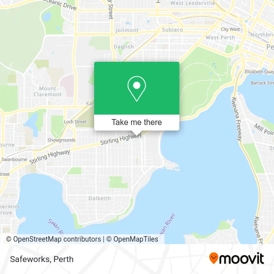
See Safeworks, Nedlands, on the map
Public Transit to Safeworks in Nedlands
Wondering how to get to Safeworks in Nedlands? Moovit helps you find the best way to get to Safeworks with step-by-step directions from the nearest public transit station.
Moovit provides free maps and live directions to help you navigate through your city. View schedules, routes, timetables, and find out how long does it take to get to Safeworks in real time.
Looking for the nearest stop or station to Safeworks? Check out this list of stops closest to your destination: Stirling Hwy After Broadway; Broadway Cooper Street Cat Id 127; Stirling Hwy After Clifton St; Broadway After Cooper St; Stirling Hwy Uwa Cat Id 121; Karrakatta Stn.
Bus: 24, 950, 950X, 995, 998, 23, 103, 999, 96, ELIZABETH QUAY BUS STN - HACKETT DR UWA BUSINESS SCHOOL CAT ID 123, 97.Train: AIRPORT LINE, FREMANTLE LINE, 906.
Want to see if there’s another route that gets you there at an earlier time? Moovit helps you find alternative routes or times. Get directions from and directions to Safeworks easily from the Moovit App or Website.
We make riding to Safeworks easy, which is why over 1.5 million users, including users in Nedlands, trust Moovit as the best app for public transit. You don’t need to download an individual bus app or train app, Moovit is your all-in-one transit app that helps you find the best bus time or train time available.
For information on prices of bus and train, costs and ride fares to Safeworks, please check the Moovit app.
Use the app to navigate to popular places including to the airport, hospital, stadium, grocery store, mall, coffee shop, school, college, and university.
Safeworks Address: 8 Stirling Hwy Nedlands WA 6009 street in Nedlands
- Perth Eye Foundation,
- Rachel Ryan Pt,
- Zambrero Nedlands,
- Broadway Caterers the Broadway Eatery,
- Caltex,
- BB Express Nedlands,
- Unnamed,
- Leon Martin Barristers Solicitors,
- Airdolphin Australia,
- Futuretek It,
- Coolzy Portable Air Conditioner,
- Calla Water & Energy Saversa,
- Aha Studio Andrew Hagemann Architecture Studio,
- Burditt Krost Strategic Planning Institute Pty,
- Maximum Tax Refund,
- Chakra Angel,
- Jr Studio,
- Haempathwa,
- Tesla Electric Car Rental Modelz,
- Canning Bridge Superwa
Places Near Safeworks (Nedlands)
- Optus Stadium, Burswood,
- Royal Perth Hospital, Perth,
- Rac Arena, Perth,
- Sir Charles Gairdner Hospital, Nedlands,
- Watertown, Perth,
- Westfield Carousel, Cannington,
- Pelicaan Investment Ho, Bellevue,
- Aqwa Aquarium, Hillarys,
- Fiona Stanley Hospital, Murdoch,
- DFO, Perth Airport,
- IKEA, Innaloo,
- Yankee Mart, Baldivis,
- Langley Park, Perth,
- Scitech, West Perth,
- Blue Boat House,
- McCallum Park, Victoria Park,
- Karrinyup Shopping Centre, Karrinyup,
- Mount Hospital, Perth,
- Perth Convention Exhibition Centre, Perth,
- Crown Perth Casino, Burswood
How to get to popular places in Perth with public transport
Get around Nedlands by public transport!
Travelling around Nedlands has never been so easy. See step by step directions as you travel to any attraction, street or major public transport station. View bus and train timetables, arrival times, service alerts and detailed routes on a map, so you know exactly how to get to anywhere in Nedlands.
When travelling to any destination around Nedlands use Moovit's Live Directions with Get Off Notifications to know exactly where and how far to walk, how long to wait for your line , and how many stops are left. Moovit will alert you when it’s time to get off — no need to constantly re-check whether yours is the next stop.
Wondering how to use public transport in Nedlands or how to pay for public transport in Nedlands? Moovit public transport app can help you navigate your way with public transport easily, and at minimum cost. It includes public transport fees, ticket prices, and costs. Looking for a map of Nedlands public transport lines? Moovit public transport app shows all public transport maps in Nedlands with all Bus, Train and Ferry routes and stops on an interactive map.
Perth has 3 transport type(s), including: Bus, Train and Ferry, operated by several transport agencies, including Transperth Rail, Transwa, Transperth Ferry, Transperth, TransBusselton, TransAlbany, TransGoldfields, TransEsperance, TransGeraldton, TransCarnarvon, TransHedland, TransKarratha, TransBunbury, Mandurah Bus Charter and TransBroome