Directions to Samuel Isaacs Complex (Bentley) with public transport
The following transport lines have routes that pass near Samuel Isaacs Complex
 Bus: 177, 179, 220, 222, 34.
- Train: ARMADALE LINE, THORNLIE-COCKBURN LINE.
How to get to Samuel Isaacs Complex by bus?
Click on the bus route to see step by step directions with maps, line arrival times and updated time schedules.
From Perth Children’s Hospital, Nedlands
61 minFrom Broadway, Nedlands
64 minFrom Angove Street, North Perth
51 minFrom Centro Maddington Shopping Centre, Maddington
42 minFrom Raine Square Shopping Centre, Perth
34 minFrom Crown Perth Casino, Burswood
33 minFrom Rossmoyne Senior High School, Bull Creek
43 minFrom Red CAT Stop 6 (Perth Mint), Perth
28 minFrom University Of Western Australia Nedlands Campus, Nedlands
64 minFrom Murdoch University, Murdoch
67 min
How to get to Samuel Isaacs Complex by train?
Click on the train route to see step by step directions with maps, line arrival times and updated time schedules.
Bus stops near Samuel Isaacs Complex in Bentley
Bus lines to Samuel Isaacs Complex in Bentley
What are the nearest stations to Samuel Isaacs Complex?
The nearest stations to Samuel Isaacs Complex are:
- Chapman Rd After Queen St is 138 meters away, 3 min walk.
- Chapman Rd After Palmerston St is 339 meters away, 5 min walk.
- Ashburton St After Chapman Rd is 342 meters away, 5 min walk.
Which bus lines stop near Samuel Isaacs Complex?
These bus lines stop near Samuel Isaacs Complex: 177, 179, 220, 222.
Which train lines stop near Samuel Isaacs Complex?
These train lines stop near Samuel Isaacs Complex: ARMADALE LINE, THORNLIE-COCKBURN LINE.
What’s the nearest bus station to Samuel Isaacs Complex in Bentley?
The nearest bus station to Samuel Isaacs Complex in Bentley is Chapman Rd After Queen St. It’s a 3 min walk away.
What time is the first bus to Samuel Isaacs Complex in Bentley?
The 177 is the first bus that goes to Samuel Isaacs Complex in Bentley. It stops nearby at 06:16.
What time is the last bus to Samuel Isaacs Complex in Bentley?
The 34 is the last bus that goes to Samuel Isaacs Complex in Bentley. It stops nearby at 23:50.
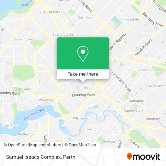
See Samuel Isaacs Complex, Bentley, on the map
Public Transit to Samuel Isaacs Complex in Bentley
Wondering how to get to Samuel Isaacs Complex in Bentley? Moovit helps you find the best way to get to Samuel Isaacs Complex with step-by-step directions from the nearest public transit station.
Moovit provides free maps and live directions to help you navigate through your city. View schedules, routes, timetables, and find out how long does it take to get to Samuel Isaacs Complex in real time.
Looking for the nearest stop or station to Samuel Isaacs Complex? Check out this list of stops closest to your destination: Chapman Rd After Queen St; Chapman Rd After Palmerston St; Ashburton St After Chapman Rd.
Bus: 177, 179, 220, 222, 34.Train: ARMADALE LINE, THORNLIE-COCKBURN LINE.
Want to see if there’s another route that gets you there at an earlier time? Moovit helps you find alternative routes or times. Get directions from and directions to Samuel Isaacs Complex easily from the Moovit App or Website.
We make riding to Samuel Isaacs Complex easy, which is why over 1.5 million users, including users in Bentley, trust Moovit as the best app for public transit. You don’t need to download an individual bus app or train app, Moovit is your all-in-one transit app that helps you find the best bus time or train time available.
For information on prices of bus and train, costs and ride fares to Samuel Isaacs Complex, please check the Moovit app.
Use the app to navigate to popular places including to the airport, hospital, stadium, grocery store, mall, coffee shop, school, college, and university.
Samuel Isaacs Complex Address: 63-65 Queen St Bentley WA 6102 street in Bentley
- Burhan Traders,
- BENTLEY Sadora Upholstery Couch Sofa,
- Bentley WA Australia,
- Ashu Ashish Chibba,
- Censure,
- Healing Hands Remedial,
- Prestige Window Cleaning,
- Gamagama Indian Cuisine,
- Bentley Hospital,
- Verse Property,
- Wyong Reserve,
- Vpya,
- Darko Maras-Builder,
- Western Arbor Contractors,
- Marchant Plumbing and Gas,
- My Fresh,
- Silverchain-Pendana Social Centre,
- Dr Yans TCM Therapy,
- Orchid Villas,
- De Kitchenette
Places Near Samuel Isaacs Complex (Bentley)
- Crown Perth Casino, Burswood,
- Sir Charles Gairdner Hospital, Nedlands,
- Mount Hospital, Perth,
- Westfield Carousel, Cannington,
- Watertown, Perth,
- Perth Convention Exhibition Centre, Perth,
- Rac Arena, Perth,
- Fiona Stanley Hospital, Murdoch,
- Scitech, West Perth,
- Pelicaan Investment Ho, Bellevue,
- DFO, Perth Airport,
- Blue Boat House,
- Karrinyup Shopping Centre, Karrinyup,
- Royal Perth Hospital, Perth,
- IKEA, Innaloo,
- Optus Stadium, Burswood,
- Yankee Mart, Baldivis,
- Aqwa Aquarium, Hillarys,
- Langley Park, Perth,
- McCallum Park, Victoria Park
How to get to popular places in Perth with public transport
Get around Bentley by public transport!
Travelling around Bentley has never been so easy. See step by step directions as you travel to any attraction, street or major public transport station. View bus and train timetables, arrival times, service alerts and detailed routes on a map, so you know exactly how to get to anywhere in Bentley.
When travelling to any destination around Bentley use Moovit's Live Directions with Get Off Notifications to know exactly where and how far to walk, how long to wait for your line , and how many stops are left. Moovit will alert you when it’s time to get off — no need to constantly re-check whether yours is the next stop.
Wondering how to use public transport in Bentley or how to pay for public transport in Bentley? Moovit public transport app can help you navigate your way with public transport easily, and at minimum cost. It includes public transport fees, ticket prices, and costs. Looking for a map of Bentley public transport lines? Moovit public transport app shows all public transport maps in Bentley with all Bus, Train and Ferry routes and stops on an interactive map.
Perth has 3 transport type(s), including: Bus, Train and Ferry, operated by several transport agencies, including Transperth Rail, Transwa, Transperth Ferry, Transperth, TransBusselton, TransAlbany, TransGoldfields, TransEsperance, TransGeraldton, TransCarnarvon, TransHedland, TransKarratha, TransBunbury, Mandurah Bus Charter and TransBroome