Directions to Shatterford (Wribbenhall & Arley) with public transport
The following transport lines have routes that pass near Shatterford
 Bus: 297, 580.
How to get to Shatterford by bus?
Click on the bus route to see step by step directions with maps, line arrival times and updated time schedules.
Bus stop near Shatterford in Wribbenhall & Arley
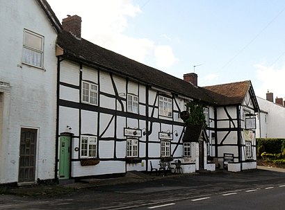
- Shatterford Inn, 2 min walk,
Bus lines to Shatterford in Wribbenhall & Arley
- 297, Harp Inn,
What are the nearest stations to Shatterford?
The nearest stations to Shatterford are:
- Shatterford Inn is 71 meters away, 2 min walk.
Which bus lines stop near Shatterford?
These bus lines stop near Shatterford: 297, 580.
What’s the nearest bus station to Shatterford in Wribbenhall & Arley?
The nearest bus station to Shatterford in Wribbenhall & Arley is Shatterford Inn. It’s a 2 min walk away.
What time is the first bus to Shatterford in Wribbenhall & Arley?
The 297 is the first bus that goes to Shatterford in Wribbenhall & Arley. It stops nearby at 07:29.
What time is the last bus to Shatterford in Wribbenhall & Arley?
The 297 is the last bus that goes to Shatterford in Wribbenhall & Arley. It stops nearby at 18:46.
See Shatterford, Wribbenhall & Arley, on the map
Public Transit to Shatterford in Wribbenhall & Arley
Wondering how to get to Shatterford in Wribbenhall & Arley? Moovit helps you find the best way to get to Shatterford with step-by-step directions from the nearest public transit station.
Moovit provides free maps and live directions to help you navigate through your city. View schedules, routes, timetables, and find out how long does it take to get to Shatterford in real time.
Looking for the nearest stop or station to Shatterford? Check out this list of stops closest to your destination: Shatterford Inn.
Bus: 297, 580.
Want to see if there’s another route that gets you there at an earlier time? Moovit helps you find alternative routes or times. Get directions from and directions to Shatterford easily from the Moovit App or Website.
We make riding to Shatterford easy, which is why over 1.5 million users, including users in Wribbenhall & Arley, trust Moovit as the best app for public transit. You don’t need to download an individual bus app or train app, Moovit is your all-in-one transit app that helps you find the best bus time or train time available.
For information on prices of bus and train, costs and ride fares to Shatterford, please check the Moovit app.
Use the app to navigate to popular places including to the airport, hospital, stadium, grocery store, mall, coffee shop, school, college, and university.
Shatterford Address: Trimpley Lane street in Wribbenhall & Arley
- Hayday Securities,
- Shatterford- Shatterford Inn (A442),
- Dominiques,
- Bellmans Cross Inn And Dominique's Restaurant,
- Shatterford Village Hall,
- Park Attwood Therapeutic Association Limited,
- Pristine Engraving,
- Midlands Roof Tent Rentals,
- Igm,
- Shatterford Holiday Accommodation,
- Hasckia,
- Trimpley,
- Trimpley,
- Hickys Limited,
- Severn Valley Homes,
- Arley Arboretum & Gardens,
- The Hot Box,
- The Lowe Farm,
- Arley Estate Office,
- Arley Village Store
Places Near Shatterford (Wribbenhall & Arley)
- Moseley, Moseley,
- Birmingham QE Hospital, Edgbaston,
- Travelodge Birmingham Airport Hotel Birmingham, Bickenhill,
- Tally Ho Police Training, Birmingham, Edgbaston,
- Bickerstaff Endoscopy Unit (PRH), Apley Castle,
- Queen Elizabeth Hospital (QEHB), Edgbaston,
- IKEA Wednesbury, Oldbury,
- Fort Shopping Centre, Birmingham, Pype Hayes,
- Birmingham Dental Hospital, Edgbaston,
- One Stop Shopping Centre, Perry Barr,
- The Merry Hill Centre, Brierley Hill,
- Lilleshall Hall National Sports Centre, Telford,
- Crown Wharf Retail Park, St. Matthew's,
- Heritage Building (Queen Elizabeth Hospital), Edgbaston,
- Royal Orthopaedic Hospital, Northfield,
- Queen Elizabeth Hospital (Stop QC), Birmingham, Edgbaston,
- Birmingham Heartlands Hospital, Heartlands,
- Stratford Road, Sparkhill,
- Sandwell General Hospital, West Bromwich Central,
- Gurdwara Baba Vadbhag Singh Ji, Poplar
How to get to popular places in West Midlands with public transport
Get around Wribbenhall & Arley by public transport!
Travelling around Wribbenhall & Arley has never been so easy. See step by step directions as you travel to any attraction, street or major public transport station. View bus and train timetables, arrival times, service alerts and detailed routes on a map, so you know exactly how to get to anywhere in Wribbenhall & Arley.
When travelling to any destination around Wribbenhall & Arley use Moovit's Live Directions with Get Off Notifications to know exactly where and how far to walk, how long to wait for your line , and how many stops are left. Moovit will alert you when it’s time to get off — no need to constantly re-check whether yours is the next stop.
Wondering how to use public transport in Wribbenhall & Arley or how to pay for public transport in Wribbenhall & Arley? Moovit public transport app can help you navigate your way with public transport easily, and at minimum cost. It includes public transport fees, ticket prices, and costs. Looking for a map of Wribbenhall & Arley public transport lines? Moovit public transport app shows all public transport maps in Wribbenhall & Arley with all Bus, Train and Light rail routes and stops on an interactive map.
West Midlands has 3 transport type(s), including: Bus, Train and Light rail, operated by several transport agencies, including National Express West Midlands, National Express Coventry, National Express, Diamond Bus, Arriva Midlands, Stagecoach Midlands, West Midlands Metro, Stagecoach West, Stagecoach South Wales, First Potteries, First Worcestershire, LandFlight, trentbarton, D & G Bus and Flexibus