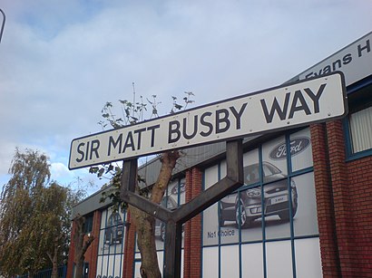
Sir Matt Busby Way stop - Saturday schedule
| Line | Direction | Time |
|---|---|---|
| 250 | Piccadilly Gardens | 05:42 |
| 250 | Piccadilly Gardens | 06:07 |
| 250 | Piccadilly Gardens | 06:32 |
| 250 | Piccadilly Gardens | 06:57 |
| 250 | Piccadilly Gardens | 07:18 |
| 250 | Piccadilly Gardens | 07:33 |
| 250 | Piccadilly Gardens | 07:48 |
| 250 | Piccadilly Gardens | 08:03 |
| 250 | Piccadilly Gardens | 08:18 |
| 250 | Piccadilly Gardens | 08:33 |
| 250 | Piccadilly Gardens | 08:48 |
| 250 | Piccadilly Gardens | 09:03 |
| 250 | Piccadilly Gardens | 09:18 |
| 250 | Piccadilly Gardens | 09:30 |
| 250 | Piccadilly Gardens | 09:42 |
| 250 | Piccadilly Gardens | 09:54 |
| 250 | Piccadilly Gardens | 10:06 |
| 250 | Piccadilly Gardens | 10:18 |
| 250 | Piccadilly Gardens | 10:30 |
| 250 | Piccadilly Gardens | 10:42 |
| 250 | Piccadilly Gardens | 10:54 |
| 250 | Piccadilly Gardens | 11:06 |
| 250 | Piccadilly Gardens | 11:18 |
| 250 | Piccadilly Gardens | 11:30 |
| 250 | Piccadilly Gardens | 11:42 |
Directions to Sir Matt Busby Way stop (Trafford Bar) with public transport
The following transport lines have routes that pass near Sir Matt Busby Way
 Bus: 250, 53, X50, T1, 255.
- Light rail: RED LINE.
How to get to Sir Matt Busby Way stop by bus?
Click on the bus route to see step by step directions with maps, line arrival times and updated time schedules.
How to get to Sir Matt Busby Way stop by train?
Click on the train route to see step by step directions with maps, line arrival times and updated time schedules.
How to get to Sir Matt Busby Way stop by light rail?
Click on the light rail route to see step by step directions with maps, line arrival times and updated time schedules.
Bus stops near Sir Matt Busby Way stop in Trafford Bar
- Matt Busby Way, 3 min walk,
- Waterside, 3 min walk,
- Sir Alex Ferguson Way, 6 min walk,
- Warwick Road, 9 min walk,
- White City, 10 min walk,
- Central Bay, 18 min walk,
Light Rail stations near Sir Matt Busby Way station in Trafford Bar
- Wharfside (Manchester Metrolink), 6 min walk,
- Exchange Quay (Manchester Metrolink), 13 min walk,
Bus lines to Sir Matt Busby Way stop in Trafford Bar
- 250, Piccadilly Gardens,
- X50, Piccadilly Gardens,
- T1, Manchester Central Convention Complex,
- 255, Partington Terminus,
- 256, Piccadilly Gardens,
- 263, Altrincham Interchange,
- 79, Salford Shopping Centre,
- 53, Salford Shopping Centre,
What are the nearest stations to Sir Matt Busby Way?
The nearest stations to Sir Matt Busby Way are:
- Matt Busby Way is 207 meters away, 3 min walk.
- Waterside is 225 meters away, 3 min walk.
- Sir Alex Ferguson Way is 412 meters away, 6 min walk.
- Wharfside (Manchester Metrolink) is 442 meters away, 6 min walk.
- Warwick Road is 685 meters away, 9 min walk.
- White City is 709 meters away, 10 min walk.
- Exchange Quay (Manchester Metrolink) is 947 meters away, 13 min walk.
- Central Bay is 1380 meters away, 18 min walk.
Which bus lines stop near Sir Matt Busby Way?
These bus lines stop near Sir Matt Busby Way: 250, 53, X50.
Which light rail line stops near Sir Matt Busby Way?
RED LINE (The Trafford Centre (Manchester Metrolink))
What’s the nearest light rail station to Sir Matt Busby Way in Trafford Bar?
The nearest light rail station to Sir Matt Busby Way in Trafford Bar is Wharfside (Manchester Metrolink). It’s a 6 min walk away.
What’s the nearest bus station to Sir Matt Busby Way in Trafford Bar?
The nearest bus stations to Sir Matt Busby Way in Trafford Bar are Matt Busby Way and Waterside. The closest one is a 3 min walk away.
What time is the first light rail to Sir Matt Busby Way in Trafford Bar?
The RED LINE is the first light rail that goes to Sir Matt Busby Way in Trafford Bar. It stops nearby at 05:25.
What time is the last light rail to Sir Matt Busby Way in Trafford Bar?
The RED LINE is the last light rail that goes to Sir Matt Busby Way in Trafford Bar. It stops nearby at 00:25.
What time is the first bus to Sir Matt Busby Way in Trafford Bar?
The 256 is the first bus that goes to Sir Matt Busby Way in Trafford Bar. It stops nearby at 04:44.
What time is the last bus to Sir Matt Busby Way in Trafford Bar?
The 256 is the last bus that goes to Sir Matt Busby Way in Trafford Bar. It stops nearby at 00:46.
See Sir Matt Busby Way stop, Trafford Bar, on the map
Public transport to Sir Matt Busby Way stop (ID: MANJMWDW) in Trafford Bar
Looking for directions to Sir Matt Busby Way in Trafford Bar, United Kingdom?
Download the Moovit App to find the current schedule and step-by-step directions for Bus or Light rail routes that pass through Sir Matt Busby Way.
Looking for the nearest stops closest to Sir Matt Busby Way ? Check out this list of closest stops to your destination: Matt Busby Way; Waterside; Sir Alex Ferguson Way; Wharfside (Manchester Metrolink); Warwick Road; White City; Exchange Quay (Manchester Metrolink); Central Bay.
Bus: 250, 53, X50, T1, 255, 256, 263, 79.Light rail: RED LINE.
We make riding on public transit to Sir Matt Busby Way easy, which is why over 1.5 million users, including users in Trafford Bar trust Moovit as the best app for public transit.
Use the app to navigate to popular places including to the airport, hospital, stadium, grocery store, mall, coffee shop, school, college, and university.
Sir Matt Busby Way stop’s code is MANJMWDW
The first line to this stop is 250, at 05:42, and the last line is 250 at 00:55.
This stop serves Bee Network’s lines
- Matt Busby Way,
- Waterside,
- Sir Alex Ferguson Way,
- Warwick Road,
- White City,
- Central Bay
Bus stops near Sir Matt Busby Way stop
- Wharfside (Manchester Metrolink),
- Exchange Quay (Manchester Metrolink)
Light Rail stations near Sir Matt Busby Way station
- Bidston Green Drive,
- Queens Road Bus Depot,
- Dakota Drive,
- Manchester Square (Blackpool Tramway),
- Unsworth Medical Centre,
- Cheadle Royal Hospital,
- Withington Library,
- Upper Hill Street,
- Thornton Gate (Blackpool Tramway),
- Belvedere Road,
- Ringley Road,
- Chorlton Street Coach Station,
- St Ambrose College,
- St Mary's Church,
- Canal Street,
- Chadwick House,
- Castle Irwell,
- Stockport College,
- Bromborough Retail Park,
- The Trafford Centre (Manchester Metrolink)
Popular public transport stations in Trafford Bar
Get around Trafford Bar by public transport!
Travelling around Trafford Bar has never been so easy. See step by step directions as you travel to any attraction, street or major public transport station. View bus and train timetables, arrival times, service alerts and detailed routes on a map, so you know exactly how to get to anywhere in Trafford Bar.
When travelling to any destination around Trafford Bar use Moovit's Live Directions with Get Off Notifications to know exactly where and how far to walk, how long to wait for your line , and how many stops are left. Moovit will alert you when it’s time to get off — no need to constantly re-check whether yours is the next stop.
Wondering how to use public transport in Trafford Bar or how to pay for public transport in Trafford Bar? Moovit public transport app can help you navigate your way with public transport easily, and at minimum cost. It includes public transport fees, ticket prices, and costs. Looking for a map of Trafford Bar public transport lines? Moovit public transport app shows all public transport maps in Trafford Bar with all Bus, Train, Light rail and Ferry routes and stops on an interactive map.
North West has 4 transport type(s), including: Bus, Train, Light rail and Ferry, operated by several transport agencies, including Arriva North West, Stagecoach Merseyside and South Lancashire, Stagecoach Cumbria and North Lancashire, First Halifax, National Express, Warrington's Own Buses, First Potteries, Rosso, Blackpool Transport, The Blackburn Bus Company, The Burnley Bus Company, Vision Bus, National Rail, Huyton Travel and Stotts Tours