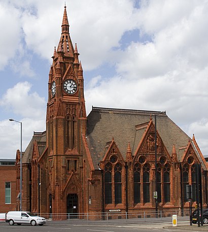
Directions to Spring Hill Library (Soho & Jewellery Quarter) with public transport
The following transport lines have routes that pass near Spring Hill Library
 Bus: 82, 87, 8A, 8C, 101.
- Train: WEST MIDLANDS RAILWAY, CHILTERN RAILWAYS.
- Light rail: METRO.
How to get to Spring Hill Library by bus?
Click on the bus route to see step by step directions with maps, line arrival times and updated time schedules.
How to get to Spring Hill Library by train?
Click on the train route to see step by step directions with maps, line arrival times and updated time schedules.
Bus stops near Spring Hill Library in Soho & Jewellery Quarter
- Ellen St, 4 min walk,
- Cope St, 5 min walk,
- Primary School, 6 min walk,
Train station near Spring Hill Library in Soho & Jewellery Quarter
- Jewellery Quarter, 10 min walk,
Light Rail stations near Spring Hill Library in Soho & Jewellery Quarter
- Jewellery Quarter (West Midlands Metro), 11 min walk,
Bus lines to Spring Hill Library in Soho & Jewellery Quarter
- 82, Colmore Row,
- 87, Oldbury Interchange,
- 8C, Selston Rd,
- 8A, Pennine Way,
- 101, The Leverretts,
What are the nearest stations to Spring Hill Library?
The nearest stations to Spring Hill Library are:
- Ellen St is 275 meters away, 4 min walk.
- Cope St is 354 meters away, 5 min walk.
- Primary School is 420 meters away, 6 min walk.
- Jewellery Quarter is 740 meters away, 10 min walk.
- Jewellery Quarter (West Midlands Metro) is 740 meters away, 11 min walk.
Which bus lines stop near Spring Hill Library?
These bus lines stop near Spring Hill Library: 82, 87, 8A, 8C.
Which train line stops near Spring Hill Library?
WEST MIDLANDS RAILWAY (Bromsgrove)
Which light rail line stops near Spring Hill Library?
METRO (Edgbaston Village)
What’s the nearest light rail station to Spring Hill Library in Soho & Jewellery Quarter?
The nearest light rail station to Spring Hill Library in Soho & Jewellery Quarter is Jewellery Quarter (West Midlands Metro). It’s a 11 min walk away.
What’s the nearest train station to Spring Hill Library in Soho & Jewellery Quarter?
The nearest train station to Spring Hill Library in Soho & Jewellery Quarter is Jewellery Quarter. It’s a 10 min walk away.
What’s the nearest bus station to Spring Hill Library in Soho & Jewellery Quarter?
The nearest bus station to Spring Hill Library in Soho & Jewellery Quarter is Ellen St. It’s a 4 min walk away.
What time is the first light rail to Spring Hill Library in Soho & Jewellery Quarter?
The METRO is the first light rail that goes to Spring Hill Library in Soho & Jewellery Quarter. It stops nearby at 04:50.
What time is the last light rail to Spring Hill Library in Soho & Jewellery Quarter?
The METRO is the last light rail that goes to Spring Hill Library in Soho & Jewellery Quarter. It stops nearby at 00:49.
What time is the first train to Spring Hill Library in Soho & Jewellery Quarter?
The WEST MIDLANDS RAILWAY is the first train that goes to Spring Hill Library in Soho & Jewellery Quarter. It stops nearby at 06:04.
What time is the last train to Spring Hill Library in Soho & Jewellery Quarter?
The WEST MIDLANDS RAILWAY is the last train that goes to Spring Hill Library in Soho & Jewellery Quarter. It stops nearby at 23:46.
What time is the first bus to Spring Hill Library in Soho & Jewellery Quarter?
The 87 is the first bus that goes to Spring Hill Library in Soho & Jewellery Quarter. It stops nearby at 03:41.
What time is the last bus to Spring Hill Library in Soho & Jewellery Quarter?
The 87 is the last bus that goes to Spring Hill Library in Soho & Jewellery Quarter. It stops nearby at 01:16.
See Spring Hill Library, Soho & Jewellery Quarter, on the map
Public Transit to Spring Hill Library in Soho & Jewellery Quarter
Wondering how to get to Spring Hill Library in Soho & Jewellery Quarter? Moovit helps you find the best way to get to Spring Hill Library with step-by-step directions from the nearest public transit station.
Moovit provides free maps and live directions to help you navigate through your city. View schedules, routes, timetables, and find out how long does it take to get to Spring Hill Library in real time.
Looking for the nearest stop or station to Spring Hill Library? Check out this list of stops closest to your destination: Ellen St; Cope St; Primary School; Jewellery Quarter; Jewellery Quarter (West Midlands Metro).
Bus: 82, 87, 8A, 8C, 101.Train: WEST MIDLANDS RAILWAY, CHILTERN RAILWAYS.Light rail: METRO.
Want to see if there’s another route that gets you there at an earlier time? Moovit helps you find alternative routes or times. Get directions from and directions to Spring Hill Library easily from the Moovit App or Website.
We make riding to Spring Hill Library easy, which is why over 1.5 million users, including users in Soho & Jewellery Quarter, trust Moovit as the best app for public transit. You don’t need to download an individual bus app or train app, Moovit is your all-in-one transit app that helps you find the best bus time or train time available.
For information on prices of bus, train and light rail, costs and ride fares to Spring Hill Library, please check the Moovit app.
Use the app to navigate to popular places including to the airport, hospital, stadium, grocery store, mall, coffee shop, school, college, and university.
Spring Hill Library Address: Spring Hill Hockley Birmingham B18 7 street in Soho & Jewellery Quarter
- Tesco Spring Hill,
- B18 7BH,
- Hockley,
- B1,
- Birmingham And Solihull Mental Health Nhs Foundation Trust,
- Tesco Superstore,
- Blessing Market African Food Store,
- Crown Court,
- New Testament Church Of God, The Rock,
- Bus Stop (82 & 87),
- Summer Hill Terrace B4135,
- B18 6rz,
- KB Performance,
- Warstone Lane Carver,
- Lekker,
- Carver St, Birmingham,
- Icknield Street (icknield street hingeston),
- B1 2pn,
- A To Z Packing Supplies,
- Cadz
Places Near Spring Hill Library (Soho & Jewellery Quarter)
- Boundary Mill Stores, Bentley And Darlaston North,
- Bickerstaff Endoscopy Unit (PRH), Apley Castle,
- Royal Orthopaedic Hospital, Northfield,
- Sandwell General Hospital, West Bromwich Central,
- Birmingham Dental Hospital, Edgbaston,
- Travelodge Birmingham Airport Hotel Birmingham, Bickenhill,
- Moseley, Moseley,
- Crown Wharf Retail Park, St. Matthew's,
- Heritage Building (Queen Elizabeth Hospital), Edgbaston,
- The Merry Hill Centre, Brierley Hill,
- Lilleshall Hall National Sports Centre, Telford,
- One Stop Shopping Centre, Perry Barr,
- Stratford Road, Sparkhill,
- Wolstanton Retail Park, Wolstanton,
- IKEA Wednesbury, Oldbury,
- Bournville Staff Shop (Cadbury World), Bournville & Cotteridge,
- Fort Shopping Centre, Birmingham, Pype Hayes,
- Hagley Road, Edgbaston,
- Tally Ho Police Training, Birmingham, Edgbaston,
- Birmingham And Midland Eye Centre, Soho & Jewellery Quarter
How to get to popular places in West Midlands with public transport
Get around Soho & Jewellery Quarter by public transport!
Travelling around Soho & Jewellery Quarter has never been so easy. See step by step directions as you travel to any attraction, street or major public transport station. View bus and train timetables, arrival times, service alerts and detailed routes on a map, so you know exactly how to get to anywhere in Soho & Jewellery Quarter.
When travelling to any destination around Soho & Jewellery Quarter use Moovit's Live Directions with Get Off Notifications to know exactly where and how far to walk, how long to wait for your line , and how many stops are left. Moovit will alert you when it’s time to get off — no need to constantly re-check whether yours is the next stop.
Wondering how to use public transport in Soho & Jewellery Quarter or how to pay for public transport in Soho & Jewellery Quarter? Moovit public transport app can help you navigate your way with public transport easily, and at minimum cost. It includes public transport fees, ticket prices, and costs. Looking for a map of Soho & Jewellery Quarter public transport lines? Moovit public transport app shows all public transport maps in Soho & Jewellery Quarter with all Bus, Train and Light rail routes and stops on an interactive map.
West Midlands has 3 transport type(s), including: Bus, Train and Light rail, operated by several transport agencies, including National Express West Midlands, National Express Coventry, National Express, Diamond Bus, Arriva Midlands, Stagecoach Midlands, West Midlands Metro, Stagecoach West, Stagecoach South Wales, First Potteries, First Worcestershire, LandFlight, trentbarton, D & G Bus and Flexibus