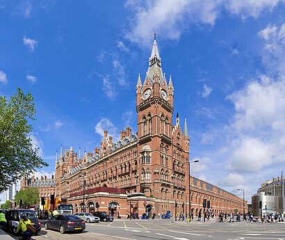
St Pancras International Station (M) stop - Wednesday schedule
| Line | Direction | Time |
|---|---|---|
| 390 | Archway | 03:06 |
| N91 | Cockfosters | 03:07 |
| 390 | Archway | 03:36 |
| N91 | Cockfosters | 03:37 |
| 390 | Archway | 04:06 |
| N91 | Cockfosters | 04:07 |
| 390 | Archway | 04:36 |
| N91 | Cockfosters | 04:37 |
| 390 | Archway | 05:06 |
| N91 | Cockfosters | 05:07 |
| 390 | Archway | 05:36 |
| N91 | Cockfosters | 05:37 |
| 91 | Trafalgar Square | 05:59 |
| 390 | Archway | 06:06 |
| 91 | Trafalgar Square | 06:09 |
| 91 | Trafalgar Square | 06:19 |
| 390 | Archway | 06:21 |
| 91 | Trafalgar Square | 06:29 |
| 390 | Archway | 06:36 |
| 91 | Trafalgar Square | 06:38 |
| 91 | Trafalgar Square | 06:46 |
| 390 | Archway | 06:51 |
| 91 | Trafalgar Square | 06:54 |
| 91 | Trafalgar Square | 07:03 |
| 390 | Archway | 07:06 |
Directions to St Pancras International Station (M) (Pentonville) with public transport
The following transport lines have routes that pass near St Pancras International Station (M)
How to get to St Pancras International Station (M) by bus?
Click on the bus route to see step by step directions with maps, line arrival times and updated time schedules.
How to get to St Pancras International Station (M) by train?
Click on the train route to see step by step directions with maps, line arrival times and updated time schedules.
How to get to St Pancras International Station (M) by Tube?
Click on the Tube route to see step by step directions with maps, line arrival times and updated time schedules.
Bus stops near St Pancras International Station (M) in Pentonville
- St Pancras International Station (A), 2 min walk,
- King's Cross Station (D), 2 min walk,
- St Pancras International And King's Cross Stations (T), 6 min walk,
- King's Cross Station / Pentonville Road (H), 6 min walk,
Tube station near St Pancras International Station (M) in Pentonville
- King's Cross St. Pancras, 7 min walk,
Train stations near St Pancras International Station (M) in Pentonville
- King's Cross, 8 min walk,
- St Pancras, 8 min walk,
- Euston Station, 18 min walk,
Bus lines to St Pancras International Station (M) in Pentonville
- 30, Euston,
- 73, Oxford Circus,
- N73, Walthamstow Central,
- 91, Trafalgar Square,
- N91, Cockfosters,
- 205, Bow Church,
- N205, Paddington,
- 390, Archway,
- 46, Smithfield, St Bartholomew's Hospital - Paddington,
- 63, King's Cross - Honor Oak,
- N63, King's Cross - Crystal Palace,
- 214, Highgate Village,
- 17, London Bridge - Archway,
- 259, King's Cross - Edmonton Green,
- 476, King's Cross - Northumberland Park,
What are the nearest stations to St Pancras International Station (M)?
The nearest stations to St Pancras International Station (M) are:
- St Pancras International Station (A) is 136 meters away, 2 min walk.
- King's Cross Station (D) is 139 meters away, 2 min walk.
- St Pancras International And King's Cross Stations (T) is 277 meters away, 6 min walk.
- King's Cross Station / Pentonville Road (H) is 396 meters away, 6 min walk.
- King's Cross St. Pancras is 460 meters away, 7 min walk.
- King's Cross is 582 meters away, 8 min walk.
- St Pancras is 597 meters away, 8 min walk.
- Euston Station is 1327 meters away, 18 min walk.
Which bus lines stop near St Pancras International Station (M)?
These bus lines stop near St Pancras International Station (M): 205, 214, 390, 63.
Which train lines stop near St Pancras International Station (M)?
These train lines stop near St Pancras International Station (M): GREAT NORTHERN, SOUTHEASTERN, THAMESLINK.
Which Tube lines stop near St Pancras International Station (M)?
These Tube lines stop near St Pancras International Station (M): CIRCLE, HAMMERSMITH & CITY, METROPOLITAN, NORTHERN, PICCADILLY, VICTORIA.
What’s the nearest Tube station to St Pancras International Station (M) in Pentonville?
The nearest Tube station to St Pancras International Station (M) in Pentonville is King's Cross St. Pancras. It’s a 7 min walk away.
What’s the nearest train station to St Pancras International Station (M) in Pentonville?
The nearest train stations to St Pancras International Station (M) in Pentonville are King's Cross and St Pancras. The closest one is a 8 min walk away.
What’s the nearest bus station to St Pancras International Station (M) in Pentonville?
The nearest bus stations to St Pancras International Station (M) in Pentonville are St Pancras International Station (A) and King's Cross Station (D). The closest one is a 2 min walk away.
What time is the first Tube to St Pancras International Station (M) in Pentonville?
The VICTORIA is the first Tube that goes to St Pancras International Station (M) in Pentonville. It stops nearby at 03:15.
What time is the last Tube to St Pancras International Station (M) in Pentonville?
The CIRCLE is the last Tube that goes to St Pancras International Station (M) in Pentonville. It stops nearby at 00:51.
What time is the first train to St Pancras International Station (M) in Pentonville?
The GREAT NORTHERN is the first train that goes to St Pancras International Station (M) in Pentonville. It stops nearby at 05:50.
What time is the last train to St Pancras International Station (M) in Pentonville?
The CALEDONIAN SLEEPER is the last train that goes to St Pancras International Station (M) in Pentonville. It stops nearby at 08:00.
What time is the first bus to St Pancras International Station (M) in Pentonville?
The 214 is the first bus that goes to St Pancras International Station (M) in Pentonville. It stops nearby at 03:00.
What time is the last bus to St Pancras International Station (M) in Pentonville?
The 390 is the last bus that goes to St Pancras International Station (M) in Pentonville. It stops nearby at 03:38.
See St Pancras International Station (M), Pentonville, on the map
Public transport to St Pancras International Station (M) stop (ID: M) in Pentonville
Looking for directions to St Pancras International Station (M) in Pentonville, United Kingdom?
Download the Moovit App to find the current schedule and step-by-step directions for Tube, Bus or Train routes that pass through St Pancras International Station (M).
Looking for the nearest stops closest to St Pancras International Station (M) ? Check out this list of closest stops to your destination: St Pancras International Station (A); King's Cross Station (D); St Pancras International And King's Cross Stations (T); King's Cross Station / Pentonville Road (H); King's Cross St. Pancras; King's Cross; St Pancras; Euston Station.
Bus: 205, 214, 390, 63, 30, 73, N73, 91, N91, 46, N63.Train: GREAT NORTHERN, SOUTHEASTERN, THAMESLINK, GRAND CENTRAL, HULL TRAINS, LONDON NORTH EASTERN RAILWAY, EAST MIDLANDS RAILWAY, AVANTI WEST COAST, CALEDONIAN SLEEPER, LIONESS LINE, MILDMAY LINE, WEST MIDLANDS RAILWAY.Tube: CIRCLE, HAMMERSMITH & CITY, METROPOLITAN, NORTHERN, PICCADILLY, VICTORIA.
We make riding on public transit to St Pancras International Station (M) easy, which is why over 1.5 million users, including users in Pentonville trust Moovit as the best app for public transit.
Use the app to navigate to popular places including to the airport, hospital, stadium, grocery store, mall, coffee shop, school, college, and university.
St Pancras International Station (M) stop’s code is M
The first line to this stop is 390, at 03:06, and the last line is N91 at 02:37.
Unit 12 Euston Road, London, England, United Kingdom
This stop serves London Buses’s lines
Bus stops near St Pancras International Station (M)
Tube station near St Pancras International Station (M)
Popular public transport stations in Pentonville
Get around Pentonville by public transport!
Travelling around Pentonville has never been so easy. See step by step directions as you travel to any attraction, street or major public transport station. View bus and train timetables, arrival times, service alerts and detailed routes on a map, so you know exactly how to get to anywhere in Pentonville.
When travelling to any destination around Pentonville use Moovit's Live Directions with Get Off Notifications to know exactly where and how far to walk, how long to wait for your line , and how many stops are left. Moovit will alert you when it’s time to get off — no need to constantly re-check whether yours is the next stop.
Wondering how to use public transport in Pentonville or how to pay for public transport in Pentonville? Moovit public transport app can help you navigate your way with public transport easily, and at minimum cost. It includes public transport fees, ticket prices, and costs. Looking for a map of Pentonville public transport lines? Moovit public transport app shows all public transport maps in Pentonville with all Bus, Train, Tube, Tramlink, River Bus and DLR routes and stops on an interactive map.
London has 6 transport type(s), including: Bus, Train, Tube, Tramlink, River Bus and DLR, operated by several transport agencies, including London Underground, London Buses, Transport for London, London Tramlink, National Rail, Bluestar, Berry's Coaches, Oxford Bus Company, Stagecoach West, Community First Wessex, Cresta Coaches, First Portsmouth, Fareham & Gosport, IFS Cloud Cable Car, FYTbus and Gosport-Portsmouth Ferry