Directions to St Winefride's Well (Flintshire) with public transport
The following transport lines have routes that pass near St Winefride's Well
How to get to St Winefride's Well by bus?
Click on the bus route to see step by step directions with maps, line arrival times and updated time schedules.
Bus stops near St Winefride's Well in Flintshire
- St James` Church, Holywell, 1 min walk,
- Plas Dewi Flats, Holywell, 3 min walk,
- Whitford Street, Holywell, 7 min walk,
- Holywell Bus Station Stand 3, Holywell, 10 min walk,
Bus lines to St Winefride's Well in Flintshire
- 11C, Holywell,
- 11M, Rhyl,
- 18, Holywell,
- 19, Flint,
- 23, Greenfield,
- 126, Wal-Wen,
- 11F, Flint,
- 11X, Holywell,
- 14A, Caerwys,
- 22, Pen-Y-Maes,
- 22A, Holywell,
- 11, Chester,
What are the nearest stations to St Winefride's Well?
The nearest stations to St Winefride's Well are:
- St James` Church, Holywell is 21 meters away, 1 min walk.
- Plas Dewi Flats, Holywell is 151 meters away, 3 min walk.
- Whitford Street, Holywell is 468 meters away, 7 min walk.
- Holywell Bus Station Stand 3, Holywell is 756 meters away, 10 min walk.
Which bus lines stop near St Winefride's Well?
These bus lines stop near St Winefride's Well: 11M, 11X.
What’s the nearest bus stop to St Winefride's Well in Flintshire?
The nearest bus stop to St Winefride's Well in Flintshire is St James` Church, Holywell. It’s a 1 min walk away.
What time is the first bus to St Winefride's Well in Flintshire?
The 11M is the first bus that goes to St Winefride's Well in Flintshire. It stops nearby at 08:22.
What time is the last bus to St Winefride's Well in Flintshire?
The 11M is the last bus that goes to St Winefride's Well in Flintshire. It stops nearby at 23:23.
See St Winefride's Well, Flintshire, on the map
Public Transit to St Winefride's Well in Flintshire
Wondering how to get to St Winefride's Well in Flintshire, United Kingdom? Moovit helps you find the best way to get to St Winefride's Well with step-by-step directions from the nearest public transit station.
Moovit provides free maps and live directions to help you navigate through your city. View schedules, routes, timetables, and find out how long does it take to get to St Winefride's Well in real time.
Looking for the nearest stop or station to St Winefride's Well? Check out this list of stops closest to your destination: St James` Church; Plas Dewi Flats; Whitford Street; Holywell Bus Station Stand 3.
Bus: 11M, 11X, 11C, 18, 19, 23, 11F, 14A, 22, 22A, 11.
Want to see if there’s another route that gets you there at an earlier time? Moovit helps you find alternative routes or times. Get directions from and directions to St Winefride's Well easily from the Moovit App or Website.
We make riding to St Winefride's Well easy, which is why over 1.5 million users, including users in Flintshire, trust Moovit as the best app for public transit. You don’t need to download an individual bus app or train app, Moovit is your all-in-one transit app that helps you find the best bus time or train time available.
For information on prices of bus and train, costs and ride fares to St Winefride's Well, please check the Moovit app.
Use the app to navigate to popular places including to the airport, hospital, stadium, grocery store, mall, coffee shop, school, college, and university.
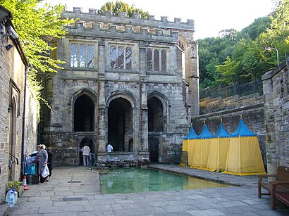
St Winefride's Well Address: Greenfield St street in Flintshire
Attractions near St Winefride's Well
Edge of Wales Walk-North Wales Pilgrim's Way,Up A Yard,Artisan Gift Shop at Holywell Art and Craft Mill,Holywell,Holway Lead Mine Roskell's Boat Level Portal,Blush - Hair & Beauty,Savoy Catering,Urban Fusion Dance,Stephen Kelso Implants and Oral Surgery,St Winefride's Church, Holywell,Holywell Superstore, Strand Walk, Holywell,Tesco Superstore,Seliwiak Transport,Holywell Football Club in the Community Limited,TESCO extra,Site Of Old Holywell Town Station,Flintshire County Council,Holywell,St Winefride's Primary School,Rose & Gun Charity ClubHow to get to popular attractions in Flintshire with public transportation
Morriston Hospital, Swansea,Colliers Park Training Ground, Wrexham,Bute Park, Cardiff,Sugar Loaf Mountain, Monmouthshire,Coronation Park, Newport,Buzz Trampoline Park, Cardiff,Aberystwyth University - Penglais Campus, Ceredigion,Newcastle Emlyn, Carmarthenshire,Clinical Photography & Medical Illustration, Newport,Fron Goch Garden Centre & Restaurant, Gwynedd,South Pembs Hospital, Pembrokeshire,Carmarthen Bay Holiday Park, Carmarthenshire,B Block, Newport,Penmon Point, Isle Of Anglesey,Pontneddfechan, Powys,Gorseinon, Swansea,Neath Port Talbot Hospital, Neath Port Talbot,Royal Gwent Hospital, Newport,Fforestfach, Swansea,SA1 Medical Centre, SwanseaGet around Wales by public transport!
Travelling around Wales has never been so easy. See step by step directions as you travel to any attraction, street or major public transport station. View bus and train timetables, arrival times, service alerts and detailed routes on a map, so you know exactly how to get to anywhere in Wales.
When travelling to any destination around Wales use Moovit's Live Directions with Get Off Notifications to know exactly where and how far to walk, how long to wait for your line , and how many stops are left. Moovit will alert you when it’s time to get off — no need to constantly re-check whether yours is the next stop.
Wondering how to use public transport in Wales or how to pay for public transport in Wales? Moovit public transport app can help you navigate your way with public transport easily, and at minimum cost. It includes public transport fees, ticket prices, and costs. Looking for a map of Wales public transport lines? Moovit public transport app shows all public transport maps in Wales with all Bus and Train routes and stops on an interactive map.
Wales has 2 transport type(s), including: Bus and Train, operated by several transport agencies, including National Rail, O R Jones, M & H Coaches, Peyton Travel, Gwynfor Coaches, Nefyn, Edwards Coaches, Cardiff Bus, Pembrokeshire County Council, Crickhowell Taxis, Village & Valleys Travel, South Wales Transport, Forge Travel, Sarah Bell, Phil Anslow Travel