How to get to Strathpine Rhee Taekwon do by bus?
Click on the bus route to see step by step directions with maps, line arrival times and updated time schedules.
How to get to Strathpine Rhee Taekwon do by train?
Click on the train route to see step by step directions with maps, line arrival times and updated time schedules.
Bus stops near Strathpine Rhee Taekwon do
Train stations near Strathpine Rhee Taekwon do
What are the nearest stations to Strathpine Rhee Taekwon do?
The nearest stations to Strathpine Rhee Taekwon do are:
- Bells Pocket Rd Near Wirraway St is 233 meters away, 4 min walk.
- Strathpine Station is 455 meters away, 6 min walk.
- Gympie Rd at Paisley Drive is 810 meters away, 11 min walk.
- Petrie Station is 3341 meters away, 43 min walk.
Which bus lines stop near Strathpine Rhee Taekwon do?
These bus lines stop near Strathpine Rhee Taekwon do: 674, 680.
Which train lines stop near Strathpine Rhee Taekwon do?
These train lines stop near Strathpine Rhee Taekwon do: BRRP, RPSP.
What’s the nearest train station to Strathpine Rhee Taekwon do?
The nearest train station to Strathpine Rhee Taekwon do is Strathpine Station. It’s a 6 min walk away.
What’s the nearest bus station to Strathpine Rhee Taekwon do?
The nearest bus station to Strathpine Rhee Taekwon do is Bells Pocket Rd Near Wirraway St. It’s a 4 min walk away.
What time is the first train to Strathpine Rhee Taekwon do?
The BRCA is the first train that goes to Strathpine Rhee Taekwon do. It stops nearby at 04:18.
What time is the last train to Strathpine Rhee Taekwon do?
The SHRP is the last train that goes to Strathpine Rhee Taekwon do. It stops nearby at 23:59.
What time is the first bus to Strathpine Rhee Taekwon do?
The 680 is the first bus that goes to Strathpine Rhee Taekwon do. It stops nearby at 07:53.
What time is the last bus to Strathpine Rhee Taekwon do?
The 680 is the last bus that goes to Strathpine Rhee Taekwon do. It stops nearby at 18:11.
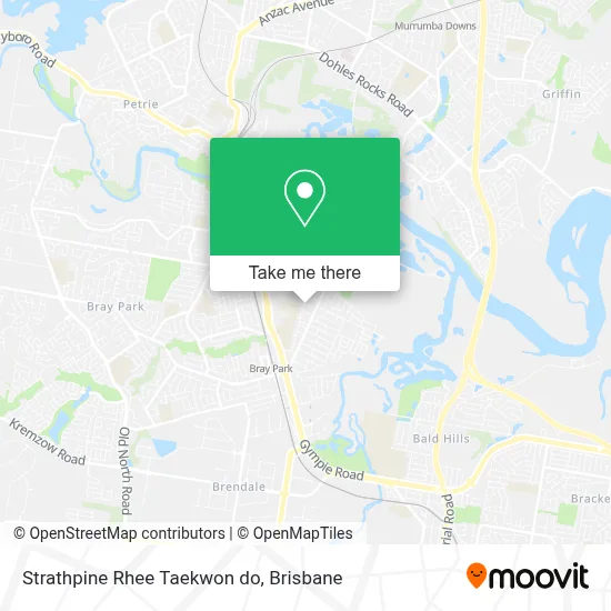
See Strathpine Rhee Taekwon do on the map
Public Transportation to Strathpine Rhee Taekwon do
Wondering how to get to Strathpine Rhee Taekwon do? Moovit helps you find the best way to get to Strathpine Rhee Taekwon do with step-by-step directions from the nearest public transit station.
Moovit provides free maps and live directions to help you navigate through your city. View schedules, routes, timetables, and find out how long does it take to get to Strathpine Rhee Taekwon do in real time.
Looking for the nearest stop or station to Strathpine Rhee Taekwon do? Check out this list of stops closest to your destination: Bells Pocket Rd Near Wirraway St; Strathpine Station; Gympie Rd at Paisley Drive; Petrie Station.
Bus: 674, 680.Train: BRRP, RPSP, BRCA, CABR, RPBR, BRGY, BRNA, CAIP, CASP, GYBR.
Want to see if there’s another route that gets you there at an earlier time? Moovit helps you find alternative routes or times. Get directions from and directions to Strathpine Rhee Taekwon do easily from the Moovit App or Website.
We make riding to Strathpine Rhee Taekwon do easy, which is why over 1.5 million users, including users in Strathpine, trust Moovit as the best app for public transit. You don’t need to download an individual bus app or train app, Moovit is your all-in-one transit app that helps you find the best bus time or train time available.
For information on prices of bus and train, costs and ride fares to Strathpine Rhee Taekwon do, please check the Moovit app.
Use the app to navigate to popular places including to the airport, hospital, stadium, grocery store, mall, coffee shop, school, college, and university.
Strathpine Rhee Taekwon do Address: 21 Wirraway St Strathpine QLD 4500 street in Strathpine
- Fanimation Lighting,
- Douglas Park,
- Courier au Go Go,
- Mindset M Powerment Pty,
- Tia's Polynesian Taste,
- Fiji Shop,
- Bumble Bee Car Care Strathpine,
- Mel Walsh Tutoring,
- Shaboomfit,
- Pine Rivers Shotokan Karate,
- Auswide Homecare Pty,
- Units Mob Professional Tree Services,
- VIP Tobacconist,
- De Boyz,
- Tarotopia,
- Inner Circle Tattooing,
- 44 Degrees Coffee Shop,
- Lawntone Reserve,
- Venmist Pty,
- Joanne M Howitt Michelle A Madden
Places Near Strathpine Rhee Taekwon do
- St Andrew's Hospital, Spring Hill,
- The Triffid, Newstead,
- Pat Rafter Arena, Tennyson,
- QUT Gardens Point, City,
- The Gabba , Woolloongabba,
- Queen Street Station Platform 3, City,
- Royal Brisbane & Women's Hospital (RBWH), Herston,
- Westfield Chermside, Chermside,
- Felons Brewing Co., Fortitude Valley,
- Stars, Herston,
- Greenslopes Private Hospital, Greenslopes,
- Brisbane Riverstage, City,
- Kangaroo Point, Kangaroo Point,
- The Star Gold Coast Hotel & Casino, Broadbeach,
- Southport Sharks, Southport,
- Casino, City,
- Queen Street Mall, City,
- Twelfth Night Theatre, Bowen Hills,
- Brisbane Showgrounds, Bowen Hills,
- Prince Charles Hospital, Chermside
How to get to popular places in Brisbane with public transport
Get around Strathpine by public transport!
Travelling around Strathpine has never been so easy. See step by step directions as you travel to any attraction, street or major public transport station. View bus and train timetables, arrival times, service alerts and detailed routes on a map, so you know exactly how to get to anywhere in Strathpine.
When travelling to any destination around Strathpine use Moovit's Live Directions with Get Off Notifications to know exactly where and how far to walk, how long to wait for your line , and how many stops are left. Moovit will alert you when it’s time to get off — no need to constantly re-check whether yours is the next stop.
Wondering how to use public transport in Strathpine or how to pay for public transport in Strathpine? Moovit public transport app can help you navigate your way with public transport easily, and at minimum cost. It includes public transport fees, ticket prices, and costs. Looking for a map of Strathpine public transport lines? Moovit public transport app shows all public transport maps in Strathpine with all Bus, Train, Light rail and Ferry routes and stops on an interactive map.
Brisbane has 4 transport type(s), including: Bus, Train, Light rail and Ferry, operated by several transport agencies, including TransLink SEQ, TransLink, Christensens Bus and Coach and North Stradbroke Island Buses