Directions to Sunny Chauffeur Wa (West Swan) with public transport
The following transport lines have routes that pass near Sunny Chauffeur Wa
 Bus: 355, 357, 358.
- Train: ELLENBROOK LINE.
How to get to Sunny Chauffeur Wa by bus?
Click on the bus route to see step by step directions with maps, line arrival times and updated time schedules.
From Australian Islamic College (AIC) - Dianella, Dianella
67 minFrom Dianella, Dianella
66 minFrom Mirrabooka Village Shopping Centre, Mirrabooka
68 minFrom Domestic Terminal 2 (T2), Perth Airport
111 minFrom Aveley North Primary School, Ellenbrook
67 minFrom K Goudis & E Tsocas, Morley
41 minFrom Noranda Palms Shopping Centre, Noranda
49 minFrom Belmont WA Australia, Belmont
74 minFrom Niggaland, Mirrabooka
58 minFrom Malaga, Malaga
54 min
How to get to Sunny Chauffeur Wa by train?
Click on the train route to see step by step directions with maps, line arrival times and updated time schedules.
Bus stop near Sunny Chauffeur Wa in West Swan
- Arthur St Before Victoria Rd, 4 min walk,VIEW
What are the nearest stations to Sunny Chauffeur Wa?
The nearest stations to Sunny Chauffeur Wa are:
- Arthur St Before Victoria Rd is 212 meters away, 4 min walk.
Which bus lines stop near Sunny Chauffeur Wa?
These bus lines stop near Sunny Chauffeur Wa: 355, 357, 358.
Which train line stops near Sunny Chauffeur Wa?
ELLENBROOK LINE (Ellenbrook Stn)
What’s the nearest bus station to Sunny Chauffeur Wa in West Swan?
The nearest bus station to Sunny Chauffeur Wa in West Swan is Arthur St Before Victoria Rd. It’s a 4 min walk away.
What time is the first bus to Sunny Chauffeur Wa in West Swan?
The 357 is the first bus that goes to Sunny Chauffeur Wa in West Swan. It stops nearby at 05:01.
What time is the last bus to Sunny Chauffeur Wa in West Swan?
The 357 is the last bus that goes to Sunny Chauffeur Wa in West Swan. It stops nearby at 22:48.
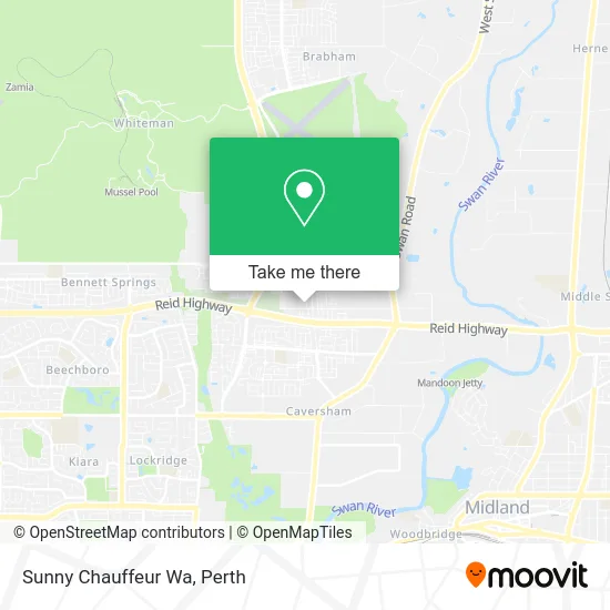
See Sunny Chauffeur Wa, West Swan, on the map
Public Transit to Sunny Chauffeur Wa in West Swan
Wondering how to get to Sunny Chauffeur Wa in West Swan? Moovit helps you find the best way to get to Sunny Chauffeur Wa with step-by-step directions from the nearest public transit station.
Moovit provides free maps and live directions to help you navigate through your city. View schedules, routes, timetables, and find out how long does it take to get to Sunny Chauffeur Wa in real time.
Looking for the nearest stop or station to Sunny Chauffeur Wa? Check out this list of stops closest to your destination: Arthur St Before Victoria Rd.
Bus: 355, 357, 358.Train: ELLENBROOK LINE.
Want to see if there’s another route that gets you there at an earlier time? Moovit helps you find alternative routes or times. Get directions from and directions to Sunny Chauffeur Wa easily from the Moovit App or Website.
We make riding to Sunny Chauffeur Wa easy, which is why over 1.5 million users, including users in West Swan, trust Moovit as the best app for public transit. You don’t need to download an individual bus app or train app, Moovit is your all-in-one transit app that helps you find the best bus time or train time available.
For information on prices of bus and train, costs and ride fares to Sunny Chauffeur Wa, please check the Moovit app.
Use the app to navigate to popular places including to the airport, hospital, stadium, grocery store, mall, coffee shop, school, college, and university.
Sunny Chauffeur Wa Address: 7 Rostratus Link Dayton WA 6055 street in West Swan
- Hazara United Tiling,
- West Drive Auto Detailing,
- Maxi Taxi Perth,
- Sardara da Ghar,
- 2 Brothers Cleaning,
- Home Perth,
- DSM Machinery Sales,
- Tutti Frutti Frozen Y,
- The Online Division,
- Omx Cleaning Services,
- Nicolas,
- Simrav Transport,
- Wild Threads,
- 3D Migration Consultancy,
- Brookleigh Estate,
- Top Quality Concrete Coatings,
- Hari Fencing,
- St Leonards Park,
- Jemskumar Patel,
- Massage Move Meditate
Places Near Sunny Chauffeur Wa (West Swan)
- Fiona Stanley Hospital, Murdoch,
- Mount Hospital, Perth,
- IKEA, Innaloo,
- Scitech, West Perth,
- Rac Arena, Perth,
- Pelicaan Investment Ho, Bellevue,
- Perth Convention Exhibition Centre, Perth,
- Sir Charles Gairdner Hospital, Nedlands,
- Watertown, Perth,
- DFO, Perth Airport,
- Karrinyup Shopping Centre, Karrinyup,
- Langley Park, Perth,
- Optus Stadium, Burswood,
- McCallum Park, Victoria Park,
- Crown Perth Casino, Burswood,
- Royal Perth Hospital, Perth,
- Blue Boat House,
- Yankee Mart, Baldivis,
- Westfield Carousel, Cannington,
- Aqwa Aquarium, Hillarys
How to get to popular places in Perth with public transport
Get around West Swan by public transport!
Travelling around West Swan has never been so easy. See step by step directions as you travel to any attraction, street or major public transport station. View bus and train timetables, arrival times, service alerts and detailed routes on a map, so you know exactly how to get to anywhere in West Swan.
When travelling to any destination around West Swan use Moovit's Live Directions with Get Off Notifications to know exactly where and how far to walk, how long to wait for your line , and how many stops are left. Moovit will alert you when it’s time to get off — no need to constantly re-check whether yours is the next stop.
Wondering how to use public transport in West Swan or how to pay for public transport in West Swan? Moovit public transport app can help you navigate your way with public transport easily, and at minimum cost. It includes public transport fees, ticket prices, and costs. Looking for a map of West Swan public transport lines? Moovit public transport app shows all public transport maps in West Swan with all Bus, Train and Ferry routes and stops on an interactive map.
Perth has 3 transport type(s), including: Bus, Train and Ferry, operated by several transport agencies, including Transperth Rail, Transwa, Transperth Ferry, Transperth, TransBusselton, TransAlbany, TransGoldfields, TransEsperance, TransGeraldton, TransCarnarvon, TransHedland, TransKarratha, TransBunbury, Mandurah Bus Charter and TransBroome