Directions to Tampines Mart (Northeast) with public transport
The following transport lines have routes that pass near Tampines Mart
 Bus: 28, 291, 81, 18, 753.
- Metro: DOWNTOWN LINE, EAST WEST LINE.
How to get to Tampines Mart by bus?
Click on the bus route to see step by step directions with maps, line arrival times and updated time schedules.
How to get to Tampines Mart by metro?
Click on the metro route to see step by step directions with maps, line arrival times and updated time schedules.
Bus stops near Tampines Mart in Northeast
- Tampines St 32 - Ngee Ann Sec Sch (76411), 1 min walk,
- Tampines Ave 7 - Blk 370 (76249), 4 min walk,
- Tampines St 32 - Opp Blk 331 (76421), 4 min walk,
- Tampines Ave 7 - Blk 390 (76239), 6 min walk,
- Tampines Ave 7 - Opp Blk 390 (76231), 9 min walk,
Metro station near Tampines Mart in Northeast
- Tampines (DT32|EW2), 19 min walk,
Bus lines to Tampines Mart in Northeast
- 18, Bedok Nth Depot,
- 28, Toa Payoh Int,
- 291, Tampines Int,
- 753, Flora Rd (Estella Gdns),
- 3, Punggol Int ↔ Tampines Int,
- 4, Tampines Int ↺ Changi North Way,
- 9, Bedok Int ↺ Changi Airfreight Ctr,
- 12, Pasir Ris Int ↔ Kg Bahru Ter,
- 17, Pasir Ris Int ↔ Bedok Int,
- 19, Tampines Int ↺ Changi Airfreight Ctr,
- 21, Pasir Ris Int ↔ St. Michael’s Ter,
- 29, Tampines Int ↺ Changi Village,
- 34, Punggol Coast Int ↺ Changi Airport,
- 37, Tampines Int ↺ Changi North Cres,
- 39, Tampines Concourse Int ↔ Yishun Int,
- 59, Bishan Int ↔ Changi Village Ter,
- 81, Tampines Int ↺ Serangoon Ctrl,
- 518, Pasir Ris Int ↺ Bayfront Ave,
- 34B, Tampines Ave 10 (Aft TPE) → Changi Airport → Tampines Ave 10 (Bef TPE),
- 12E, Pasir Ris Int ↔ Kg Bahru Ter,
What are the nearest stations to Tampines Mart?
The nearest stations to Tampines Mart are:
- Tampines St 32 - Ngee Ann Sec Sch (76411) is 6 meters away, 1 min walk.
- Tampines Ave 7 - Blk 370 (76249) is 267 meters away, 4 min walk.
- Tampines St 32 - Opp Blk 331 (76421) is 271 meters away, 4 min walk.
- Tampines Ave 7 - Blk 390 (76239) is 445 meters away, 6 min walk.
- Tampines Ave 7 - Opp Blk 390 (76231) is 661 meters away, 9 min walk.
- Tampines (DT32|EW2) is 1442 meters away, 19 min walk.
Which bus lines stop near Tampines Mart?
These bus lines stop near Tampines Mart: 28, 291, 81.
Which metro line stops near Tampines Mart?
DOWNTOWN LINE (to ⑫ Expo)
What’s the nearest metro station to Tampines Mart in Northeast?
The nearest metro station to Tampines Mart in Northeast is Tampines (DT32|EW2). It’s a 19 min walk away.
What’s the nearest bus station to Tampines Mart in Northeast?
The nearest bus station to Tampines Mart in Northeast is Tampines St 32 - Ngee Ann Sec Sch (76411). It’s a 1 min walk away.
What time is the first metro to Tampines Mart in Northeast?
The EAST WEST LINE is the first metro that goes to Tampines Mart in Northeast. It stops nearby at 05:24.
What time is the last metro to Tampines Mart in Northeast?
The EAST WEST LINE is the last metro that goes to Tampines Mart in Northeast. It stops nearby at 00:59.
What time is the first bus to Tampines Mart in Northeast?
The 293 is the first bus that goes to Tampines Mart in Northeast. It stops nearby at 05:01.
What time is the last bus to Tampines Mart in Northeast?
The 293 is the last bus that goes to Tampines Mart in Northeast. It stops nearby at 01:24.
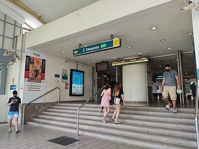
See Tampines Mart, Northeast, on the map
Public Transit to Tampines Mart in Northeast
Wondering how to get to Tampines Mart in Northeast? Moovit helps you find the best way to get to Tampines Mart with step-by-step directions from the nearest public transit station.
Moovit provides free maps and live directions to help you navigate through your city. View schedules, routes, timetables, and find out how long does it take to get to Tampines Mart in real time.
Looking for the nearest stop or station to Tampines Mart? Check out this list of stops closest to your destination: Tampines St 32 - Ngee Ann Sec Sch (76411); Tampines Ave 7 - Blk 370 (76249); Tampines St 32 - Opp Blk 331 (76421); Tampines Ave 7 - Blk 390 (76239); Tampines Ave 7 - Opp Blk 390 (76231); Tampines (DT32|EW2).
Bus: 28, 291, 81, 18, 753, TE1, 3, 4, 9, 12, 17, 293, 3A, 9A, 29A, 9B.Metro: DOWNTOWN LINE, EAST WEST LINE.
Want to see if there’s another route that gets you there at an earlier time? Moovit helps you find alternative routes or times. Get directions from and directions to Tampines Mart easily from the Moovit App or Website.
We make riding to Tampines Mart easy, which is why over 1.5 million users, including users in Northeast, trust Moovit as the best app for public transit. You don’t need to download an individual bus app or train app, Moovit is your all-in-one transit app that helps you find the best bus time or train time available.
For information on prices of bus and metro, costs and ride fares to Tampines Mart, please check the Moovit app.
Use the app to navigate to popular places including to the airport, hospital, stadium, grocery store, mall, coffee shop, school, college, and university.
Tampines Mart Address: Tampines Street 32, Tampines Mart, Singapore 529287 street in Northeast
- Bake Inc @ Tampines Mart,
- Lass Hair Salon @Tampines Mart,
- Tampines Mart LAN Shop,
- Elken Tampines Mart,
- Jin Tai Tong @ Tampines Mart,
- Giant Tampines Mart,
- Iffah Muslimah Hair & Beauty Salon,
- Kopitiam - Tampines Mart ,
- Homeplus the D. I. Y. Store,
- 意言社 Artistori,
- Miltan Enterprise,
- Winson Aquarium & Trading,
- Guardian Pharmacy - Tampines Mart,
- Shafiq Halal Food,
- Jin Tai Tong Chinese Medicine Shop,
- Singapore Pools - Tampines Mart Branch,
- Chang Cheng - 9 Tampines Street 32,
- Al Amin Preschool Tampines Mart,
- blk 332,
- blk 305
Places Near Tampines Mart (Northeast)
- Apple Store (Apple Orchard Road), Singapore,
- Fortune Centre, Singapore,
- Mustafa Centre, Singapore,
- East Coast Park, Southeast,
- Seletar Mall, Singapore,
- MOM Services Centre (MOMSC), Singapore,
- Merlion Park, Singapore,
- East Coast Lagoon Food Village, Southeast,
- SAFRA Toa Payoh, Singapore,
- Changi Airport Terminal 1, Southeast,
- IKEA @Alexandra Road, Singapore,
- High Commission Of Malaysia, Singapore,
- Kk Hospital, Singapore,
- The Ritz-Carlton, Millenia Singapore, Singapore,
- Maxwell Food Centre, Singapore,
- Museum of Ice Cream, Singapore,
- Dempsey Hill, Singapore,
- Funan, Singapore,
- Old Airport Road Market & Food Centre, Southeast,
- Embassy Of Indonesia, Singapore
How to get to popular places in Singapore with public transport
Get around Northeast by public transport!
Travelling around Northeast has never been so easy. See step by step directions as you travel to any attraction, street or major public transport station. View bus and train timetables, arrival times, service alerts and detailed routes on a map, so you know exactly how to get to anywhere in Northeast.
When travelling to any destination around Northeast use Moovit's Live Directions with Get Off Notifications to know exactly where and how far to walk, how long to wait for your line , and how many stops are left. Moovit will alert you when it’s time to get off — no need to constantly re-check whether yours is the next stop.
Wondering how to use public transport in Northeast or how to pay for public transport in Northeast? Moovit public transport app can help you navigate your way with public transport easily, and at minimum cost. It includes public transport fees, ticket prices, and costs. Looking for a map of Northeast public transport lines? Moovit public transport app shows all public transport maps in Northeast with all Bus, Train, Metro, MRT & LRT, Ferry and Cable Car routes and stops on an interactive map.
Singapore has 6 transport type(s), including: Bus, Train, Metro, MRT & LRT, Ferry and Cable Car, operated by several transport agencies, including SMRT, SBS Transit, Tower Transit, Go-Ahead Singapore, Premium Bus, City Direct Bus, Changi Airport, Sentosa Development Corporation, Cross Border Bus, Singapore Cable Car Network, NUS Shuttle (ComfortDelGro), NTU Shuttle (ComfortDelGro), JTC Corp, Shuttle Bus (Appx. Schedule) and Tourist Bus (Book in Advance)