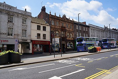
Directions to The Headrow (Leeds) with public transport
The following transport lines have routes that pass near The Headrow
 Bus: 110, 141, 229, 47, 7.
- Train: NORTHERN.
How to get to The Headrow by bus?
Click on the bus route to see step by step directions with maps, line arrival times and updated time schedules.
How to get to The Headrow by train?
Click on the train route to see step by step directions with maps, line arrival times and updated time schedules.
Bus stops near The Headrow in Leeds
- Headrow G, 1 min walk,
- Headrow E, 2 min walk,
- Victoria I, 2 min walk,
- Victoria P, 2 min walk,
- Victoria J, 2 min walk,
- Victoria O, 2 min walk,
- Victoria Q, 2 min walk,
- Victoria A, 2 min walk,
- Victoria N, 2 min walk,
Bus lines to The Headrow in Leeds
- 42, Old Farnley,
- 49, Monkswood Gate,
- 50, Seacroft Bus Stn,
- 50A, Seacroft Bus Stn,
- 22, Headingley Campus,
- 23, Holt Park,
- 25, Lawnswood School,
- 27, Guiseley Morrisons,
- 28, Adel,
- X84, Otley Bus Station,
- 7, Leeds,
- 7A, Leeds - Alwoodley,
- 7S, Shadwell - Leeds,
- 200, Heckmondwike - Leeds,
- 201, Leeds - Heckmondwike,
- 202, Huddersfield - Leeds,
- 203, Huddersfield - Leeds,
- 229, Leeds - Huddersfield,
- 254, Huddersfield - Leeds,
- 255, Leeds - Halifax,
What are the nearest stations to The Headrow?
The nearest stations to The Headrow are:
- Headrow G is 28 meters away, 1 min walk.
- Headrow E is 70 meters away, 2 min walk.
- Victoria I is 75 meters away, 2 min walk.
- Victoria P is 84 meters away, 2 min walk.
- Victoria J is 94 meters away, 2 min walk.
- Victoria O is 105 meters away, 2 min walk.
- Victoria Q is 109 meters away, 2 min walk.
- Victoria A is 113 meters away, 2 min walk.
- Victoria N is 127 meters away, 2 min walk.
Which bus lines stop near The Headrow?
These bus lines stop near The Headrow: 110, 141, 229, 47, 7, 72, A1, X84.
Which train line stops near The Headrow?
NORTHERN (Leeds)
What’s the nearest bus station to The Headrow in Leeds?
The nearest bus station to The Headrow in Leeds is Headrow G. It’s a 1 min walk away.
What time is the first bus to The Headrow in Leeds?
The 72 is the first bus that goes to The Headrow in Leeds. It stops nearby at 03:05.
What time is the last bus to The Headrow in Leeds?
The 72 is the last bus that goes to The Headrow in Leeds. It stops nearby at 02:51.
See The Headrow, Leeds, on the map
Public Transit to The Headrow in Leeds
Wondering how to get to The Headrow in Leeds? Moovit helps you find the best way to get to The Headrow with step-by-step directions from the nearest public transit station.
Moovit provides free maps and live directions to help you navigate through your city. View schedules, routes, timetables, and find out how long does it take to get to The Headrow in real time.
Looking for the nearest stop or station to The Headrow? Check out this list of stops closest to your destination: Headrow G; Headrow E; Victoria I; Victoria P; Victoria J; Victoria O; Victoria Q; Victoria A; Victoria N.
Bus: 110, 141, 229, 47, 7, 72, A1, X84, 42, 49, 50, 50A, 22, 23, 25, 27, 28, 7A, 7S, 200, 201, 56, 64, 12, 13, 13A, 36, BS47, 48.Train: NORTHERN.
Want to see if there’s another route that gets you there at an earlier time? Moovit helps you find alternative routes or times. Get directions from and directions to The Headrow easily from the Moovit App or Website.
We make riding to The Headrow easy, which is why over 1.5 million users, including users in Leeds, trust Moovit as the best app for public transit. You don’t need to download an individual bus app or train app, Moovit is your all-in-one transit app that helps you find the best bus time or train time available.
For information on prices of bus and train, costs and ride fares to The Headrow, please check the Moovit app.
Use the app to navigate to popular places including to the airport, hospital, stadium, grocery store, mall, coffee shop, school, college, and university.
Location: Leeds, Yorkshire
- Headrow H (45010667),
- Barclays,
- Headrow House,
- Hmv,
- Turtle Bay Leeds,
- Ji Chicken Shop,
- Itiz,
- Victoria Quarter,
- Sports Direct,
- Flannels,
- Space Nk,
- Travelodge,
- Tesla,
- The Grand Theatre And Opera House Leeds,
- Victoria Leeds,
- Travelodge Leeds Central Vicar Lane,
- The 97 Bus - Leeds To Guiseley,
- The Ivy,
- The Man Behind the Curtain,
- Samsung Experience Store
Places Near The Headrow (Leeds)
- Meadowhall Retail Park, Sheffield, Sheffield,
- St James Hospital, Leeds, Leeds,
- Ecclesall Road, Sheffield, Sheffield,
- York Hospital, York, York,
- Boundary Mill Stores, Catcliffe,
- Sheffield Crown Court, Sheffield,
- Temple Newsam House, Leeds,
- The White Rose, Leeds,
- Leeds Train Station, Leeds,
- Northern General Hospital, Sheffield,
- Foreman (O+P) computer cluster, Leeds,
- Buy Nembutal Pentobarbital Sodium Online, Leeds,
- IKEA Sheffield, Sheffield,
- Meadowhall Shopping Centre, Sheffield,
- IKEA Leeds, Heckmondwike,
- Ls14 1ng, Leeds,
- Shay Grange Crematorium, Shipley,
- Royal Hallamshire Hospital, Sheffield,
- Northern General Hospital, Sheffield, Sheffield,
- Weston Park Hospital, Sheffield
How to get to popular places in Yorkshire with public transport
Get around Leeds by public transport!
Travelling around Leeds has never been so easy. See step by step directions as you travel to any attraction, street or major public transport station. View bus and train timetables, arrival times, service alerts and detailed routes on a map, so you know exactly how to get to anywhere in Leeds.
When travelling to any destination around Leeds use Moovit's Live Directions with Get Off Notifications to know exactly where and how far to walk, how long to wait for your line , and how many stops are left. Moovit will alert you when it’s time to get off — no need to constantly re-check whether yours is the next stop.
Wondering how to use public transport in Leeds or how to pay for public transport in Leeds? Moovit public transport app can help you navigate your way with public transport easily, and at minimum cost. It includes public transport fees, ticket prices, and costs. Looking for a map of Leeds public transport lines? Moovit public transport app shows all public transport maps in Leeds with all Bus, Train and Light rail routes and stops on an interactive map.
Yorkshire has 3 transport type(s), including: Bus, Train and Light rail, operated by several transport agencies, including First Leeds, First South Yorkshire, First York, Arriva Yorkshire, Stagecoach Yorkshire, National Rail, First Bradford, First Halifax, Calder Valley & Huddersfield, East Yorkshire, The Keighley Bus Company, South Yorkshire Future Tram, The Harrogate Bus Company, TM Travel, Coastliner and Stevenson's Travel