How to get to Timber Frame Engineering Services by bus?
Click on the bus route to see step by step directions with maps, line arrival times and updated time schedules.
From Studley Castle Hotel and Conference Centre, Studley
38 minFrom Alexandra Hospital, Redditch, Greenlands
17 minFrom Stratford upon Avon Racecourse, Shottery
51 minFrom St Augustine's High School, Redditch, Crabbs Cross
29 minFrom Warner Leisure Studley Castle, Studley
34 minFrom Matalan, Central
38 minFrom Anne Hathaway's Cottage, Hathaway
29 minFrom Kingfisher Shopping Centre, Abbey
33 minFrom B98 0DE, Matchborough
32 minFrom Stratford Racecourse, Shottery
38 min
Bus stops near Timber Frame Engineering Services in Alcester & Rural
Bus lines to Timber Frame Engineering Services in Alcester & Rural
- 26, Natwest Bank Stratford-Upon-Avon,VIEW
- 202, Alcester High School,VIEW
- 229, Redditch Redditch Bus Station,VIEW
- 247, Evesham Bus Station,VIEW
- 247A, Alcester Priory Road Opp Police Station,VIEW
- 502, Alcester Rd South, Addison Rd,VIEW
- 247S, Evesham Bus Station,VIEW
- 240, Alcester High School,VIEW
- 512, Mcdonalds,VIEW
- 212, Stratford Tesco Bus Shelter,VIEW
- 243, Alcester High School,VIEW
What are the nearest stations to Timber Frame Engineering Services?
The nearest stations to Timber Frame Engineering Services are:
- Grammar School is 230 meters away, 4 min walk.
- Police Station is 314 meters away, 5 min walk.
Which bus line stops near Timber Frame Engineering Services?
26 (Natwest Bank Stratford-Upon-Avon)
What’s the nearest bus station to Timber Frame Engineering Services in Alcester & Rural?
The nearest bus station to Timber Frame Engineering Services in Alcester & Rural is Grammar School. It’s a 4 min walk away.
What time is the first bus to Timber Frame Engineering Services in Alcester & Rural?
The 26 is the first bus that goes to Timber Frame Engineering Services in Alcester & Rural. It stops nearby at 08:26.
What time is the last bus to Timber Frame Engineering Services in Alcester & Rural?
The 26 is the last bus that goes to Timber Frame Engineering Services in Alcester & Rural. It stops nearby at 19:46.
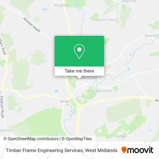
See Timber Frame Engineering Services, Alcester & Rural, on the map
Public Transit to Timber Frame Engineering Services in Alcester & Rural
Wondering how to get to Timber Frame Engineering Services in Alcester & Rural? Moovit helps you find the best way to get to Timber Frame Engineering Services with step-by-step directions from the nearest public transit station.
Moovit provides free maps and live directions to help you navigate through your city. View schedules, routes, timetables, and find out how long does it take to get to Timber Frame Engineering Services in real time.
Looking for the nearest stop or station to Timber Frame Engineering Services? Check out this list of stops closest to your destination: Grammar School; Police Station.
Bus: 26, 202, 229, 247, 247A, 247S, 240, 512, 212, 243.
Want to see if there’s another route that gets you there at an earlier time? Moovit helps you find alternative routes or times. Get directions from and directions to Timber Frame Engineering Services easily from the Moovit App or Website.
We make riding to Timber Frame Engineering Services easy, which is why over 1.5 million users, including users in Alcester & Rural, trust Moovit as the best app for public transit. You don’t need to download an individual bus app or train app, Moovit is your all-in-one transit app that helps you find the best bus time or train time available.
For information on prices of bus, costs and ride fares to Timber Frame Engineering Services, please check the Moovit app.
Use the app to navigate to popular places including to the airport, hospital, stadium, grocery store, mall, coffee shop, school, college, and university.
Timber Frame Engineering Services Address: 4 Cross Road Alcester Alcester B49 5EX street in Alcester & Rural
- All Groundworks,
- Westgarth Properties,
- KCDC Resources Limited,
- Georgian Close Alcester Management Company,
- L & C Solutions Midlands,
- The Tipsy Pig,
- Teamgym,
- E & J Tooling Limited,
- Ajm Associates,
- Villa Select,
- Offenham Village Stores,
- S2 Technologies Limited,
- Alcester Cemetery,
- Alcester District Nurses,
- Alcester Police Station,
- Shell Recharge,
- Alcester,
- Alcester Station,
- Cherry Picked Kicks,
- G P Turner
Places Near Timber Frame Engineering Services (Alcester & Rural)
- Sandwell General Hospital, West Bromwich Central,
- Boundary Mill Stores, Bentley And Darlaston North,
- Stratford Road, Sparkhill,
- Birmingham Dental Hospital, Edgbaston,
- Lilleshall Hall National Sports Centre, Telford,
- Royal Orthopaedic Hospital, Northfield,
- Travelodge Birmingham Airport Hotel Birmingham, Bickenhill,
- IKEA Wednesbury, Oldbury,
- Moseley, Moseley,
- Crown Wharf Retail Park, St. Matthew's,
- Sandwell General Hospital, West Bromwich Central,
- The Merry Hill Centre, Brierley Hill,
- Tally Ho Police Training, Birmingham, Edgbaston,
- Heritage Building (Queen Elizabeth Hospital), Edgbaston,
- Waseley Hills Crematorium, Frankley Great Park,
- Bournville Staff Shop (Cadbury World), Bournville & Cotteridge,
- Bickerstaff Endoscopy Unit (PRH), Apley Castle,
- Birmingham And Midland Eye Centre, Soho & Jewellery Quarter,
- One Stop Shopping Centre, Perry Barr,
- Fort Shopping Centre, Birmingham, Pype Hayes
How to get to popular places in West Midlands with public transport
Get around Alcester & Rural by public transport!
Travelling around Alcester & Rural has never been so easy. See step by step directions as you travel to any attraction, street or major public transport station. View bus and train timetables, arrival times, service alerts and detailed routes on a map, so you know exactly how to get to anywhere in Alcester & Rural.
When travelling to any destination around Alcester & Rural use Moovit's Live Directions with Get Off Notifications to know exactly where and how far to walk, how long to wait for your line , and how many stops are left. Moovit will alert you when it’s time to get off — no need to constantly re-check whether yours is the next stop.
Wondering how to use public transport in Alcester & Rural or how to pay for public transport in Alcester & Rural? Moovit public transport app can help you navigate your way with public transport easily, and at minimum cost. It includes public transport fees, ticket prices, and costs. Looking for a map of Alcester & Rural public transport lines? Moovit public transport app shows all public transport maps in Alcester & Rural with all Bus, Train and Light rail routes and stops on an interactive map.
West Midlands has 3 transport type(s), including: Bus, Train and Light rail, operated by several transport agencies, including National Express West Midlands, National Express Coventry, National Express, Diamond Bus, Arriva Midlands, Stagecoach Midlands, West Midlands Metro, Stagecoach West, Stagecoach South Wales, First Potteries, First Worcestershire, LandFlight, trentbarton, D & G Bus and Flexibus