How to get to Touriction by bus?
Click on the bus route to see step by step directions with maps, line arrival times and updated time schedules.
From Pinnaroo Valley Memorial Park, Padbury
68 minFrom Stirling Station, Osborne Park
42 minFrom Chu Bakery, Highgate
66 minFrom Siena's of Leederville, Leederville
68 minFrom Jb O'Reilly's, West Leederville
68 minFrom West Leederville, West Leederville
85 minFrom Australian Islamic College (AIC) - Dianella, Dianella
58 minFrom Koorong Books, Mount Lawley
67 minFrom Tech Revo Group Pty, Innaloo
55 minFrom St John of God Mt Lawley Hospital, Mount Lawley
94 min
Bus stops near Touriction in Balga
Bus lines to Touriction in Balga
What are the nearest stations to Touriction?
The nearest stations to Touriction are:
- Finchley Cr After Markham Wy is 184 meters away, 3 min walk.
- Redcliffe Av Balga Senior High School is 426 meters away, 6 min walk.
- Beach Rd Before Redcliffe Av is 779 meters away, 11 min walk.
Which bus lines stop near Touriction?
These bus lines stop near Touriction: 375, 449, 975.
What’s the nearest bus station to Touriction in Balga?
The nearest bus station to Touriction in Balga is Finchley Cr After Markham Wy. It’s a 3 min walk away.
What time is the first bus to Touriction in Balga?
The 449 is the first bus that goes to Touriction in Balga. It stops nearby at 04:52.
What time is the last bus to Touriction in Balga?
The 375 is the last bus that goes to Touriction in Balga. It stops nearby at 00:26.
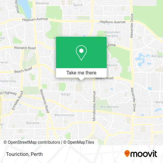
See Touriction, Balga, on the map
Public Transit to Touriction in Balga
Wondering how to get to Touriction in Balga? Moovit helps you find the best way to get to Touriction with step-by-step directions from the nearest public transit station.
Moovit provides free maps and live directions to help you navigate through your city. View schedules, routes, timetables, and find out how long does it take to get to Touriction in real time.
Looking for the nearest stop or station to Touriction? Check out this list of stops closest to your destination: Finchley Cr After Markham Wy; Redcliffe Av Balga Senior High School; Beach Rd Before Redcliffe Av.
Bus: 375, 449, 975, 377.
Want to see if there’s another route that gets you there at an earlier time? Moovit helps you find alternative routes or times. Get directions from and directions to Touriction easily from the Moovit App or Website.
We make riding to Touriction easy, which is why over 1.5 million users, including users in Balga, trust Moovit as the best app for public transit. You don’t need to download an individual bus app or train app, Moovit is your all-in-one transit app that helps you find the best bus time or train time available.
For information on prices of bus and train, costs and ride fares to Touriction, please check the Moovit app.
Use the app to navigate to popular places including to the airport, hospital, stadium, grocery store, mall, coffee shop, school, college, and university.
Touriction Address: 37 Markham Way Balga WA 6061 street in Balga
- Northstar Maintenance,
- Pacific It Solutionz,
- Resala Assotiation Perth,
- Twigital Infotech,
- Finchley Markham Reserve,
- Deadstocks,
- Kangaroo Angel Wash Car,
- Ausiken Co OP,
- Topaz Lashes,
- Caress of Nature,
- Balga Senior High School,
- Temted,
- Lexi Therapy & Wellness,
- The African Drumming,
- Flawless Nails and Beauty,
- Harcourts Your Home,
- Warriapendi Dental Therapy Centre,
- Newport Park,
- Warriapendi Early Learning Centre,
- Harcourts Your Home
Places Near Touriction (Balga)
- Rac Arena, Perth,
- Hillarys Boat Harbour,
- Westfield Carousel, Cannington,
- Sir Charles Gairdner Hospital, Nedlands,
- Yankee Mart, Baldivis,
- McCallum Park, Victoria Park,
- Perth Convention Exhibition Centre, Perth,
- Blue Boat House,
- Pelicaan Investment Ho, Bellevue,
- Langley Park, Perth,
- DFO, Perth Airport,
- Royal Perth Hospital, Perth,
- Aqwa Aquarium, Hillarys,
- Scitech, West Perth,
- Karrinyup Shopping Centre, Karrinyup,
- Optus Stadium, Burswood,
- Fiona Stanley Hospital, Murdoch,
- IKEA, Innaloo,
- Crown Perth Casino, Burswood,
- Mount Hospital, Perth
How to get to popular places in Perth with public transport
Get around Balga by public transport!
Travelling around Balga has never been so easy. See step by step directions as you travel to any attraction, street or major public transport station. View bus and train timetables, arrival times, service alerts and detailed routes on a map, so you know exactly how to get to anywhere in Balga.
When travelling to any destination around Balga use Moovit's Live Directions with Get Off Notifications to know exactly where and how far to walk, how long to wait for your line , and how many stops are left. Moovit will alert you when it’s time to get off — no need to constantly re-check whether yours is the next stop.
Wondering how to use public transport in Balga or how to pay for public transport in Balga? Moovit public transport app can help you navigate your way with public transport easily, and at minimum cost. It includes public transport fees, ticket prices, and costs. Looking for a map of Balga public transport lines? Moovit public transport app shows all public transport maps in Balga with all Bus, Train and Ferry routes and stops on an interactive map.
Perth has 3 transport type(s), including: Bus, Train and Ferry, operated by several transport agencies, including Transperth Rail, Transwa, Transperth Ferry, Transperth, TransBusselton, TransAlbany, TransGoldfields, TransEsperance, TransGeraldton, TransCarnarvon, TransHedland, TransKarratha, TransBunbury, Mandurah Bus Charter and TransBroome