Trinity N stop - Sunday schedule
| Line | Direction | Time |
|---|---|---|
| A1 | Airport | 05:38 |
| A1 | Airport | 07:08 |
| 5A | Leeds Albion St | 08:27 |
| A1 | Airport | 08:39 |
| 255 | Bus Station | 08:57 |
| 5A | Leeds Albion St | 08:58 |
| 229 | Bus Station Stand J | 09:12 |
| 201 | Market Place H5 | 09:16 |
| 254 | Bus Station Stand J | 09:27 |
| 5A | Leeds Albion St | 09:30 |
| 203 | Bus Station Stand J | 09:31 |
| A1 | Airport | 09:39 |
| 229 | Bus Station Stand J | 09:42 |
| 200 | Northgate T3 | 09:46 |
| 116 | Bus Station Stand 7 | 09:54 |
| 255 | Halifax Bus Station L | 09:57 |
| 5A | Leeds Albion St | 10:00 |
| 202 | Bus Station Stand J | 10:01 |
| 229 | Bus Station Stand J | 10:12 |
| 201 | Market Place H5 | 10:16 |
| A1 | Airport | 10:20 |
| 254 | Bus Station Stand J | 10:27 |
| 203 | Bus Station Stand J | 10:31 |
| 5A | Leeds Albion St | 10:35 |
| 229 | Bus Station Stand J | 10:42 |
Directions to Trinity N stop (Leeds) with public transport
The following transport lines have routes that pass near Trinity N
 Bus: 116, 12, 140, 19A, 2.
- Train: NORTHERN.
How to get to Trinity N stop by bus?
Click on the bus route to see step by step directions with maps, line arrival times and updated time schedules.
How to get to Trinity N stop by train?
Click on the train route to see step by step directions with maps, line arrival times and updated time schedules.
Bus stops near Trinity N stop in Leeds
- Corn Exchange I, 2 min walk,
- Corn Exchange J, 2 min walk,
- Corn Exchange H, 2 min walk,
- Corn Exchange F, 2 min walk,
- Corn Exchange A, 2 min walk,
- Corn Exchange E, 2 min walk,
- Trinity K, 2 min walk,
- Station D, 2 min walk,
- Trinity L, 3 min walk,
- Station C, 3 min walk,
- Trinity M, 3 min walk,
- Trinity R, 4 min walk,
- Trinity Q, 4 min walk,
- Trinity P, 4 min walk,
- Leeds, 17 min walk,
Bus lines to Trinity N stop in Leeds
- 19, Leeds Boar Lane,
- 19A, Tinshill,
- 74, Leeds the Headrow L,
- 75, Leeds Duncan Street,
- 5, Leeds Albion St,
- 5A, Leeds Albion St,
- X98, Deighton Road,
- X99, Deighton Road,
- 40, Corn Exchange H,
- 163, Bus Station,
- 12, Middleton Thorpe Ln,
- 13, Leeds Corn Exchange,
- 13A, Middleton Thorpe Ln,
- 47, Morley Town Hall,
- 47A, Leeds Corn Exchange,
- 51, Victoria D,
- 52, Victoria D,
- 2, Leeds,
- 3, Morley - Leeds,
- 3A, Leeds - Morley,
What are the nearest stations to Trinity N?
The nearest stations to Trinity N are:
- Corn Exchange I stop is 108 meters away, 2 min walk.
- Corn Exchange J stop is 114 meters away, 2 min walk.
- Corn Exchange H stop is 116 meters away, 2 min walk.
- Corn Exchange F stop is 118 meters away, 2 min walk.
- Corn Exchange A stop is 125 meters away, 2 min walk.
- Corn Exchange E stop is 136 meters away, 2 min walk.
- Trinity K stop is 143 meters away, 2 min walk.
- Station D is 146 meters away, 2 min walk.
- Trinity L stop is 178 meters away, 3 min walk.
- Station C is 207 meters away, 3 min walk.
- Trinity M stop is 214 meters away, 3 min walk.
- Trinity R stop is 234 meters away, 4 min walk.
- Trinity Q stop is 276 meters away, 4 min walk.
- Trinity P stop is 283 meters away, 4 min walk.
- Leeds stop is 1294 meters away, 17 min walk.
Which bus lines stop near Trinity N?
These bus lines stop near Trinity N: 116, 12, 140, 19A, 2, 201, 229, 24, 4.
Which train line stops near Trinity N?
NORTHERN (Leeds)
What’s the nearest bus station to Trinity N in Leeds?
The nearest bus stations to Trinity N in Leeds are Corn Exchange I, Corn Exchange J, Corn Exchange H, Corn Exchange F, Corn Exchange A, Corn Exchange E, Trinity K and Station D. The closest one is a 2 min walk away.
What time is the first train to Trinity N in Leeds?
The NORTHERN is the first train that goes to Trinity N in Leeds. It stops nearby at 07:58.
What time is the last train to Trinity N in Leeds?
The TRANSPENNINE EXPRESS is the last train that goes to Trinity N in Leeds. It stops nearby at 04:25.
What time is the first bus to Trinity N in Leeds?
The 16A is the first bus that goes to Trinity N in Leeds. It stops nearby at 06:07.
What time is the last bus to Trinity N in Leeds?
The TRANSPENNINE EXPRESS is the last bus that goes to Trinity N in Leeds. It stops nearby at 01:43.
Trinity N station
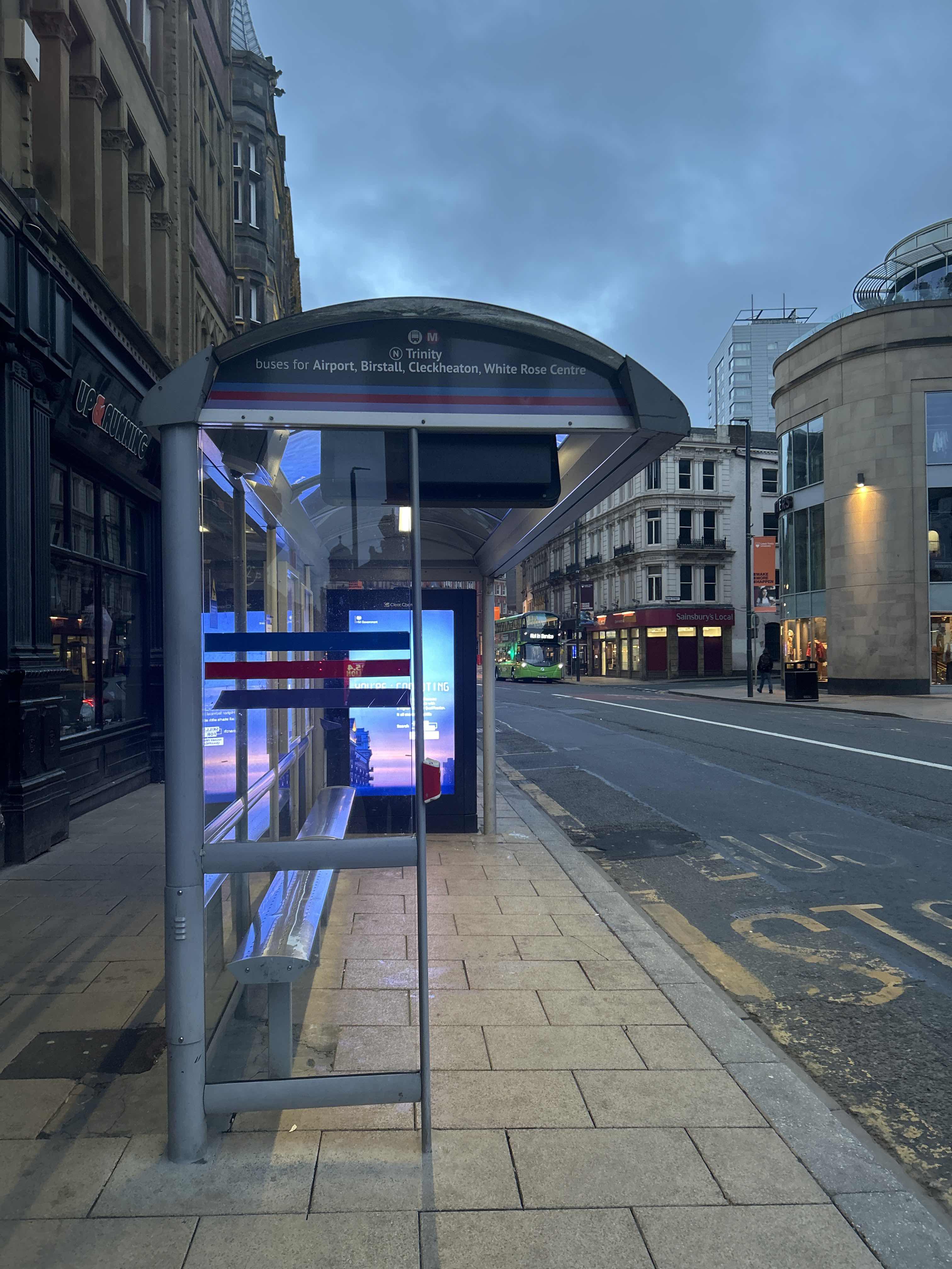 Taken by Anonymous
See Trinity N stop, Leeds, on the map
Public transport to Trinity N stop (ID: 45010686) in Leeds
Looking for directions to Trinity N in Leeds, United Kingdom?
Download the Moovit App to find the current schedule and step-by-step directions for Bus or Train routes that pass through Trinity N.
Looking for the nearest stops closest to Trinity N ? Check out this list of closest stops to your destination: Corn Exchange I; Corn Exchange J; Corn Exchange H; Corn Exchange F; Corn Exchange A; Corn Exchange E; Trinity K; Station D; Trinity L; Station C; Trinity M; Trinity R; Trinity Q; Trinity P; Leeds.
Bus: 116, 12, 140, 19A, 2, 201, 229, 24, 4, 19, 74, 75, 40, 163, 13, 13A, 47, 47A, 5, 5A, X98, X99, 51, 52, 3, 3A.Train: NORTHERN.
We make riding on public transit to Trinity N easy, which is why over 1.7 billion users, including users in Leeds trust Moovit as the best app for public transit.
Use the app to navigate to popular places including to the airport, hospital, stadium, grocery store, mall, coffee shop, school, college, and university.
Trinity N stop’s code is 45010686
The first line to this stop is A1, at 05:38, and the last line is 201 at 23:16.
12 Boar Lane, Leeds, England, United Kingdom
This stop serves Arriva Yorkshire, Flyer and First Leeds’s lines
Popular routes from Trinity N stop, Leeds
- Corn Exchange I,
- Corn Exchange J,
- Corn Exchange H,
- Corn Exchange F,
- Corn Exchange A,
- Corn Exchange E,
- Trinity K,
- Station D,
- Trinity L,
- Station C,
- Trinity M,
- Trinity R,
- Trinity Q,
- Trinity P,
- Leeds
Bus stops near Trinity N stop
- Eccleshill Co-Op,
- Burn Road,
- Pleasley Road/Chaff Lane,
- Sandbeds Road,
- Bridlington Limekiln Lane,
- Cottingham St Margarets Avenue,
- City Square I,
- John Leggott College,
- Leppings Lane/Leake Road,
- Arla Foods,
- Springfield Mills,
- Waterdale/College Road,
- Halfway House,
- St George's Square S2,
- Headrow A,
- York Road,
- None-Go-Bye Farm,
- Woodlesford,
- Grovehall Lane Tk Maxx,
- Barnsley Road/Main Street
Popular public transport stations in Leeds
Get around Leeds by public transport!
Travelling around Leeds has never been so easy. See step by step directions as you travel to any attraction, street or major public transport station. View bus and train timetables, arrival times, service alerts and detailed routes on a map, so you know exactly how to get to anywhere in Leeds.
When travelling to any destination around Leeds use Moovit's Live Directions with Get Off Notifications to know exactly where and how far to walk, how long to wait for your line , and how many stops are left. Moovit will alert you when it’s time to get off — no need to constantly re-check whether yours is the next stop.
Wondering how to use public transport in Leeds or how to pay for public transport in Leeds? Moovit public transport app can help you navigate your way with public transport easily, and at minimum cost. It includes public transport fees, ticket prices, and costs. Looking for a map of Leeds public transport lines? Moovit public transport app shows all public transport maps in Leeds with all Bus, Train and Light rail routes and stops on an interactive map.
Yorkshire has 3 transport type(s), including: Bus, Train and Light rail, operated by several transport agencies, including First Leeds, First South Yorkshire, First York, Arriva Yorkshire, Stagecoach Yorkshire, National Rail, First Bradford, First Halifax, Calder Valley & Huddersfield, East Yorkshire, The Keighley Bus Company, South Yorkshire Future Tram, The Harrogate Bus Company, TM Travel, Coastliner and Stevenson's Travel