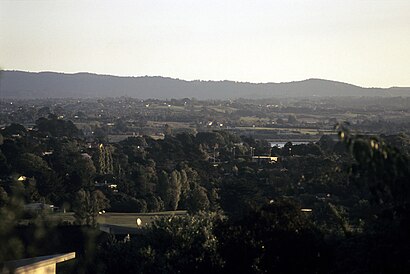
See Upper Harbour Primary School, Greenhithe, on the map
Directions to Upper Harbour Primary School (Greenhithe) with public transport
The following transport lines have routes that pass near Upper Harbour Primary School
Bus:
How to get to Upper Harbour Primary School by Bus?
Click on the Bus route to see step by step directions with maps, line arrival times and updated time schedules.
Bus stations near Upper Harbour Primary School in Greenhithe
- Aberley Road,33 min walk,
Bus lines to Upper Harbour Primary School in Greenhithe
- 883,Constellation Station To Schnapper Rock,
What are the nearest stations to Upper Harbour Primary School?
The nearest stations to Upper Harbour Primary School are:
- Aberley Road is 2540 meters away, 33 min walk.
Which Bus lines stop near Upper Harbour Primary School?
These Bus lines stop near Upper Harbour Primary School: 120, 883
What time is the first Bus to Upper Harbour Primary School in Greenhithe?
The 883 is the first Bus that goes to Upper Harbour Primary School in Greenhithe. It stops nearby at 06:02.
What time is the last Bus to Upper Harbour Primary School in Greenhithe?
The 883 is the last Bus that goes to Upper Harbour Primary School in Greenhithe. It stops nearby at 21:32.
How much is the Bus fare to Upper Harbour Primary School?
The Bus fare to Upper Harbour Primary School costs about $2.34 - $7.40.
See Upper Harbour Primary School, Greenhithe, on the map

Public Transit to Upper Harbour Primary School in Greenhithe
Wondering how to get to Upper Harbour Primary School in Greenhithe, New Zealand? Moovit helps you find the best way to get to Upper Harbour Primary School with step-by-step directions from the nearest public transit station.
Moovit provides free maps and live directions to help you navigate through your city. View schedules, routes, timetables, and find out how long does it take to get to Upper Harbour Primary School in real time.
Looking for the nearest stop or station to Upper Harbour Primary School? Check out this list of stops closest to your destination: Aberley Road.
Bus:
Want to see if there’s another route that gets you there at an earlier time? Moovit helps you find alternative routes or times. Get directions from and directions to Upper Harbour Primary School easily from the Moovit App or Website.
We make riding to Upper Harbour Primary School easy, which is why over 1.5 million users, including users in Greenhithe, trust Moovit as the best app for public transit. You don’t need to download an individual bus app or train app, Moovit is your all-in-one transit app that helps you find the best bus time or train time available.
For information on prices of Bus, costs and ride fares to Upper Harbour Primary School, please check the Moovit app.
Use the app to navigate to popular places including to the airport, hospital, stadium, grocery store, mall, coffee shop, school, college, and university.
Upper Harbour Primary School Address: Kyle Road, Albany street in Greenhithe

Attractions near Upper Harbour Primary School
- Upper Harbour Primary School
- Lady Phoenix Reserve
- Invespectrum
- Albany Mega Centre Den
- Oncall Consultants 2004
- New Zealand Pearl Li
- Design 11 NZ Limited
- Bucket Hats NZ
- Smoky Chimney Sweeps & Repairs Active Window Cleaning
- Virtual Workplace
- Penniall M & M
- Designz
- 123 Greenhithe Rd
- North Shore Cemetery & Crematorium
- Forest Creek Enterprises
- Schnapper Rock Road Cemetery
- Love Green New Zealand
- Winning Performance
- Upper Harbour Drive
- New Shoots Children's Centre
How to get to popular attractions in Greenhithe with public transportation
- Pakuranga Plaza, Pakuranga Central
- Watchman's Island, Inlet-Waitemata Harbour
- Nando's, Sherbourne
- wagamama, Mt Wellington South
- Auckland Airport, Mangere South
- Bread & Butter Bakery and Cafe, Grey Lynn West
- Pride Mobility NZ, Glenavon
- BurgerFuel, Glenfield Central
- VTNZ New Lynn, Lynnmall
- Sylvia Park Shopping Centre, Mt Wellington South
- Pure, Ponsonby West
- Monsoon Poon, Auckland Harbourside
- Countdown, Manukau Central
- Wendy's Old Fashioned Hamburgers, Ellerslie South
- Black Salt Bar and Eatery, Lynnmall
- KFC, Silverdale Central
- Blankenberge Belgian Beer Cafe, Takapuna Central
- Western Springs, Point Chevalier South
- Revera, North Harbour East
- Henderson Heights, Henderson West