Directions to Victoria Park Market (Auckland Central West) with public transport
The following transport lines have routes that pass near Victoria Park Market
How to get to Victoria Park Market by bus?
Click on the bus route to see step by step directions with maps, line arrival times and updated time schedules.
How to get to Victoria Park Market by train?
Click on the train route to see step by step directions with maps, line arrival times and updated time schedules.
Bus stops near Victoria Park Market in Auckland Central West
- Victoria Park Market, 2 min walk,
- Halsey Street/Victoria Park, 4 min walk,
- Dock Street, 4 min walk,
- Sale Street, 4 min walk,
- Gudgeon Street, 6 min walk,
- Fanshawe Street/Victoria Park, 7 min walk,
- Daldy Street/Gaunt Street, 8 min walk,
Train stations near Victoria Park Market in Auckland Central West
- Parnell Train Station, 20 min walk,
- Britomart Train Station, 34 min walk,
Ferry stations near Victoria Park Market in Auckland Central West
- Hamer St, 26 min walk,
- Hamer Street Ferry Terminal, 28 min walk,
- Ferry Terminal - Downtown, 33 min walk,
Bus lines to Victoria Park Market in Auckland Central West
- INN, Inner Link Clockwise,
- OUT, Outer Link Clockwise Newmarket To City Centre,
- 101, Auckland University To Pt Chevalier Via Jervois Rd,
- 106, Freemans Bay Loop,
- NX2, Hibiscus Coast Station To Auckland Universities,
- 75, Glen Innes To Wynyard Quarter Via Remuera Rd,
- 82, Mayoral Dr To Milford Via Takapuna,
- 802, City (Mayoral Dr) To Bayswater,
- 923, Akoranga Station To City (Mayoral Dr) Via Hillcrest,
- 22N, New Lynn To City Centre Via New North Rd,
- 22R, City Centre To Rosebank Rd Via New North Rd,
- 24B, New Lynn And Blockhouse Bay To City Centre Via Sandingham Rd,
- 24R, New Lynn To City Centre Via Sandingham Rd,
- 924, Hillcrest To City (Mayoral Dr),
- 20, St Lukes To Wynyard Quarter Via Kingsland,
- MEX, Snells Beach To Parnell,
- NX1, Britomart (Lower Albert St) To Albany Station,
- 95B, Bayview To Britomart (Lower Albert St),
- 95C, Britomart (Quay St) To Constellation Station Via Glenfield,
- 97B, Beach Haven To Britomart (Lower Albert St),
What are the nearest stations to Victoria Park Market?
The nearest stations to Victoria Park Market are:
- Victoria Park Market is 76 meters away, 2 min walk.
- Halsey Street/Victoria Park is 265 meters away, 4 min walk.
- Dock Street is 273 meters away, 4 min walk.
- Sale Street is 293 meters away, 4 min walk.
- Gudgeon Street is 438 meters away, 6 min walk.
- Fanshawe Street/Victoria Park is 503 meters away, 7 min walk.
- Daldy Street/Gaunt Street is 580 meters away, 8 min walk.
- Parnell Train Station is 1508 meters away, 20 min walk.
- Hamer St is 1954 meters away, 26 min walk.
- Hamer Street Ferry Terminal is 2153 meters away, 28 min walk.
- Ferry Terminal - Downtown is 2532 meters away, 33 min walk.
- Britomart Train Station is 2576 meters away, 34 min walk.
Which bus lines stop near Victoria Park Market?
These bus lines stop near Victoria Park Market: 24R, 802, 95C, INN, NX2, OUT.
Which train lines stop near Victoria Park Market?
These train lines stop near Victoria Park Market: EAST, STH, WEST.
What’s the nearest train station to Victoria Park Market in Auckland Central West?
The nearest train station to Victoria Park Market in Auckland Central West is Parnell Train Station. It’s a 20 min walk away.
What’s the nearest bus stop to Victoria Park Market in Auckland Central West?
The nearest bus stop to Victoria Park Market in Auckland Central West is Victoria Park Market. It’s a 2 min walk away.
What’s the nearest ferry station to Victoria Park Market in Auckland Central West?
The nearest ferry station to Victoria Park Market in Auckland Central West is Hamer St. It’s a 26 min walk away.
What time is the first train to Victoria Park Market in Auckland Central West?
The WEST is the first train that goes to Victoria Park Market in Auckland Central West. It stops nearby at 05:24.
What time is the last train to Victoria Park Market in Auckland Central West?
The WEST is the last train that goes to Victoria Park Market in Auckland Central West. It stops nearby at 22:29.
What time is the first bus to Victoria Park Market in Auckland Central West?
The NX1 is the first bus that goes to Victoria Park Market in Auckland Central West. It stops nearby at 05:15.
What time is the last bus to Victoria Park Market in Auckland Central West?
The OUT is the last bus that goes to Victoria Park Market in Auckland Central West. It stops nearby at 01:00.
What time is the first ferry to Victoria Park Market in Auckland Central West?
The DEV is the first ferry that goes to Victoria Park Market in Auckland Central West. It stops nearby at 05:45.
What time is the last ferry to Victoria Park Market in Auckland Central West?
The MTIA is the last ferry that goes to Victoria Park Market in Auckland Central West. It stops nearby at 01:05.
How much is the train fare to Victoria Park Market?
The train fare to Victoria Park Market costs about $2.34 - $6.00.
How much is the bus fare to Victoria Park Market?
The bus fare to Victoria Park Market costs about $2.34 - $6.00.
See Victoria Park Market, Auckland Central West, on the map
Public Transit to Victoria Park Market in Auckland Central West
Wondering how to get to Victoria Park Market in Auckland Central West, New Zealand? Moovit helps you find the best way to get to Victoria Park Market with step-by-step directions from the nearest public transit station.
Moovit provides free maps and live directions to help you navigate through your city. View schedules, routes, timetables, and find out how long does it take to get to Victoria Park Market in real time.
Looking for the nearest stop or station to Victoria Park Market? Check out this list of stops closest to your destination: Victoria Park Market; Halsey Street/Victoria Park; Dock Street; Sale Street; Gudgeon Street; Fanshawe Street/Victoria Park; Daldy Street/Gaunt Street; Parnell Train Station; Hamer St; Hamer Street Ferry Terminal; Ferry Terminal - Downtown; Britomart Train Station.
Bus: 24R, 802, 95C, INN, NX2, OUT, 101, 106, 75, 82, 923, 22N, 22R, 24B.Train: EAST, STH, WEST.Ferry: GREAT BARRIER ISLAND FERRY.
Want to see if there’s another route that gets you there at an earlier time? Moovit helps you find alternative routes or times. Get directions from and directions to Victoria Park Market easily from the Moovit App or Website.
We make riding to Victoria Park Market easy, which is why over 1.5 million users, including users in Auckland Central West, trust Moovit as the best app for public transit. You don’t need to download an individual bus app or train app, Moovit is your all-in-one transit app that helps you find the best bus time or train time available.
For information on prices of bus and train, costs and ride fares to Victoria Park Market, please check the Moovit app.
Use the app to navigate to popular places including to the airport, hospital, stadium, grocery store, mall, coffee shop, school, college, and university.
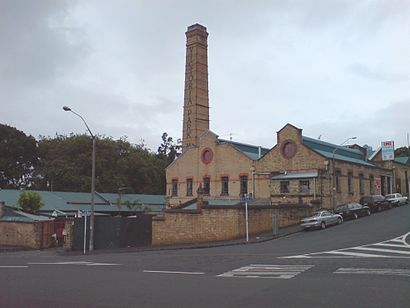
Victoria Park Market Address: Drake Street street in Auckland Central West
Attractions near Victoria Park Market
Bus Stop 7106,Ivillage at Victoria,Labtests Victoria Park,Fitsquad Bootcamp,Adelaide Street,The Birdcage Tavern,Victoria Park,Titan Marine Engineering,Altex Coatings Ltd,Oceania Medical LTD,21 Halsey St,Oceania Medical,Halsey Street,Placemakers,GHD,New World Victoria Park,Victoria Park Skate Plaza,Inner Link (clockwise),Spark City Conference Centre,11/88 Cook StreetHow to get to popular attractions in Auckland Central West with public transportation
Bus Stop 3551 (Takapuna Platform 1), Takapuna Central,BP Connect New Lynn, Glenavon,Auckland War Memorial Museum Tāmaki Paenga Hira, Parnell West,Meola Road, Westmere,One Tree Hill, One Tree Hill Central,Ripe Delicatessen, Ponsonby East,Goode Brothers, Dannemora,Murrays Bay Beach, Murrays Bay,Tamaki Gym, Glen Innes East,Atomic Coffee, Mangere South,Plant & Food Research, Mt Albert Central,Greenhithe Cafe & Restaurant, Greenhithe,Pakuranga Plaza, Pakuranga Central,CR & PI PAYNE CARTAGE CONTRACTORS, Henderson South,Tuia, Meadowbank North,Wairau Road, Target Road,Auckland Airport, Mangere South,Localist HQ, Newton,wagamama, Mt Wellington South,Martha's Backyard, Mt Wellington NorthGet around Auckland and Hamilton by public transport!
Travelling around Auckland and Hamilton has never been so easy. See step by step directions as you travel to any attraction, street or major public transport station. View bus and train timetables, arrival times, service alerts and detailed routes on a map, so you know exactly how to get to anywhere in Auckland and Hamilton.
When travelling to any destination around Auckland and Hamilton use Moovit's Live Directions with Get Off Notifications to know exactly where and how far to walk, how long to wait for your line , and how many stops are left. Moovit will alert you when it’s time to get off — no need to constantly re-check whether yours is the next stop.
Wondering how to use public transport in Auckland and Hamilton or how to pay for public transport in Auckland and Hamilton? Moovit public transport app can help you navigate your way with public transport easily, and at minimum cost. It includes public transport fees, ticket prices, and costs. Looking for a map of Auckland and Hamilton public transport lines? Moovit public transport app shows all public transport maps in Auckland and Hamilton with all Bus, Train and Ferry routes and stops on an interactive map.
Auckland and Hamilton has 3 transport type(s), including: Bus, Train and Ferry, operated by several transport agencies, including AT Metro, AT Metro Bus, Fullers360, SeaLink Pine Harbour, Belaire Ferries, Tranzit Group Ltd, New Zealand Bus, Pavlovich Transport Solutions, Bayes Coachlines, Howick and Eastern, Ritchies Transport, Waiheke Bus Company, Mahu City Express, Go Bus, SeaLink