Directions to WCS Group (Nedlands) with public transport
The following transport lines have routes that pass near WCS Group
 Bus: 103, 995, 998, 999, 25.
- Train: AIRPORT LINE, FREMANTLE LINE, 906.
How to get to WCS Group by bus?
Click on the bus route to see step by step directions with maps, line arrival times and updated time schedules.
From Fremantle Cemetery, Palmyra
78 minFrom Scarborough WA Australia, Scarborough
54 minFrom Myer, Perth
22 minFrom Fremantle Train Station, Fremantle
54 minFrom Taxi Rank, Fremantle
51 minFrom Aberdeen Street, Northbridge
29 minFrom Westfield Booragoon, Booragoon
60 minFrom Fremantle Prison, Fremantle
55 minFrom The Camfield, Burswood
44 minFrom Oats Street Station, East Victoria Park
52 min
How to get to WCS Group by train?
Click on the train route to see step by step directions with maps, line arrival times and updated time schedules.
Bus stops near WCS Group in Nedlands
Train station near WCS Group in Nedlands
- Loch Street Stn, 20 min walk,VIEW
Bus lines to WCS Group in Nedlands
- 25, Claremont Stn,VIEW
- 23, Claremont Stn,VIEW
- 103, Claremont Stn,VIEW
- 995, Elizabeth Quay Bus Stn,VIEW
- 999, Fremantle Stn,VIEW
- 998, Stirling Stn,VIEW
- 24, Claremont Stn,VIEW
- 96, Leederville Stn,VIEW
- 97, Crawley,VIEW
- ELIZABETH QUAY BUS STN - HACKETT DR UWA BUSINESS SCHOOL CAT ID 123, Crawley,VIEW
- 950, Galleria Bus Stn,VIEW
- 950X, Qeii Medical Ctr,VIEW
What are the nearest stations to WCS Group?
The nearest stations to WCS Group are:
- Carrington St Before Smyth Rd is 204 meters away, 3 min walk.
- Stirling Hwy After Broadway is 272 meters away, 4 min walk.
- Stirling Hwy After Clifton St is 307 meters away, 5 min walk.
- Hampden Rd Hampden Road South Cat Id 120 is 510 meters away, 7 min walk.
- Hampden Rd Hampden Road South Cat Id 128 is 574 meters away, 8 min walk.
- Loch Street Stn is 1524 meters away, 20 min walk.
Which bus lines stop near WCS Group?
These bus lines stop near WCS Group: 103, 995, 998, 999.
Which train lines stop near WCS Group?
These train lines stop near WCS Group: AIRPORT LINE, FREMANTLE LINE.
What’s the nearest train station to WCS Group in Nedlands?
The nearest train station to WCS Group in Nedlands is Loch Street Stn. It’s a 20 min walk away.
What’s the nearest bus station to WCS Group in Nedlands?
The nearest bus station to WCS Group in Nedlands is Carrington St Before Smyth Rd. It’s a 3 min walk away.
What time is the first train to WCS Group in Nedlands?
The FREMANTLE LINE is the first train that goes to WCS Group in Nedlands. It stops nearby at 05:30.
What time is the last train to WCS Group in Nedlands?
The FREMANTLE LINE is the last train that goes to WCS Group in Nedlands. It stops nearby at 00:33.
What time is the first bus to WCS Group in Nedlands?
The 950 is the first bus that goes to WCS Group in Nedlands. It stops nearby at 04:55.
What time is the last bus to WCS Group in Nedlands?
The 950 is the last bus that goes to WCS Group in Nedlands. It stops nearby at 00:58.
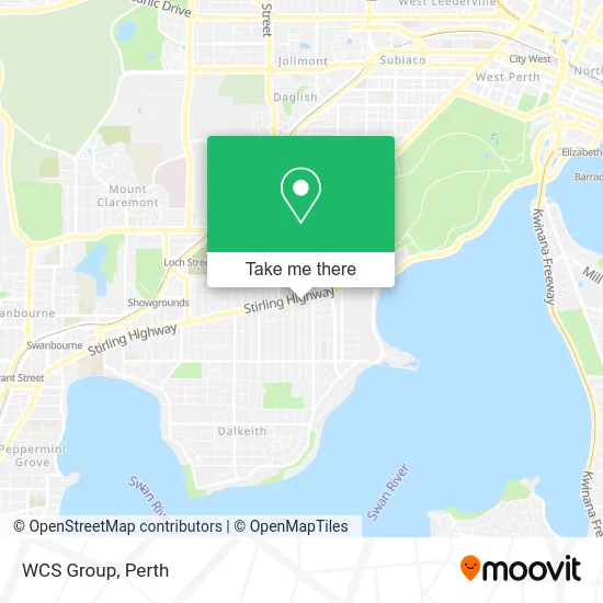
See WCS Group, Nedlands, on the map
Public Transit to WCS Group in Nedlands
Wondering how to get to WCS Group in Nedlands? Moovit helps you find the best way to get to WCS Group with step-by-step directions from the nearest public transit station.
Moovit provides free maps and live directions to help you navigate through your city. View schedules, routes, timetables, and find out how long does it take to get to WCS Group in real time.
Looking for the nearest stop or station to WCS Group? Check out this list of stops closest to your destination: Carrington St Before Smyth Rd; Stirling Hwy After Broadway; Stirling Hwy After Clifton St; Hampden Rd Hampden Road South Cat Id 120; Hampden Rd Hampden Road South Cat Id 128; Loch Street Stn.
Bus: 103, 995, 998, 999, 25, 23, 24, 96, 97, ELIZABETH QUAY BUS STN - HACKETT DR UWA BUSINESS SCHOOL CAT ID 123, 950, 950X.Train: AIRPORT LINE, FREMANTLE LINE, 906.
Want to see if there’s another route that gets you there at an earlier time? Moovit helps you find alternative routes or times. Get directions from and directions to WCS Group easily from the Moovit App or Website.
We make riding to WCS Group easy, which is why over 1.5 million users, including users in Nedlands, trust Moovit as the best app for public transit. You don’t need to download an individual bus app or train app, Moovit is your all-in-one transit app that helps you find the best bus time or train time available.
For information on prices of bus and train, costs and ride fares to WCS Group, please check the Moovit app.
Use the app to navigate to popular places including to the airport, hospital, stadium, grocery store, mall, coffee shop, school, college, and university.
WCS Group Address: 42 Stirling Hwy Nedlands WA 6009 street in Nedlands
- Nedex Delivery,
- Zayasan,
- Health in Mind,
- Key Petroleum,
- Fue Clinics Australia,
- Neurodiagnostic Centre,
- Dr Peter Burke,
- Dr John Clarkson,
- Repair Genius,
- Brightsign Australia,
- Casa Nueva,
- Histories of Australian Rock Art Research,
- PRC Consultants Australia,
- Clover Capital,
- Mouve,
- Ascot Capital,
- ANZ,
- The Switch New To Perth,
- Acicis Study Indonesia,
- The McCusker Centre
Places Near WCS Group (Nedlands)
- IKEA, Innaloo,
- Blue Boat House,
- Hillarys Boat Harbour,
- Sir Charles Gairdner Hospital, Nedlands,
- Langley Park, Perth,
- Royal Perth Hospital, Perth,
- Optus Stadium, Burswood,
- Perth Convention Exhibition Centre, Perth,
- Mount Hospital, Perth,
- Aqwa Aquarium, Hillarys,
- Fiona Stanley Hospital, Murdoch,
- DFO, Perth Airport,
- Westfield Carousel, Cannington,
- Yankee Mart, Baldivis,
- Scitech, West Perth,
- Pelicaan Investment Ho, Bellevue,
- Karrinyup Shopping Centre, Karrinyup,
- Crown Perth Casino, Burswood,
- McCallum Park, Victoria Park,
- Rac Arena, Perth
How to get to popular places in Perth with public transport
Get around Nedlands by public transport!
Travelling around Nedlands has never been so easy. See step by step directions as you travel to any attraction, street or major public transport station. View bus and train timetables, arrival times, service alerts and detailed routes on a map, so you know exactly how to get to anywhere in Nedlands.
When travelling to any destination around Nedlands use Moovit's Live Directions with Get Off Notifications to know exactly where and how far to walk, how long to wait for your line , and how many stops are left. Moovit will alert you when it’s time to get off — no need to constantly re-check whether yours is the next stop.
Wondering how to use public transport in Nedlands or how to pay for public transport in Nedlands? Moovit public transport app can help you navigate your way with public transport easily, and at minimum cost. It includes public transport fees, ticket prices, and costs. Looking for a map of Nedlands public transport lines? Moovit public transport app shows all public transport maps in Nedlands with all Bus, Train and Ferry routes and stops on an interactive map.
Perth has 3 transport type(s), including: Bus, Train and Ferry, operated by several transport agencies, including Transperth Rail, Transwa, Transperth Ferry, Transperth, TransBusselton, TransAlbany, TransGoldfields, TransEsperance, TransGeraldton, TransCarnarvon, TransHedland, TransKarratha, TransBunbury, Mandurah Bus Charter and TransBroome