Walkmill Drive stop - Thursday schedule
| Line | Direction | Time |
|---|---|---|
| 144 | Catshill | 05:57 |
| 144 | Catshill | 06:24 |
| 144 | Catshill | 06:55 |
| 144 | Catshill | 07:26 |
| 144 | Catshill | 07:59 |
| 144 | Catshill | 08:31 |
| 144 | Catshill | 09:05 |
| 144 | Catshill | 09:35 |
| 144 | Catshill | 10:05 |
| 144 | Catshill | 10:35 |
| 145 | Rubery, Supermarket | 10:57 |
| 144 | Catshill | 11:05 |
| 144 | Catshill | 11:36 |
| 144 | Catshill | 12:06 |
| 144 | Catshill | 12:39 |
| 144 | Catshill | 13:07 |
| 145 | Rubery, Supermarket | 13:07 |
| 144 | Catshill | 13:39 |
| 144 | Catshill | 14:08 |
| 144 | Catshill | 14:37 |
| 144 | Catshill | 15:11 |
| 144 | Catshill | 15:44 |
| 144 | Catshill | 16:16 |
| 145 | Sainsburys Longbridge | 16:47 |
| 144 | Catshill | 16:47 |
Directions to Walkmill Drive stop (Dodderhill) with public transport
The following transport lines have routes that pass near Walkmill Drive
 Bus: 144, 145, 145A.
- Train: WEST MIDLANDS RAILWAY.
How to get to Walkmill Drive stop by bus?
Click on the bus route to see step by step directions with maps, line arrival times and updated time schedules.
Bus stops near Walkmill Drive stop in Dodderhill
- St Richard's Road, 8 min walk,
- Paper Mill Lane, 10 min walk,
Train stations near Walkmill Drive station in Dodderhill
- Droitwich Spa, 53 min walk,
Bus lines to Walkmill Drive stop in Dodderhill
- 145, Wychbold Adj St Richards Rd,
- 145A, Webbs Of Wychbold,
- 144, Bromsgrove,
What are the nearest stations to Walkmill Drive?
The nearest stations to Walkmill Drive are:
- St Richard's Road stop is 559 meters away, 8 min walk.
- Paper Mill Lane stop is 725 meters away, 10 min walk.
- Droitwich Spa station is 4181 meters away, 53 min walk.
Which bus line stops near Walkmill Drive?
144 (Catshill)
What’s the nearest bus station to Walkmill Drive in Dodderhill?
The nearest bus station to Walkmill Drive in Dodderhill is St Richard's Road. It’s a 8 min walk away.
What time is the first train to Walkmill Drive in Dodderhill?
The WEST MIDLANDS RAILWAY is the first train that goes to Walkmill Drive in Dodderhill. It stops nearby at 09:13.
What time is the last train to Walkmill Drive in Dodderhill?
The WEST MIDLANDS RAILWAY is the last train that goes to Walkmill Drive in Dodderhill. It stops nearby at 23:43.
What time is the first bus to Walkmill Drive in Dodderhill?
The 144 is the first bus that goes to Walkmill Drive in Dodderhill. It stops nearby at 09:09.
What time is the last bus to Walkmill Drive in Dodderhill?
The 144 is the last bus that goes to Walkmill Drive in Dodderhill. It stops nearby at 18:17.
Walkmill Drive station
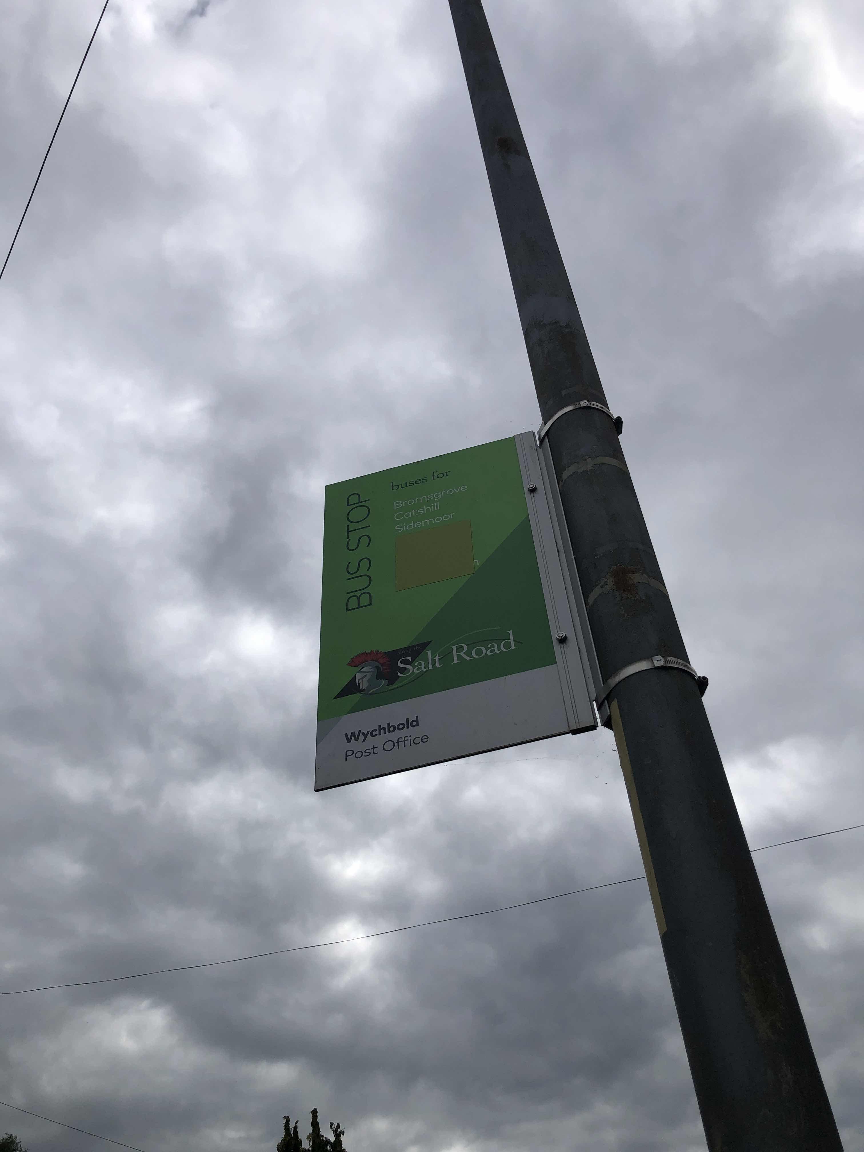 Taken by Anonymous
See Walkmill Drive stop, Dodderhill, on the map
Public transport to Walkmill Drive stop (ID: wocgtpaj) in Dodderhill
Looking for directions to Walkmill Drive in Dodderhill, United Kingdom?
Download the Moovit App to find the current schedule and step-by-step directions for Bus routes that pass through Walkmill Drive.
Looking for the nearest stops closest to Walkmill Drive ? Check out this list of closest stops to your destination: St Richard's Road; Paper Mill Lane; Droitwich Spa.
Bus: 144, 145, 145A.Train: WEST MIDLANDS RAILWAY.
We make riding on public transit to Walkmill Drive easy, which is why over 1.7 billion users, including users in Dodderhill trust Moovit as the best app for public transit.
Use the app to navigate to popular places including to the airport, hospital, stadium, grocery store, mall, coffee shop, school, college, and university.
Walkmill Drive stop’s code is wocgtpaj
The first line to this stop is 144, at 05:57, and the last line is 144 at 18:46.
This stop serves Diamond Bus and First Worcestershire’s lines
- St Richard's Road,
- Paper Mill Lane
Bus stops near Walkmill Drive stop
- Droitwich Spa
Train station near Walkmill Drive station
- Constitution Hill,
- Birmingham Snow Hill,
- Acocks Green,
- Warwick Technology Park,
- Worcestershire Parkway,
- Fox Hollies Leisure Centre,
- Oldbury Cemetery,
- Ward Block (Entrance 1),
- Colmore Circus,
- Bordesley Green,
- Edgehill Road,
- Solihull Town Centre,
- Marston Road,
- Lichfield Road,
- Marsh Lane,
- Grove Crescent,
- Tesco,
- The Hawthorns,
- Osborne Road,
- Bishop Perowne School
Popular public transport stations in Dodderhill
Get around Dodderhill by public transport!
Travelling around Dodderhill has never been so easy. See step by step directions as you travel to any attraction, street or major public transport station. View bus and train timetables, arrival times, service alerts and detailed routes on a map, so you know exactly how to get to anywhere in Dodderhill.
When travelling to any destination around Dodderhill use Moovit's Live Directions with Get Off Notifications to know exactly where and how far to walk, how long to wait for your line , and how many stops are left. Moovit will alert you when it’s time to get off — no need to constantly re-check whether yours is the next stop.
Wondering how to use public transport in Dodderhill or how to pay for public transport in Dodderhill? Moovit public transport app can help you navigate your way with public transport easily, and at minimum cost. It includes public transport fees, ticket prices, and costs. Looking for a map of Dodderhill public transport lines? Moovit public transport app shows all public transport maps in Dodderhill with all Bus, Train and Light rail routes and stops on an interactive map.
West Midlands has 3 transport type(s), including: Bus, Train and Light rail, operated by several transport agencies, including National Express West Midlands, National Express Coventry, National Express, Diamond Bus, Arriva Midlands, Stagecoach Midlands, West Midlands Metro, Stagecoach West, Stagecoach South Wales, First Potteries, First Worcestershire, LandFlight, trentbarton, D & G Bus and Flexibus