Directions to Webb Bridge (Docklands) with public transport
The following transport lines have routes that pass near Webb Bridge
How to get to Webb Bridge by bus?
Click on the bus route to see step by step directions with maps, line arrival times and updated time schedules.
How to get to Webb Bridge by train?
Click on the train route to see step by step directions with maps, line arrival times and updated time schedules.
Tram stations near Webb Bridge in Docklands
- D4-Docklands Park/Harbour Esp (Docklands), 4 min walk,
- D16-Harbour Esp/Collins St (Docklands), 5 min walk,
Bus stations near Webb Bridge in Docklands
- Skybus Coach Terminal/Spencer St (Melbourne City), 5 min walk,
- Ingles St/Normanby Rd (Port Melbourne), 5 min walk,
- Eighteen Pence Ln/Lorimer St (Southbank), 9 min walk,
- Collins Square/Batmans Hill Dr (Docklands), 11 min walk,
Bus lines to Webb Bridge in Docklands
- AVALON CITY EXPRESS, Avalon Airport,
- 235, City (Queen Victoria Market),
- 237, City (Queen Victoria Market),
- 232, Altona North,
What are the nearest stations to Webb Bridge?
The nearest stations to Webb Bridge are:
- D4-Docklands Park/Harbour Esp (Docklands) is 236 meters away, 4 min walk.
- Skybus Coach Terminal/Spencer St (Melbourne City) is 318 meters away, 5 min walk.
- Ingles St/Normanby Rd (Port Melbourne) is 326 meters away, 5 min walk.
- D16-Harbour Esp/Collins St (Docklands) is 351 meters away, 5 min walk.
- Eighteen Pence Ln/Lorimer St (Southbank) is 621 meters away, 9 min walk.
- Collins Square/Batmans Hill Dr (Docklands) is 722 meters away, 11 min walk.
Which bus lines stop near Webb Bridge?
These bus lines stop near Webb Bridge: 232, 606.
Which train lines stop near Webb Bridge?
These train lines stop near Webb Bridge: CRAIGIEBURN, GLEN WAVERLEY, PAKENHAM, WERRIBEE.
Which tram lines stop near Webb Bridge?
These tram lines stop near Webb Bridge: 11, 48, 70, 75.
What’s the nearest tram station to Webb Bridge in Docklands?
The nearest tram station to Webb Bridge in Docklands is D4-Docklands Park/Harbour Esp (Docklands). It’s a 4 min walk away.
What’s the nearest bus stop to Webb Bridge in Docklands?
The nearest bus stops to Webb Bridge in Docklands are Skybus Coach Terminal/Spencer St (Melbourne City) and Ingles St/Normanby Rd (Port Melbourne). The closest one is a 5 min walk away.
What time is the first tram to Webb Bridge in Docklands?
The 75 is the first tram that goes to Webb Bridge in Docklands. It stops nearby at 03:03.
What time is the last tram to Webb Bridge in Docklands?
The 11 is the last tram that goes to Webb Bridge in Docklands. It stops nearby at 00:37.
What time is the first bus to Webb Bridge in Docklands?
The AVALON CITY EXPRESS is the first bus that goes to Webb Bridge in Docklands. It stops nearby at 03:50.
What time is the last bus to Webb Bridge in Docklands?
The 235 is the last bus that goes to Webb Bridge in Docklands. It stops nearby at 00:04.
See Webb Bridge, Docklands, on the map
Public Transit to Webb Bridge in Docklands
How to get to Webb Bridge in Docklands, Australia?
It’s easy with Moovit. Type in your street address and Moovit’s route finder will locate the fastest way to get you there! Not sure where to get off on the street? Download the Moovit App to find live directions (including where to get off on Webb Bridge), see timetables and get the estimated arrival times for your favourite tram, bus or train lines.
Looking for the nearest stop or station to Webb Bridge? Check out this list of closest stops available to your destination: D4-Docklands Park/Harbour Esp (Docklands); Skybus Coach Terminal/Spencer St (Melbourne City); Ingles St/Normanby Rd (Port Melbourne); D16-Harbour Esp/Collins St (Docklands); Eighteen Pence Ln/Lorimer St (Southbank); Collins Square/Batmans Hill Dr (Docklands).
Bus: 232, 606, AVALON CITY EXPRESS, 235, 237.Train: CRAIGIEBURN, GLEN WAVERLEY, PAKENHAM, WERRIBEE.Tram: 11, 48, 70, 75.
Download the Moovit App to see the current schedule and routes available for Docklands. No need to install a special bus app to check the bus time or a train app to get train time. Moovit is the only all-in-one transport app that helps you get where you need to go.
We make riding on public transit to Webb Bridge easy, which is why over 1.5 million users, including users in Docklands trust Moovit as the best app for public transport.
Use the app to navigate to popular places including to the airport, hospital, stadium, grocery store, mall, coffee shop, school, college, and university.
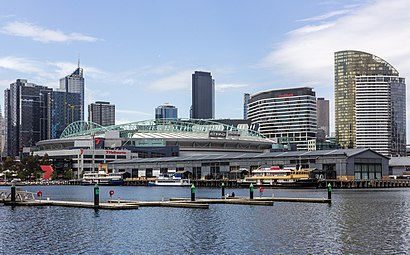
Location: Docklands, Melbourne
Streets near Webb Bridge, Docklands
Charles Grimes Bridge Road, Docklands,Wurundjeri Way, Southbank,Australian Wharf, Docklands,Jim Stynes Bridge, Docklands,Capital City Trail Main Yarra Trail, Southbank,Mccrae Street, Docklands,Montague Street, Docklands,Cargo Lane, Docklands,Lorimer Street, Southbank,Wright Walk, Southbank,Convention Centre Place, Southbank,Eighteen Pence Lane, Docklands,Batmans Hill Drive, Docklands,Navigation Drive, Docklands,Capital City Trail, Docklands,Montague Street, Southbank,Ferryman Lane, Docklands,Lorimer Street Offramp, Southbank,Rona Walk, Southbank,South Wharf Promenade, SouthbankGet around Melbourne by public transport!
Travelling around Melbourne has never been so easy. See step by step directions as you travel to any attraction, street or major public transport station. View bus and train timetables, arrival times, service alerts and detailed routes on a map, so you know exactly how to get to anywhere in Melbourne.
When travelling to any destination around Melbourne use Moovit's Live Directions with Get Off Notifications to know exactly where and how far to walk, how long to wait for your line , and how many stops are left. Moovit will alert you when it’s time to get off — no need to constantly re-check whether yours is the next stop.
Wondering how to use public transport in Melbourne or how to pay for public transport in Melbourne? Moovit public transport app can help you navigate your way with public transport easily, and at minimum cost. It includes public transport fees, ticket prices, and costs. Looking for a map of Melbourne public transport lines? Moovit public transport app shows all public transport maps in Melbourne with all Bus, Train and Tram routes and stops on an interactive map.
Melbourne has 3 transport type(s), including: Bus, Train and Tram, operated by several transport agencies, including PTV Metropolitan Trains, PTV Metropolitan Bus, Yarra Trams, PTV Regional Bus, SkyBus, Interstate Services, V/Line, V/Line (Coach)