West Ruislip Station (S) stop - Sunday schedule
| Line | Direction | Time |
|---|---|---|
| 278 | Heathrow Central | 03:04 |
| 278 | Heathrow Central | 03:34 |
| 278 | Heathrow Central | 04:04 |
| 278 | Heathrow Central | 04:34 |
| 278 | Heathrow Central | 05:04 |
| 278 | Heathrow Central | 05:29 |
| 278 | Heathrow Central | 05:59 |
| 278 | Heathrow Central | 06:29 |
| U1 | West Drayton | 06:44 |
| 278 | Heathrow Central | 06:59 |
| U1 | West Drayton | 07:14 |
| 278 | Heathrow Central | 07:29 |
| U1 | West Drayton | 07:44 |
| 278 | Heathrow Central | 07:59 |
| U1 | West Drayton | 08:14 |
| 278 | Heathrow Central | 08:19 |
| 278 | Heathrow Central | 08:39 |
| U1 | West Drayton | 08:44 |
| 278 | Heathrow Central | 08:59 |
| U1 | West Drayton | 09:13 |
| 278 | Heathrow Central | 09:19 |
| 278 | Heathrow Central | 09:39 |
| U1 | West Drayton | 09:43 |
| 278 | Heathrow Central | 09:59 |
| U1 | West Drayton | 10:12 |
See West Ruislip Station on the map
Directions to West Ruislip Station with public transportation
The following transport lines have routes that pass near West Ruislip Station
 Bus:
Bus: - Train:
- Tube:
How to get to West Ruislip Station by bus?
Click on the bus route to see step by step directions with maps, line arrival times and updated time schedules.
How to get to West Ruislip Station by train?
Click on the train route to see step by step directions with maps, line arrival times and updated time schedules.
How to get to West Ruislip Station by Tube?
Click on the Tube route to see step by step directions with maps, line arrival times and updated time schedules.
Bus stations near West Ruislip Station
- Church Avenue (Q),3 min walk,
- Sharps Lane (R),4 min walk,
- West Ruislip,9 min walk,
Tube stations near West Ruislip Station
- Ruislip,12 min walk,
Bus routes to West Ruislip Station
- U1,West Drayton,
- E7,Ealing Broadway,
- 278,Ruislip,
- U10,Ruislip, Heathfield Rise,
- CENTRAL,Hainault,
- CHILTERN RAILWAYS,Oxford,
- CHILTERN RAILWAYS,Bus Replacement: West Ruislip,
What are the nearest stations to West Ruislip Station?
The nearest stations to West Ruislip Station are:
- Church Avenue (Q) is 221 meters away, 3 min walk.
- Sharps Lane (R) is 248 meters away, 4 min walk.
- West Ruislip is 666 meters away, 9 min walk.
- Ruislip is 889 meters away, 12 min walk.
Which bus lines stop near West Ruislip Station?
These bus lines stop near West Ruislip Station: 278, U1, U10.
Which train line stops near West Ruislip Station?
CHILTERN RAILWAYS
Which Tube lines stop near West Ruislip Station?
These Tube lines stop near West Ruislip Station: CENTRAL, METROPOLITAN, PICCADILLY.
What’s the nearest Tube station to West Ruislip Station?
The nearest Tube station to West Ruislip Station is Ruislip. It’s a 12 min walk away.
What’s the nearest bus stop to West Ruislip Station?
The nearest bus stop to West Ruislip Station is Church Avenue (Q). It’s a 3 min walk away.
What time is the first Tube to West Ruislip Station?
The METROPOLITAN is the first Tube that goes to West Ruislip Station. It stops nearby at 05:14.
What time is the last Tube to West Ruislip Station?
The PICCADILLY is the last Tube that goes to West Ruislip Station. It stops nearby at 01:29.
What time is the first train to West Ruislip Station?
The CHILTERN RAILWAYS is the first train that goes to West Ruislip Station. It stops nearby at 05:59.
What time is the last train to West Ruislip Station?
The CHILTERN RAILWAYS is the last train that goes to West Ruislip Station. It stops nearby at 00:32.
What time is the first bus to West Ruislip Station?
The 278 is the first bus that goes to West Ruislip Station. It stops nearby at 03:02.
What time is the last bus to West Ruislip Station?
The 278 is the last bus that goes to West Ruislip Station. It stops nearby at 01:40.
See West Ruislip Station on the map
Public transport to West Ruislip Station (S) stop (ID: S)
Looking for directions to West Ruislip Station in Ruislip, United Kingdom?
Download the Moovit App to find the current schedule and step-by-step directions for Bus, Train or Tube routes that pass through West Ruislip Station.
Looking for the nearest stops closest to West Ruislip Station ? Check out this list of closest stops to your destination: Church Avenue (Q); Sharps Lane (R); West Ruislip; Ruislip.
Bus:Train:Tube:
We make riding on public transit to West Ruislip Station easy, which is why over 1.5 million users, including users in Ruislip trust Moovit as the best app for public transit.
Use the app to navigate to popular places including to the airport, hospital, stadium, grocery store, mall, coffee shop, school, college, and university.
West Ruislip Station (S) stop’s code is S
The first line to this stop is 278, at 03:04, and the last line is U1 at 01:14.
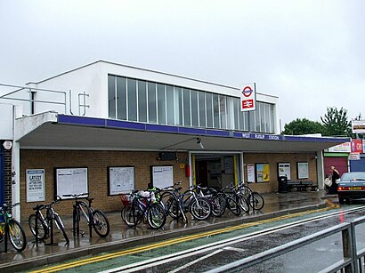
High Road Ickenham, London, England, United Kingdom
This stop serves London Buses’s lines
Tube station near West Ruislip Station (S)
RuislipPopular public transport stations in Ruislip
St George's Hospital / Main Entrance (HV),Stratford International DLR,Bluewater Shopping Centre (7),Moorfields Eye Hospital (T),Westminster City Hall (SA),Barbican,West Cromwell Road Tesco, Earls Court,East Surrey Hospital, Earlswood,Maze Hill,Rose Theatre, Kingston upon Thames,West Berkshire Community Hospital, Newbury,Queensbury Academy, Dunstable,Tufnell Park,Darent Valley Hospital,Thames Ditton,Tonbridge Grammar School For Girls, Tonbridge,Stratford International Station (F),Bus Station, Basingstoke,Animal Reception Centre (E),High Street KensingtonGet around Ruislip by public transport!
Travelling around Ruislip has never been so easy. See step by step directions as you travel to any attraction, street or major public transport station. View bus and train timetables, arrival times, service alerts and detailed routes on a map, so you know exactly how to get to anywhere in Ruislip.
When travelling to any destination around Ruislip use Moovit's Live Directions with Get Off Notifications to know exactly where and how far to walk, how long to wait for your line , and how many stops are left. Moovit will alert you when it’s time to get off — no need to constantly re-check whether yours is the next stop.
Wondering how to use public transport in Ruislip or how to pay for public transport in Ruislip? Moovit public transport app can help you navigate your way with public transport easily, and at minimum cost. It includes public transport fees, ticket prices, and costs. Looking for a map of Ruislip public transport lines? Moovit public transport app shows all public transport maps in Ruislip with all bus, train or Tube routes and stops on an interactive map.
Ruislip has 3 transport type(s), including: bus, train or Tube, operated by several transport agencies, including London Underground, London Buses, Transport for London, London Tramlink, Transport for London, National Rail, Bluestar, Berry's Coaches, Oxford Bus Company, Stagecoach West, Community First Wessex, Cresta Coaches, D & P Boat Hire, First Portsmouth, Fareham & Gosport and FYTbus