Directions to Wfi (Bassendean) with public transport
The following transport lines have routes that pass near Wfi
 Bus: 356, 40, 45, 999, MIDLAND LINE.
- Train: MIDLAND LINE.
How to get to Wfi by bus?
Click on the bus route to see step by step directions with maps, line arrival times and updated time schedules.
From 15 Robinson Avenue, Perth
54 minFrom Officeworks, Subiaco
88 minFrom Victoria Park Western Australia, Victoria Park
59 minFrom Bennett Springs, Beechboro
49 minFrom The Merrywell, Burswood
59 minFrom Belgian Beer Cafe, Perth
56 minFrom South Metropolitan Tafe (Bentley Campus), Bentley
74 minFrom Como Hotel, South Perth
70 minFrom Queens Park, Queens Park
75 minFrom Zamia Cafe, Perth
88 min
How to get to Wfi by train?
Click on the train route to see step by step directions with maps, line arrival times and updated time schedules.
Bus stops near Wfi in Bassendean
Bus lines to Wfi in Bassendean
What are the nearest stations to Wfi?
The nearest stations to Wfi are:
- Ashfield Stn is 431 meters away, 7 min walk.
- Margaret St Before Colstoun Rd is 1040 meters away, 15 min walk.
- Meltham Stn is 1302 meters away, 17 min walk.
- Collier Rd After Alice St is 1434 meters away, 20 min walk.
Which bus lines stop near Wfi?
These bus lines stop near Wfi: 356, 40, 45, 999.
Which train line stops near Wfi?
MIDLAND LINE (Midland Stn)
What’s the nearest bus station to Wfi in Bassendean?
The nearest bus station to Wfi in Bassendean is Ashfield Stn. It’s a 7 min walk away.
What time is the first train to Wfi in Bassendean?
The AIRPORT LINE is the first train that goes to Wfi in Bassendean. It stops nearby at 05:17.
What time is the last train to Wfi in Bassendean?
The MIDLAND LINE is the last train that goes to Wfi in Bassendean. It stops nearby at 00:19.
What time is the first bus to Wfi in Bassendean?
The 45 is the first bus that goes to Wfi in Bassendean. It stops nearby at 05:19.
What time is the last bus to Wfi in Bassendean?
The 901 is the last bus that goes to Wfi in Bassendean. It stops nearby at 00:32.
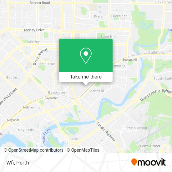
See Wfi, Bassendean, on the map
Public Transit to Wfi in Bassendean
Wondering how to get to Wfi in Bassendean? Moovit helps you find the best way to get to Wfi with step-by-step directions from the nearest public transit station.
Moovit provides free maps and live directions to help you navigate through your city. View schedules, routes, timetables, and find out how long does it take to get to Wfi in real time.
Looking for the nearest stop or station to Wfi? Check out this list of stops closest to your destination: Ashfield Stn; Margaret St Before Colstoun Rd; Meltham Stn; Collier Rd After Alice St.
Bus: 356, 40, 45, 999, MIDLAND LINE, 901, AIRPORT LINE, ELLENBROOK LINE, 902, 903, 47.Train: MIDLAND LINE.
Want to see if there’s another route that gets you there at an earlier time? Moovit helps you find alternative routes or times. Get directions from and directions to Wfi easily from the Moovit App or Website.
We make riding to Wfi easy, which is why over 1.5 million users, including users in Bassendean, trust Moovit as the best app for public transit. You don’t need to download an individual bus app or train app, Moovit is your all-in-one transit app that helps you find the best bus time or train time available.
For information on prices of train and bus, costs and ride fares to Wfi, please check the Moovit app.
Use the app to navigate to popular places including to the airport, hospital, stadium, grocery store, mall, coffee shop, school, college, and university.
Wfi Address: 184 Railway Pde Bassendean WA 6054 street in Bassendean
- Dowell Windows,
- Sea-Doo Sport and Leisure,
- Bayswater Ink,
- Glassential Development,
- Unasco,
- TLT Fans,
- Ajm Constructions,
- Effective Building Group,
- Kingstyle Investments,
- Ashfield Station WA Australia,
- Tempe Tyres Perth,
- Ashfield Station,
- Bis Fabrication,
- Dellawyatt,
- Corprahire Staging and Dance Floor Hire,
- Tabb Automotive,
- Amg Interiors,
- Kleenduct (Wa),
- Ashfield Wa Fitclub,
- Concept Rail Services Pty
Places Near Wfi (Bassendean)
- Yankee Mart, Baldivis,
- Aqwa Aquarium, Hillarys,
- Watertown, Perth,
- Perth Convention Exhibition Centre, Perth,
- Karrinyup Shopping Centre, Karrinyup,
- Westfield Carousel, Cannington,
- Sir Charles Gairdner Hospital, Nedlands,
- Scitech, West Perth,
- Fiona Stanley Hospital, Murdoch,
- Mount Hospital, Perth,
- Optus Stadium, Burswood,
- Royal Perth Hospital, Perth,
- Rac Arena, Perth,
- Blue Boat House,
- IKEA, Innaloo,
- Pelicaan Investment Ho, Bellevue,
- Langley Park, Perth,
- Crown Perth Casino, Burswood,
- DFO, Perth Airport,
- McCallum Park, Victoria Park
How to get to popular places in Perth with public transport
Get around Bassendean by public transport!
Travelling around Bassendean has never been so easy. See step by step directions as you travel to any attraction, street or major public transport station. View bus and train timetables, arrival times, service alerts and detailed routes on a map, so you know exactly how to get to anywhere in Bassendean.
When travelling to any destination around Bassendean use Moovit's Live Directions with Get Off Notifications to know exactly where and how far to walk, how long to wait for your line , and how many stops are left. Moovit will alert you when it’s time to get off — no need to constantly re-check whether yours is the next stop.
Wondering how to use public transport in Bassendean or how to pay for public transport in Bassendean? Moovit public transport app can help you navigate your way with public transport easily, and at minimum cost. It includes public transport fees, ticket prices, and costs. Looking for a map of Bassendean public transport lines? Moovit public transport app shows all public transport maps in Bassendean with all Bus, Train and Ferry routes and stops on an interactive map.
Perth has 3 transport type(s), including: Bus, Train and Ferry, operated by several transport agencies, including Transperth Rail, Transwa, Transperth Ferry, Transperth, TransBusselton, TransAlbany, TransGoldfields, TransEsperance, TransGeraldton, TransCarnarvon, TransHedland, TransKarratha, TransBunbury, Mandurah Bus Charter and TransBroome