Directions to Willowbrook Shopping Centre (Langley District Municipality) with public transportation
The following transit lines have routes that pass near Willowbrook Shopping Centre
How to get to Willowbrook Shopping Centre by bus?
Click on the bus route to see step by step directions with maps, line arrival times and updated time schedules.
Bus stops near Willowbrook Shopping Centre in Langley District Municipality
- Mall Access Rd @ Willowbrook Mall, 4 min walk,
- Northbound Willowbrook Dr @ 19600 Block, 5 min walk,
- Westbound Fraser Hwy @ 196a St, 5 min walk,
- Eastbound Willowbrook Dr @ 197 St, 6 min walk,
- Eastbound Fraser Hwy @ 196 St, 7 min walk,
Bus lines to Willowbrook Shopping Centre in Langley District Municipality
- 370, Cloverdale,
- 564, Langley Centre,
- 501, Surrey Central Station,
- 502, Langley Centre,
- 503, Fraser Hwy Exp/Surrey Central Station,
- 531, White Rock Centre,
- 320, Surrey Central Station,
What are the closest stations to Willowbrook Shopping Centre?
The closest stations to Willowbrook Shopping Centre are:
- Mall Access Rd @ Willowbrook Mall is 257 meters away, 4 min walk.
- Northbound Willowbrook Dr @ 19600 Block is 378 meters away, 5 min walk.
- Westbound Fraser Hwy @ 196a St is 380 meters away, 5 min walk.
- Eastbound Willowbrook Dr @ 197 St is 437 meters away, 6 min walk.
- Eastbound Fraser Hwy @ 196 St is 520 meters away, 7 min walk.
Which bus lines stop near Willowbrook Shopping Centre?
These bus lines stop near Willowbrook Shopping Centre: 370, 501, 502, 531.
What’s the nearest bus stop to Willowbrook Shopping Centre in Langley District Municipality?
The nearest bus stop to Willowbrook Shopping Centre in Langley District Municipality is Mall Access Rd @ Willowbrook Mall. It’s a 4 min walk away.
What time is the first bus to Willowbrook Shopping Centre in Langley District Municipality?
The 502 is the first bus that goes to Willowbrook Shopping Centre in Langley District Municipality. It stops nearby at 4:27 AM.
What time is the last bus to Willowbrook Shopping Centre in Langley District Municipality?
The 320 is the last bus that goes to Willowbrook Shopping Centre in Langley District Municipality. It stops nearby at 2:56 AM.
See Willowbrook Shopping Centre, Langley District Municipality, on the map
Public Transit to Willowbrook Shopping Centre in Langley District Municipality
Wondering how to get to Willowbrook Shopping Centre in Langley District Municipality, Canada? Moovit helps you find the best way to get to Willowbrook Shopping Centre with step-by-step directions from the nearest public transit station.
Moovit provides free maps and live directions to help you navigate through your city. View schedules, routes, timetables, and find out how long does it take to get to Willowbrook Shopping Centre in real time.
Looking for the nearest stop or station to Willowbrook Shopping Centre? Check out this list of stops closest to your destination: Mall Access Rd @ Willowbrook Mall; Northbound Willowbrook Dr @ 19600 Block; Westbound Fraser Hwy @ 196a St; Eastbound Willowbrook Dr @ 197 St; Eastbound Fraser Hwy @ 196 St.
Bus: 370, 501, 502, 531, 564, 503, 320.
Want to see if there’s another route that gets you there at an earlier time? Moovit helps you find alternative routes or times. Get directions from and directions to Willowbrook Shopping Centre easily from the Moovit App or Website.
We make riding to Willowbrook Shopping Centre easy, which is why over 1.5 million users, including users in Langley District Municipality, trust Moovit as the best app for public transit. You don’t need to download an individual bus app or train app, Moovit is your all-in-one transit app that helps you find the best bus time or train time available.
For information on prices of bus, costs and ride fares to Willowbrook Shopping Centre, please check the Moovit app.
Use the app to navigate to popular places including to the airport, hospital, stadium, grocery store, mall, coffee shop, school, college, and university.
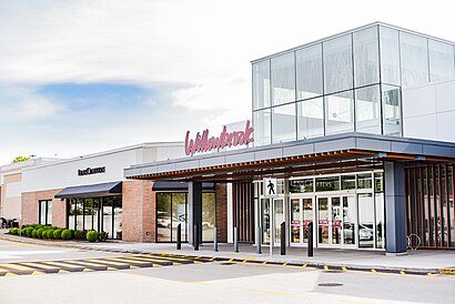
Willowbrook Shopping Centre Address: Willowbrook Shopping Centre, 19705 Fraser Highway, Langley, BC V3A 7E9, Canada street in Langley District Municipality
Attractions near Willowbrook Shopping Centre
Charlotte Tilbury,Virgin Plus,Escents Aromatherapy,Arctic Fame Diamonds,Vivah-Sterling Silver Jewellery & Accessories,Dairy Queen,Awesome Blossoms,Quilts Etc.,Coles Books,Tacotime,Rogers,Willowbrook Shopping Centre (Willowbrook Centre),Sweet Factory,Nail Studio,Mobile Q,Nordstrom Rack,ChargePoint,Lee's Donuts,Warehouse One,Westland InsuranceHow to get to popular attractions in Langley District Municipality with public transit
22nd Street SkyTrain Station, New Westminster,British Airways First Class Lounge Vancouver Airport, Richmond,Richmond General Hospital, Richmond,La Quinta Inn Vancouver Airport, Richmond,Holiday Inn Express Vancouver Airport - Richmond, Richmond,Long Term Parking, Sunshine Coast F,Rosedale on Robson Suite Hotel, Vancouver,Queen's Park, New Westminster,West 4th Avenue, Vancouver,International Village, Vancouver,Radiology Dept - St Paul's Hospital, Vancouver,Garibaldi Provincial Park, Squamish,Hare Krishna ISKCON Temple, Burnaby,Mcbarge, Maple Ridge,Hen Long Market, Surrey,WorldMark Vancouver - The Canadian, Vancouver,Canada Post Pacific Processing Centre, Richmond,Costco Wholesale Nanaimo BC, Nanaimo,Norvan Falls Trail, North Vancouver,Rocky Mountaineer Vancouver Station, VancouverGet around Southwest British Columbia by public transit!
Traveling around Southwest British Columbia has never been so easy. See step by step directions as you travel to any attraction, street or major public transit station. View bus and train schedules, arrival times, service alerts and detailed routes on a map, so you know exactly how to get to anywhere in Southwest British Columbia.
When traveling to any destination around Southwest British Columbia use Moovit's Live Directions with Get Off Notifications to know exactly where and how far to walk, how long to wait for your line, and how many stops are left. Moovit will alert you when it's time to get off — no need to constantly re-check whether yours is the next stop.
Wondering how to use public transit in Southwest British Columbia or how to pay for public transit in Southwest British Columbia? Moovit public transit app can help you navigate your way with public transit easily, and at minimum cost. It includes public transit fees, ticket prices, and costs. Looking for a map of Southwest British Columbia public transit lines? Moovit public transit app shows all public transit maps in Southwest British Columbia with all Bus, Train, SkyTrain and Ferry routes and stops on an interactive map.
Southwest British Columbia has 4 transit type(s), including: Bus, Train, SkyTrain and Ferry, operated by several transit agencies, including TransLink, False Creek Ferries, BC Ferries, Aquabus, BC Transit - Central Fraser Valley Transit System, BCTransit, BC Transit - Comox Valley Transit System, BC Transit - Aggasiz-Harrison and Hope Transit System, BC Transit - Chilliwack Transit System, BC Transit - Squamish, BC Transit - Whistler Transit System, BC Transit - Cowichan Valley Regional Transit System, BC Transit - Campbell River Transit System, BC Transit - Powell River Regional Transit System, BC Transit - Sunshine Coast Transit System