
231 Bus Route Map
View the 231 route map and see all 231 stops along the route. The map of 231 shows where the bus travels and the location of each stop, making it easy to understand the entire route at a glance.
Explore Stagecoach East Midlands routes on the map and see where Stagecoach East Midlands bus services operate. Use the 231 map to find bus stops and see how the 231 connects different areas along its trip.
All 231 stops on the map are displayed in route order, helping you follow the 231 bus from the first stop to the last.
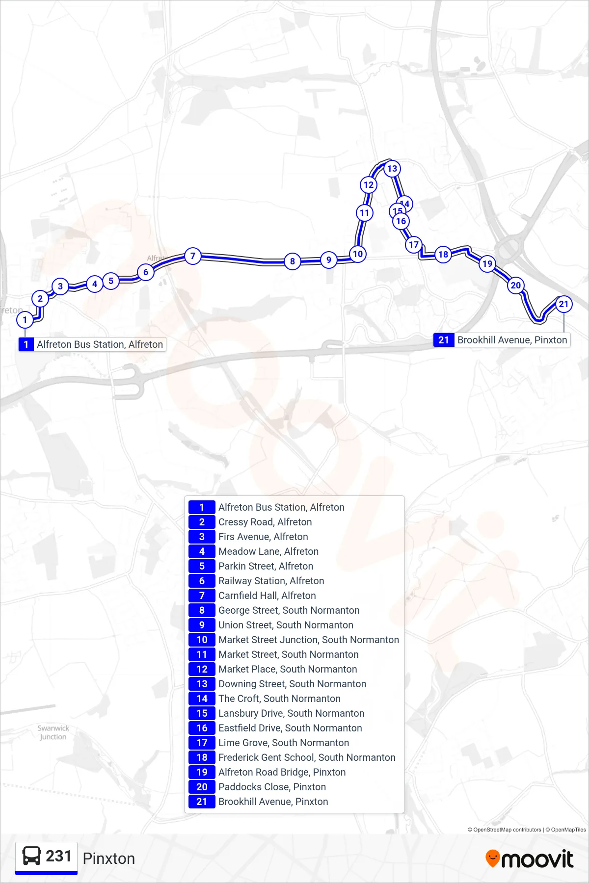
Stops list (231 - Pinxton)
- Alfreton Bus Station, Alfreton
- Cressy Road, Alfreton
- Firs Avenue, Alfreton
- Meadow Lane, Alfreton
- Parkin Street, Alfreton
- Railway Station, Alfreton
- Carnfield Hall, Alfreton
- George Street, South Normanton
- Union Street, South Normanton
- Market Street Junction, South Normanton
- Market Street, South Normanton
- Market Place, South Normanton
- Downing Street, South Normanton
- The Croft, South Normanton
- Lansbury Drive, South Normanton
- Eastfield Drive, South Normanton
- Lime Grove, South Normanton
- Frederick Gent School, South Normanton
- Alfreton Road Bridge, Pinxton
- Paddocks Close, Pinxton
- Brookhill Avenue, Pinxton