
32A Bus Route Map
View the 32A route map and see all 32A stops along the route. The map of 32A shows where the bus travels and the location of each stop, making it easy to understand the entire route at a glance.
Explore D & G Bus routes on the map and see where D & G Bus bus services operate. Use the 32A map to find bus stops and see how the 32A connects different areas along its trip.
All 32A stops on the map are displayed in route order, helping you follow the 32A bus from the first stop to the last.
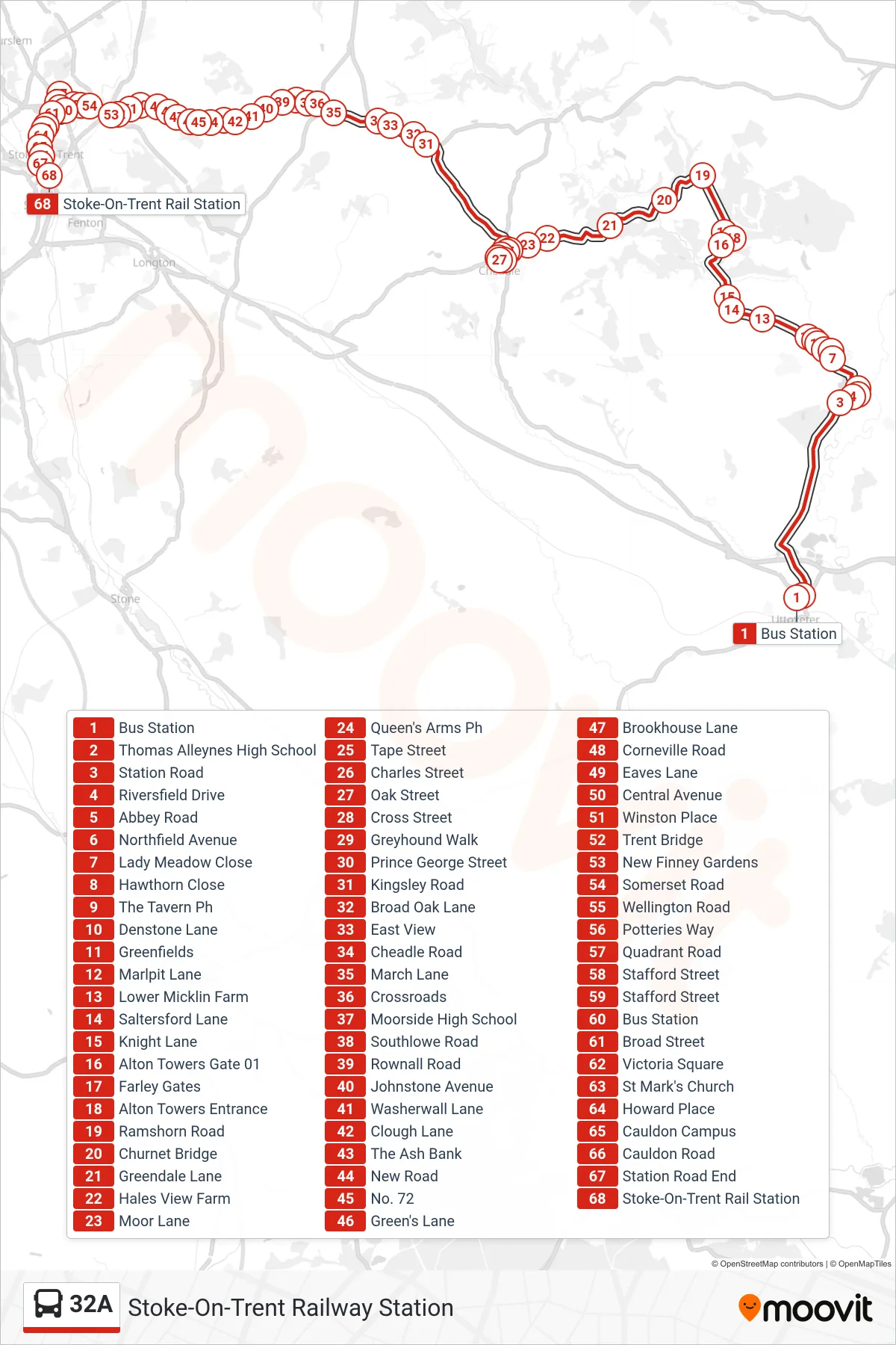
Stops list (32A - Stoke-On-Trent Railway Station)
- Bus Station
- Thomas Alleynes High School
- Station Road
- Riversfield Drive
- Abbey Road
- Northfield Avenue
- Lady Meadow Close
- Hawthorn Close
- The Tavern Ph
- Denstone Lane
- Greenfields
- Marlpit Lane
- Lower Micklin Farm
- Saltersford Lane
- Knight Lane
- Alton Towers Gate 01
- Farley Gates
- Alton Towers Entrance
- Ramshorn Road
- Churnet Bridge
- Greendale Lane
- Hales View Farm
- Moor Lane
- Queen's Arms Ph
- Tape Street
- Charles Street
- Oak Street
- Cross Street
- Greyhound Walk
- Prince George Street
- Kingsley Road
- Broad Oak Lane
- East View
- Cheadle Road
- March Lane
- Crossroads
- Moorside High School
- Southlowe Road
- Rownall Road
- Johnstone Avenue
- Washerwall Lane
- Clough Lane
- The Ash Bank
- New Road
- No. 72
- Green's Lane
- Brookhouse Lane
- Corneville Road
- Eaves Lane
- Central Avenue
- Winston Place
- Trent Bridge
- New Finney Gardens
- Somerset Road
- Wellington Road
- Potteries Way
- Quadrant Road
- Stafford Street
- Stafford Street
- Bus Station
- Broad Street
- Victoria Square
- St Mark's Church
- Howard Place
- Cauldon Campus
- Cauldon Road
- Station Road End
- Stoke-On-Trent Rail Station