
BOB1B Bus Route Map
View the BOB1B route map and see all BOB1B stops along the route. The map of BOB1B shows where the bus travels and the location of each stop, making it easy to understand the entire route at a glance.
Explore Totness Community Bus routes on the map and see where Totness Community Bus bus services operate. Use the BOB1B map to find bus stops and see how the BOB1B connects different areas along its trip.
All BOB1B stops on the map are displayed in route order, helping you follow the BOB1B bus from the first stop to the last.
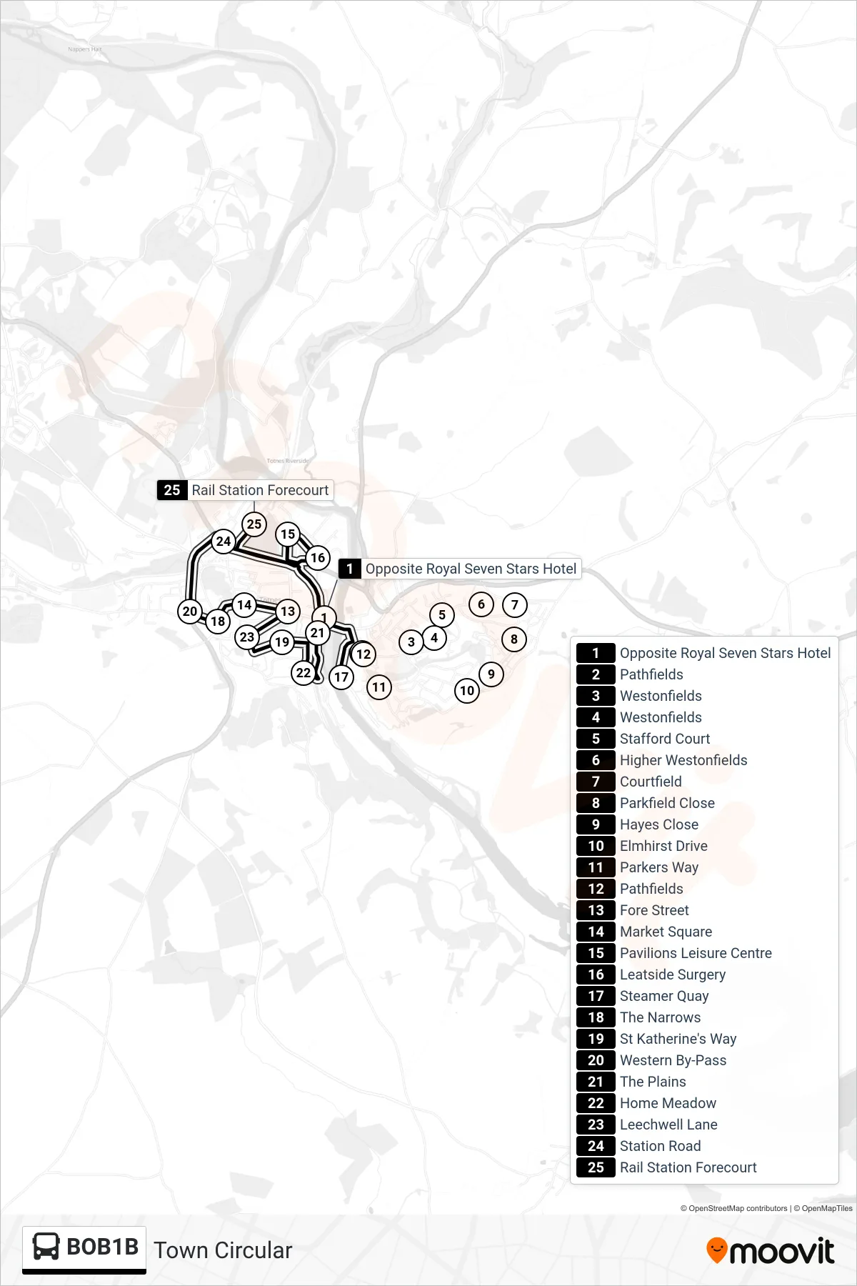
Stops list (BOB1B - Town Circular)
- Opposite Royal Seven Stars Hotel
- Pathfields
- Westonfields
- Westonfields
- Stafford Court
- Higher Westonfields
- Courtfield
- Parkfield Close
- Hayes Close
- Elmhirst Drive
- Parkers Way
- Pathfields
- Fore Street
- Market Square
- Pavilions Leisure Centre
- Leatside Surgery
- Steamer Quay
- The Narrows
- St Katherine's Way
- Western By-Pass
- The Plains
- Home Meadow
- Leechwell Lane
- Station Road
- Rail Station Forecourt