
E14 Bus Route Map
View the E14 route map and see all E14 stops along the route. The map of E14 shows where the bus travels and the location of each stop, making it easy to understand the entire route at a glance.
Explore Ember routes on the map and see where Ember bus services operate. Use the E14 map to find bus stops and see how the E14 connects different areas along its trip.
All E14 stops on the map are displayed in route order, helping you follow the E14 bus from the first stop to the last.
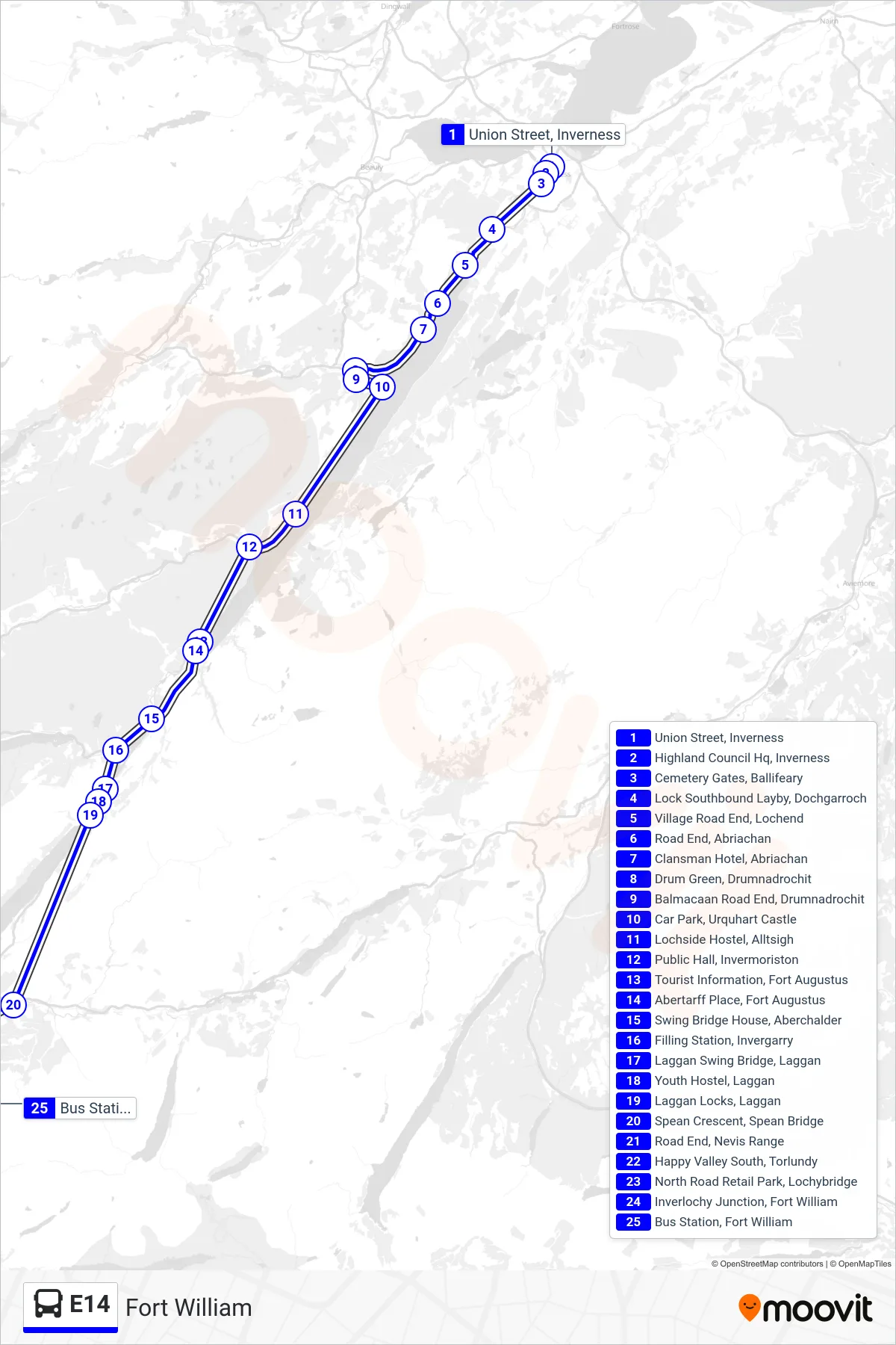
Stops list (E14 - Fort William)
- Union Street, Inverness
- Highland Council Hq, Inverness
- Cemetery Gates, Ballifeary
- Lock Southbound Layby, Dochgarroch
- Village Road End, Lochend
- Road End, Abriachan
- Clansman Hotel, Abriachan
- Drum Green, Drumnadrochit
- Balmacaan Road End, Drumnadrochit
- Car Park, Urquhart Castle
- Lochside Hostel, Alltsigh
- Public Hall, Invermoriston
- Tourist Information, Fort Augustus
- Abertarff Place, Fort Augustus
- Swing Bridge House, Aberchalder
- Filling Station, Invergarry
- Laggan Swing Bridge, Laggan
- Youth Hostel, Laggan
- Laggan Locks, Laggan
- Spean Crescent, Spean Bridge
- Road End, Nevis Range
- Happy Valley South, Torlundy
- North Road Retail Park, Lochybridge
- Inverlochy Junction, Fort William
- Bus Station, Fort William