
O7 Tram Route Map
View the O7 route map and see all O7 stops along the route. The map of O7 shows where the tram travels and the location of each stop, making it easy to understand the entire route at a glance.
Explore routes on the map and see where tram services operate. Use the O7 map to find tram stations and see how the O7 connects different areas along its trip.
All O7 stops on the map are displayed in route order, helping you follow the O7 tram from the first station to the last.
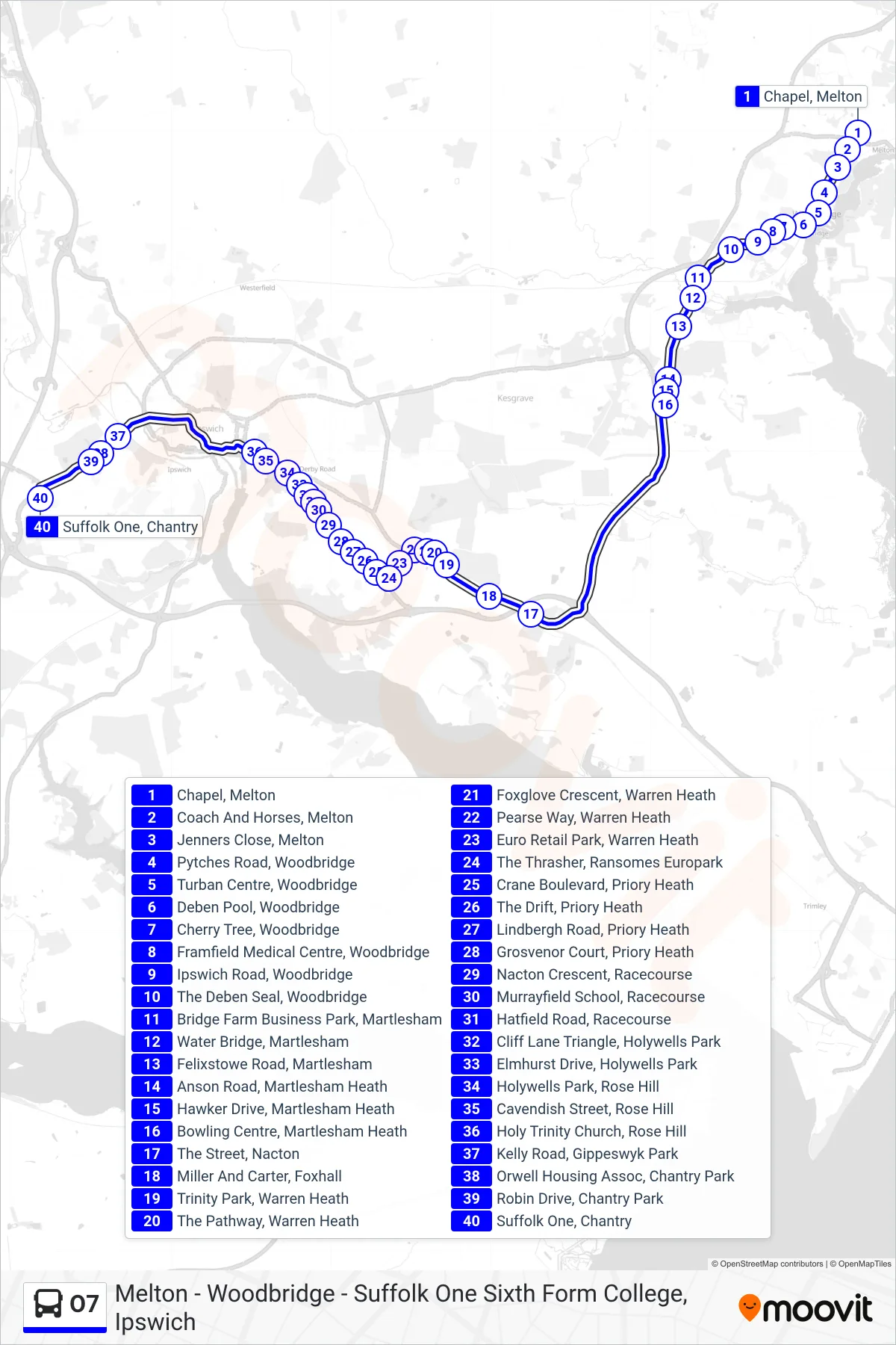
Stops list (O7 - Chantry)
- Chapel, Melton
- Coach And Horses, Melton
- Jenners Close, Melton
- Pytches Road, Woodbridge
- Turban Centre, Woodbridge
- Deben Pool, Woodbridge
- Cherry Tree, Woodbridge
- Framfield Medical Centre, Woodbridge
- Ipswich Road, Woodbridge
- The Deben Seal, Woodbridge
- Bridge Farm Business Park, Martlesham
- Water Bridge, Martlesham
- Felixstowe Road, Martlesham
- Anson Road, Martlesham Heath
- Hawker Drive, Martlesham Heath
- Bowling Centre, Martlesham Heath
- The Street, Nacton
- Miller And Carter, Foxhall
- Trinity Park, Warren Heath
- The Pathway, Warren Heath
- Foxglove Crescent, Warren Heath
- Pearse Way, Warren Heath
- Euro Retail Park, Warren Heath
- The Thrasher, Ransomes Europark
- Crane Boulevard, Priory Heath
- The Drift, Priory Heath
- Lindbergh Road, Priory Heath
- Grosvenor Court, Priory Heath
- Nacton Crescent, Racecourse
- Murrayfield School, Racecourse
- Hatfield Road, Racecourse
- Cliff Lane Triangle, Holywells Park
- Elmhurst Drive, Holywells Park
- Holywells Park, Rose Hill
- Cavendish Street, Rose Hill
- Holy Trinity Church, Rose Hill
- Kelly Road, Gippeswyk Park
- Orwell Housing Assoc, Chantry Park
- Robin Drive, Chantry Park
- Suffolk One, Chantry