
How to get to 大炮台 in 花王堂區 by Bus?

See 大炮台, 花王堂區, on the map

Directions to 大炮台 (花王堂區) with public transportation

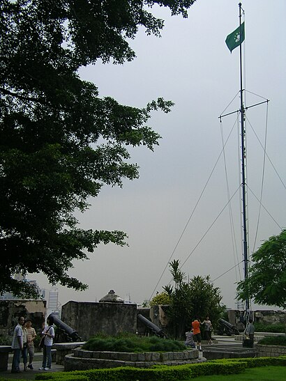
The following transit lines have routes that pass near 大炮台

  • BusBus:

How to get to 大炮台 by Bus?

Click on the Bus route to see step by step directions with maps, line arrival times and updated time schedules.

Bus stations near 大炮台 in 花王堂區

  • M245 鏡湖醫院 Hospital Kiang Wu,1 min walk,
  • M121 連勝/鏡湖醫院 Est. C. Amaral/ Kiang Wu,3 min walk,
  • M144/1 水坑尾 / 天神巷 R. Campo / Travessa Dos Anjos,4 min walk,
  • M144/3 水坑尾 / 天神巷 R. Campo / Travessa Dos Anjos,7 min walk,
  • M144/2 水坑尾 / 天神巷 R. Campo / Travessa Dos Anjos,7 min walk,
  • M146 水坑尾/方圓廣場 R. Campo / Vicky Plaza,8 min walk,
  • M153 水坑尾/公共行政大樓 R. Campo/ Edf. Admin. Pública,8 min walk,

Gondola stations near 大炮台 in 花王堂區

  • 二龍喉公園 Jardim Da Flora, Flora Garden,14 min walk,

Light Rail stations near 大炮台 in 花王堂區

  • 媽閣 Barra,55 min walk,

Bus lines to 大炮台 in 花王堂區

  • 7,城市日大馬路/波爾圖街 Av.24 De Junho / R. Do. Porto,
  • 8,工業園街 R. Do Parque Industrial,
  • 17,白鴿巢總站 Jardim Camões / Terminal,
  • 18,牧場街總站 Rua Dos Currais / Terminal,
  • 19,永寧廣場總站 Al. Tranquilidade / Terminal,
  • 26,沙梨頭北街/筷子基北灣 Rua Norte Do Patane / Bacia Norte Do Patane,
  • 8A,工業園街 R. Do Parque Industrial,
  • 18A,東方明珠總站 Pérola Oriental / Terminal,
  • 18B,永定街 Rua Da Serenidade,
  • 2,媽閣交通樞紐 Centro Modal De Transportes Da Barra,
  • 2A,東方明珠總站 Pérola Oriental / Terminal,
  • 12,永寧廣場總站 Al. Tranquilidade / Terminal,
  • 22,祐漢第二街 Rua 2 Iao Hon,
  • 25,關閘總站 Portas Do Cerco / Terminal,
  • 25B,橫琴澳方口岸 Posto Fronteiriço Macau-Hengqin,
  • N2,沙梨頭北街/筷子基北灣 Rua Norte Do Patane / Bacia Norte Do Patane,
  • 5,媽閣 - 華大新村 (循環線) Barra - Bairro Vá Tai (Circular),
  • 9,牧場街 - 媽閣 (循環線) Rua dos Currais - Barra (Circular),
  • 16,牧場街 - 下環街市 (循環線) Rua dos Currais - Mercado de S. Lourenco (Circular),
  • 9A,牧場街 - 旅遊塔 (循環線) Rua dos Currais - Torre de Macau (Circular),
Questions & Answers
  • What are the closest stations to 大炮台?

    The closest stations to 大炮台 are:

    • M245 鏡湖醫院 Hospital Kiang Wu is 12 meters away, 1 min walk.
    • M121 連勝/鏡湖醫院 Est. C. Amaral/ Kiang Wu is 164 meters away, 3 min walk.
    • M144/1 水坑尾 / 天神巷 R. Campo / Travessa Dos Anjos is 229 meters away, 4 min walk.
    • M144/3 水坑尾 / 天神巷 R. Campo / Travessa Dos Anjos is 513 meters away, 7 min walk.
    • M144/2 水坑尾 / 天神巷 R. Campo / Travessa Dos Anjos is 513 meters away, 7 min walk.
    • M146 水坑尾/方圓廣場 R. Campo / Vicky Plaza is 559 meters away, 8 min walk.
    • M153 水坑尾/公共行政大樓 R. Campo/ Edf. Admin. Pública is 599 meters away, 8 min walk.
    • 二龍喉公園 Jardim Da Flora, Flora Garden is 1039 meters away, 14 min walk.
    • 媽閣 Barra is 4217 meters away, 55 min walk.
  • Which Bus lines stop near 大炮台?

    These Bus lines stop near 大炮台: 22, 25, 25B, 2A, 7

  • What’s the nearest bus stop to 大炮台 in 花王堂區?

    The nearest bus stop to 大炮台 in 花王堂區 is M245 鏡湖醫院 Hospital Kiang Wu. It’s a 1 min walk away.

  • What’s the nearest gondola station to 大炮台 in 花王堂區?

    The nearest gondola station to 大炮台 in 花王堂區 is 二龍喉公園 Jardim Da Flora, Flora Garden. It’s a 14 min walk away.

  • What time is the first Light Rail to 大炮台 in 花王堂區?

    The 氹仔線 LINHA DA TAIPA, TAIPA LINE is the first Light Rail that goes to 大炮台 in 花王堂區. It stops nearby at 6:30 AM.

  • What time is the last Light Rail to 大炮台 in 花王堂區?

    The 氹仔線 LINHA DA TAIPA, TAIPA LINE is the last Light Rail that goes to 大炮台 in 花王堂區. It stops nearby at 11:39 PM.

  • What time is the first Bus to 大炮台 in 花王堂區?

    The N2 is the first Bus that goes to 大炮台 in 花王堂區. It stops nearby at 3:02 AM.

  • What time is the last Bus to 大炮台 in 花王堂區?

    The N2 is the last Bus that goes to 大炮台 in 花王堂區. It stops nearby at 3:02 AM.

  • What time is the first Gondola to 大炮台 in 花王堂區?

    The 松山登山纜車 CABLE GUIA is the first Gondola that goes to 大炮台 in 花王堂區. It stops nearby at 8:00 AM.

  • What time is the last Gondola to 大炮台 in 花王堂區?

    The 松山登山纜車 CABLE GUIA is the last Gondola that goes to 大炮台 in 花王堂區. It stops nearby at 6:01 PM.

  • How much is the Bus fare to 大炮台?

    The Bus fare to 大炮台 costs about P6.00.

See 大炮台, 花王堂區, on the map

The Most Popular Urban Mobility App in 花王堂區.
All local mobility options in one app

Public Transit to 大炮台 in 花王堂區

Wondering how to get to 大炮台 in 花王堂區, Macau? Moovit helps you find the best way to get to 大炮台 with step-by-step directions from the nearest public transit station.

Moovit provides free maps and live directions to help you navigate through your city. View schedules, routes, timetables, and find out how long does it take to get to 大炮台 in real time.

Looking for the nearest stop or station to 大炮台? Check out this list of stops closest to your destination: M245 鏡湖醫院 Hospital Kiang Wu; M121 連勝/鏡湖醫院 Est. C. Amaral/ Kiang Wu; M144/1 水坑尾 / 天神巷 R. Campo / Travessa Dos Anjos; M144/3 水坑尾 / 天神巷 R. Campo / Travessa Dos Anjos; M144/2 水坑尾 / 天神巷 R. Campo / Travessa Dos Anjos; M146 水坑尾/方圓廣場 R. Campo / Vicky Plaza; M153 水坑尾/公共行政大樓 R. Campo/ Edf. Admin. Pública; 二龍喉公園 Jardim Da Flora; 媽閣 Barra.

Bus:

Want to see if there’s another route that gets you there at an earlier time? Moovit helps you find alternative routes or times. Get directions from and directions to 大炮台 easily from the Moovit App or Website.

We make riding to 大炮台 easy, which is why over 1.5 million users, including users in 花王堂區, trust Moovit as the best app for public transit. You don’t need to download an individual bus app or train app, Moovit is your all-in-one transit app that helps you find the best bus time or train time available.

For information on prices of Bus, costs and ride fares to 大炮台, please check the Moovit app.

Use the app to navigate to popular places including to the airport, hospital, stadium, grocery store, mall, coffee shop, school, college, and university.

大炮台 Address: 大炮台 Fortaleza Do Monte street in 花王堂區

大炮台, 花王堂區
大炮台, 花王堂區 The Fortaleza do Monte (Portuguese for Mount Fortress, also Monte Forte; officially Fortaleza de Nossa Senhora do Monte de São Paulo, in English: Fortress of Our Lady of the Mount of St. Paul; Chinese: 大砲台; Cantonese Yale: daaih paau yìh) is a fort in Santo António in Macau. It is the historical military centre of Macau. The fort forms part of the "Historic Centre of Macau" and is a UNESCO World Heritage Site.The fort was built between 1617 and 1626 on the 52-metre tall Mount Hill, located directly east of the Ruins of Saint Paul's. It was constructed to protect the properties of the Jesuits (mainly Portuguese Jesuits) in Macau, especially from pirates. Later, the fort was taken over by the Portuguese colonial governor and the relevant authorities for the defence of Macau. The fort occupies an area of roughly 8,000 square metres. Thirty-two muzzle-loading cannon were placed around the fort's walls, and the two corners of the southeastern fort wall have small watchtowers. The fort proved crucial in successfully holding off the attempted Dutch invasion of Macau in 1622.The fort remained a restricted military area until 1965 when the barracks in the fort were converted into a weather observatory and the fort was opened to the public. The observatory ceased its function and was relocated to Taipa in 1996 before it was demolished to make way for the Museum of Macau, which was officially opened on 19 April 1998. The tree-covered park at the top of the fort has a panoramic view of the mainland area of Macau. Apart from being a fortress, it has served various functions: The first residence of the governors of Macau (in 1623 and in 1740). The base for two companies of the Portuguese Prince Regent Battalion to act as a police force from 1810 to 1841. A weather observatory of the Meteorological Department of Portuguese Macau (from 1966 to 1996). The Museum of Macau (1998 to present).
How to get to 大炮台 with public transit - About the place

Public transit lines with stations closest to 大炮台 in 花王堂區

Bus lines with stations closest to 大炮台 in 花王堂區

Gondola lines with stations closest to 大炮台 in 花王堂區

Easier to get to 大炮台 in…